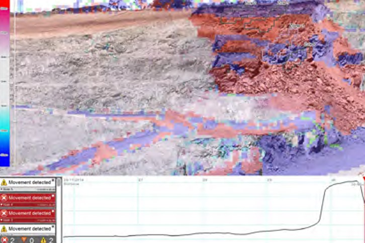
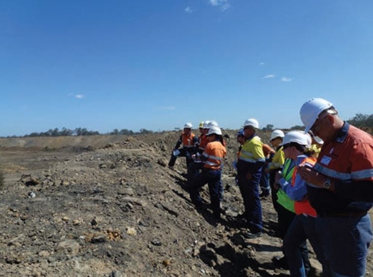
Hillgrove Resources found Sentry improved awareness of pit movement and helped plan remedial action, meeting mine safety objectives.
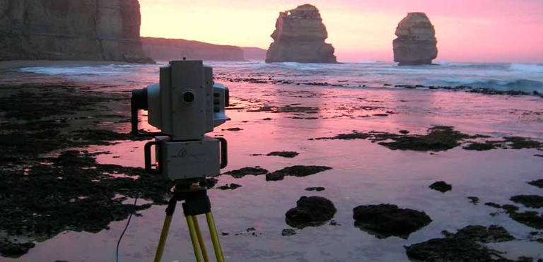
Coastal cliff survey
The Maptek I-Site 8800 laser scanner was used to scan the Victorian coastline near the Twelve Apostles for ongoing geotechnical studies of these natural formations.
Stockpile success at Hibbing Taconite
The Maptek I-Site laser scanner is used to measure stockpiles at the Hibbing Taconite mine in Minnesota, cutting delivery of results from weeks to days.
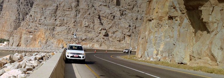
Geology helps define road expansion
I-Site technology defined the geology and stability of cliff faces, helping a road construction company to plan a safe expansion project.
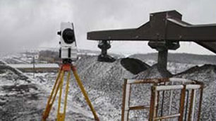
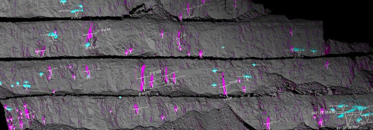
Monitoring wear rates in crushers
Laser scanning and modelling tools provide a safe, accurate solution for recording and monitoring wear in crushers to minimise down time.
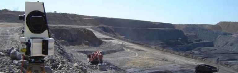
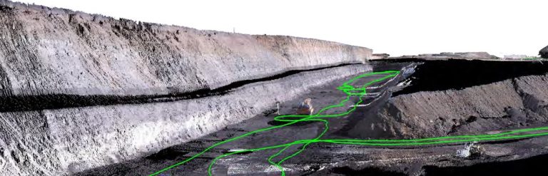
Millennium Coal acquires accurate survey data
End of month survey at Millennium Coal Mine now takes one day, with I-Site laser scanning capturing the entire 1400m length of open pit and in-pit waste dumps.
Accurate models aid ground support
Maptek I-Site Studio generates high resolution models for geological mapping and ground support quality control at a large mine in Utah.
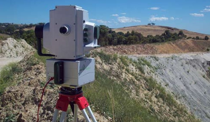
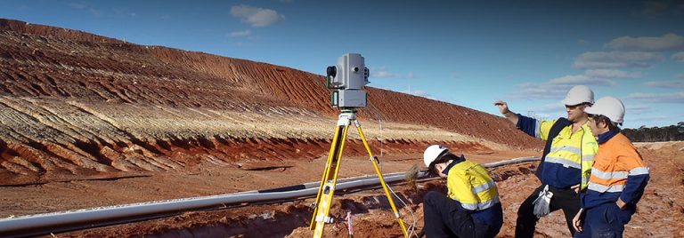
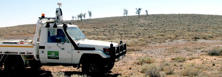
The best survey solution for your task
Laser scanning is widely used in mine survey for its safety, accuracy and speed. We compare the benefits of different modes of operation including continuous survey.
I-Site Survey Efficiency
BHP Billiton uses the Maptek I-Site 8800 laser scanner to monitor reclamation volumes at its Spence copper project in Chile, achieving more accurate reconciliation.
Geotechnical studies at Anglo American Coal
Maptek technology helps geotechnical engineers handle a range of mapping and analysis applications at Anglo American coal sites in Australia.
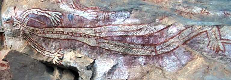
Rock art preservation in Kakadu
Maptek I-Site Studio software has been used for 3D reproduction of historical Aboriginal rock art at Kakadu National Park in Australia’s Northern Territory.
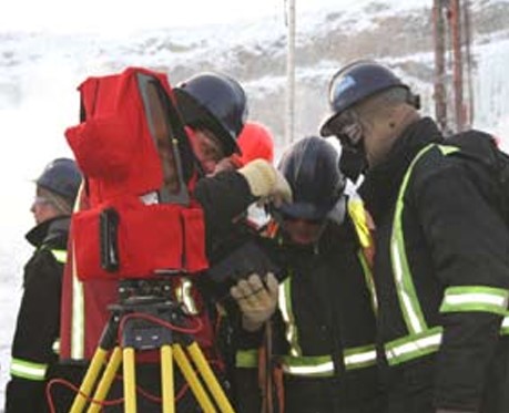
Laser scanning in extreme conditions
When Diavik Diamond mine needed a laser scanner to work in -50°C conditions Maptek I-Site technology provided the answer. The new system reduced the pit survey time to several hours.
Maptek for rehabilitation studies
I-Site provides a solution for monitoring landforms and vegetation that is gaining acceptance from authorities signing off on rehabilitation plans.
I-Site shines on diamond mine
I-Site technology helps De Beers track and manage pit surfaces, ore stockpiles and waste dumps at the Venetia diamond mine in South Africa.
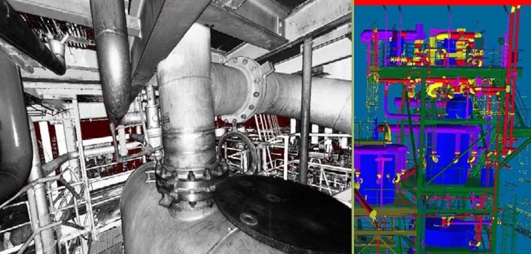
Complex infrastructure survey
Maptek is the Australian reseller of the Z+F Imager 5010. The short range scanner is ideal for forensic, plant and industrial survey, architectural and tunnelling applications.
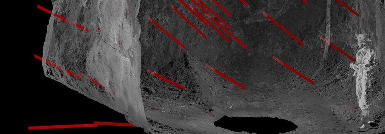
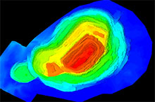
Slope stability analysis
I-Site Studio modelling and analysis tools helped provide an accurate geotechnical assessment of a large slope failure in a limestone quarry.
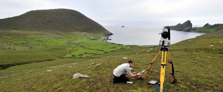
Recording St Kilda Island off Scotland
Maptek I-Site technology was used in the Scottish Ten project to scan the remote island of St Kilda, 100 miles off the west coast of Scotland in the North Atlantic.
Topographic Survey
Accurate surfaces are the key to knowing material volumes, handling methods and storage locations. This streamlines the design process and leads to efficient operations.
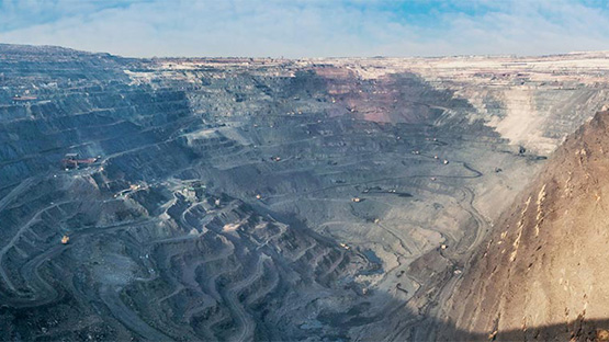
I-Site meets the open pit survey challenge
Maptek I-Site laser scanning technology delivers accurate end-of-month data for pit surfaces, and ROM, concentrate and coarse stockpile volume at OZ Minerals Prominent Hill mine.
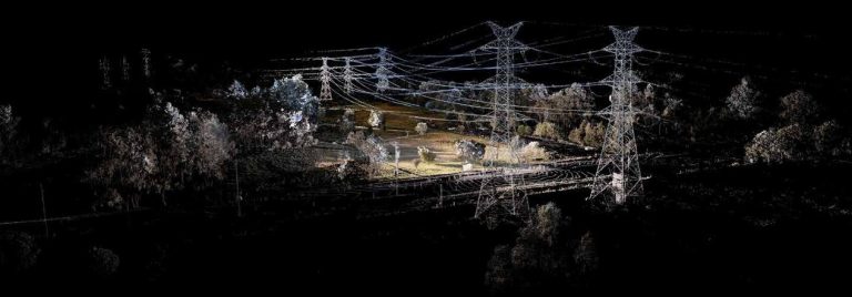
Powerline scanning
This study demonstrated that Maptek surveys take less time, and deliver more accurate results than traditional methods for powerline survey.