Historic railway gets back on track
Modern survey technology has been applied to assess the safety of derelict railway tunnels and collect data for rehabilitation planning.
Wingfield Scale & Measure is applying cutting-edge 3D spatial data collection methods and software to assess the safety of derelict railway tunnels in Pennsylvania, USA.
The East Broad Top Railroad (EBT) National Historic Landmark is the oldest surviving narrow-gauge railroad east of the Rocky Mountains. The EBT non-profit foundation is dedicated to restoring and preserving 27 miles of rail lines, six steam locomotives, a roundhouse, rail and engine manufacturing shops, as well as passenger and freight cars.
Since 1937, Wingfield Scale & Measure has been a leader across the USA in the industrial scale and weighing systems industry. The Tennessee-based business expanded into bulk inventory measurements in 2013 using terrestrial laser scanning.
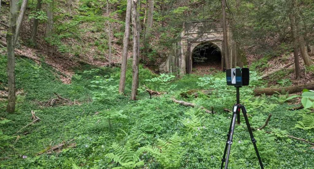
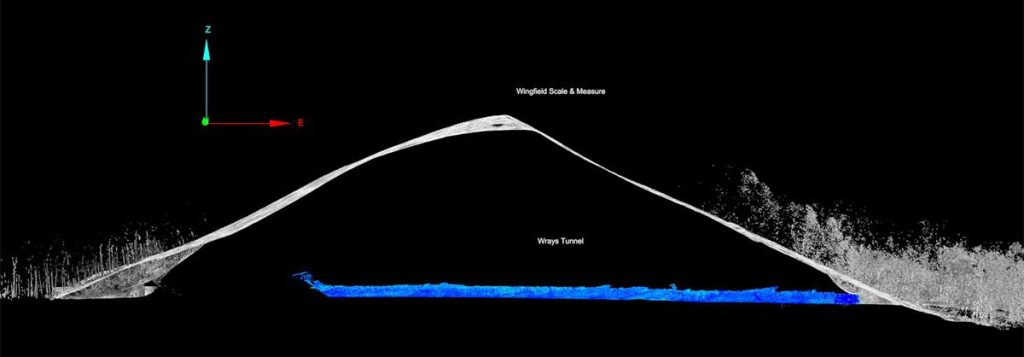
EBT approached Wingfield to assess rehabilitation for tunnels that had been bored in 1874. The Sideling Hill and Wrays Hill tunnels had not been used since 1956 when the rail line closed. Structural conditions were a significant safety concern, preventing access for traditional inspection methods.
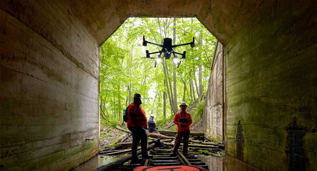
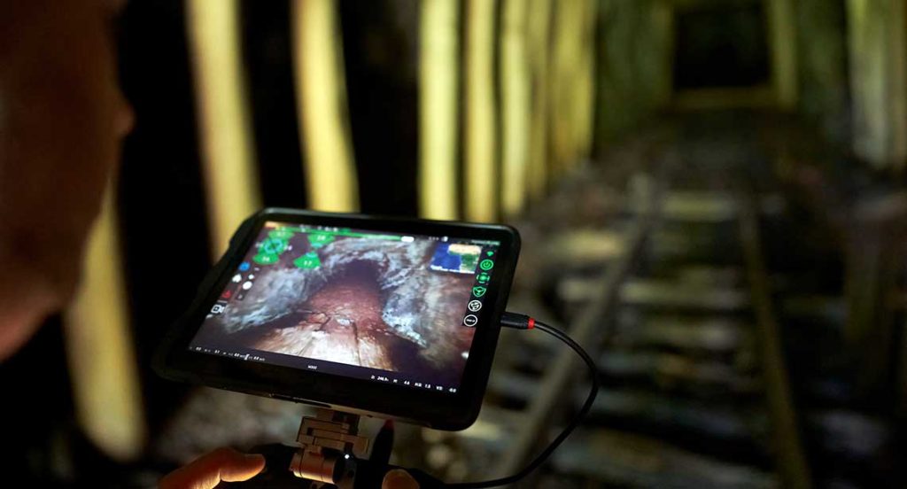
Autonomous data collection was determined as the ideal approach to safely and effectively map the tunnels before initiating rehabilitation efforts.
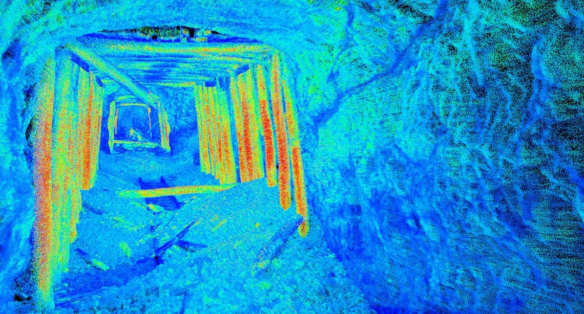
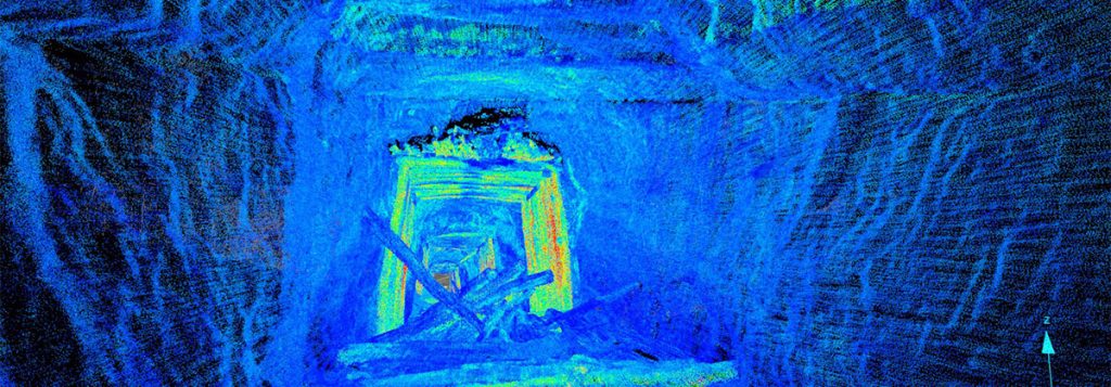
Wingfield used multiple data collection methods over one field day to capture 106 GB of raw data. Efficient data capture and post processing techniques delivered high quality verified 3D models of more than 2000 ft of inaccessible tunnels to EBT.
Aerial LiDAR, Maptek SR3, FARO S350 and Emesent Hovermap, DJI M300 drone and Spectra Precision GPS were all used. The collected data was combined into a single dataset in Maptek PointStudio where the final deliverables were produced.
Wingfield Senior Engineer James Kenney said that autonomous UAVs made it possible to collect high calibre data, and PointStudio brought the best out of that data.
‘The robust filtering, enhanced visualisation and modelling options allow the mapping team to check data quality and coverage to ensure accuracy and note areas of interest,’ Kenney said.
Proprietary workflows combine lidar and photogrammetry platforms to optimise field data capture and enhance the overall deliverables.
Autonomous mapping systems delivered new data for several locations that had not been accessible or lacked 21st century documentation.
The data captured aids in the rehabilitation and planning for future work. Remote mapping provides a higher level of safety by removing personnel from potential risk.
‘Safety should always be at the forefront. The tunnel mapping data provides clients and contractors with real information to support decisions on how to best approach the rehab phase of the project,’ Kenney said.
‘I hope one day to ride on the restored EBT railroad with my family and see more of the rail line. Preserving history is very important – connecting with the past helps us work towards a positive future.’
Kenney is enthusiastic about the technology advances in the 65-plus years since the last steam locomotive rolled through the tunnels.
‘How great is it that in 2022 the next ‘engine’ to enter the tunnels is an autonomous UAV with a laser lidar scanner. It is fantastic to see the old and the new combine and for historical landmarks to be shared with global communities.
EBT Director of Engineering James Roslund is excited at the use of new technology to refurbish the 150-year-old railroad.
‘It is amazing seeing the past come alive through the data gathered,’ Roslund says.
‘The lidar mapping is incredible, and we had no idea how detailed it would be. This helps us document and better plan refurbishment while minimising safety risk.’
The knowledge gained through this project will allow the focus to turn to the actual rehabilitation work. The project owners already anticipate a post-rehabilitation role for lidar, specifically to record a precise map for future comparisons.
Thanks to
Wingfield Scale & Measure – James Kenney, Senior Engineer,
Austin Brooks, Field Technician III
East Broad Top Railroad – James Roslund, Director of Engineering,
Brad Esposito, General Manager
- The latest data acquisition systems helped to safely record stretches of an historic turnpike railway for the first time
- More than 100 GB of raw data was captured, processed and modelled – the final deliverables were produced in PointStudio
- Tunnel mapping data provides accurate information for designing the best approach to restore the railway tunnels and rehabilitate their environs