New SR3 underground laser scanner from Maptek
Tuesday, March 20th, 2018
Whether for general underground survey or detailed geological face mapping, few understand the mine survey challenge like Maptek.
Which is why the new Maptek I-Site SR3 600-metre range laser scanner is destined to become the mine measurement standard for underground operations.
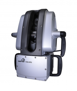 The SR3 follows the extra long range XR3 and long range LR3, which came onto the market in 2017. The R3 series is 30% smaller and 25% lighter, with 2.5 times faster data acquisition than the earlier I-Site 8000 scanners. Survey teams can work faster and smarter, with confidence that accurate, current topographic and volumetric data is guiding mine planning and geotechnical investigations.
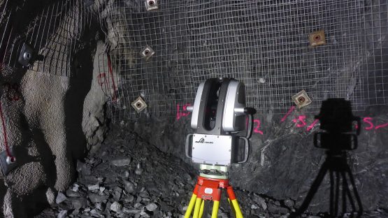
The SR3 laser scanner weighs only 9.6 kg and is accurate to 4 mm. Surveyors will be able to measure stopes, drives and tunnels with ease.
High resolution laser scans collect detailed data for geological and geotechnical face mapping. High fidelity imagery captured underground at the same time as scanning provides context and support for analysis and communication.
A scan window of -40° to 90° vertically, and 360° horizontally captures all surfaces in any direction without the need for complicated configurations. Whatever the orientation of the scanner, integrated levelling automatically corrects scans before processing.
New functionality on the tablet controller allows users to import mine CAD strings and surfaces to view together with scans. This facilitates real time comparison between the scans and allows users to compare this directly to the mine plan or geological models while underground.
‘Operations who choose Maptek laser scanners for one particular survey application, quickly find many more uses across their different engineering and planning disciplines,’ said Mine Measurement Product Manager for Maptek, James Howarth. ‘Customers have called the technology a game changer for improving site efficiency and enhancing integration of survey with mine planning.’
‘The positive experience from a fairly routine job to create a 3D map of an underground mine builds confidence in the system for additional applications using the data captured. This adds value for critical tasks as change detection, calculating volumes of material removed from drifts, and design conformance.’
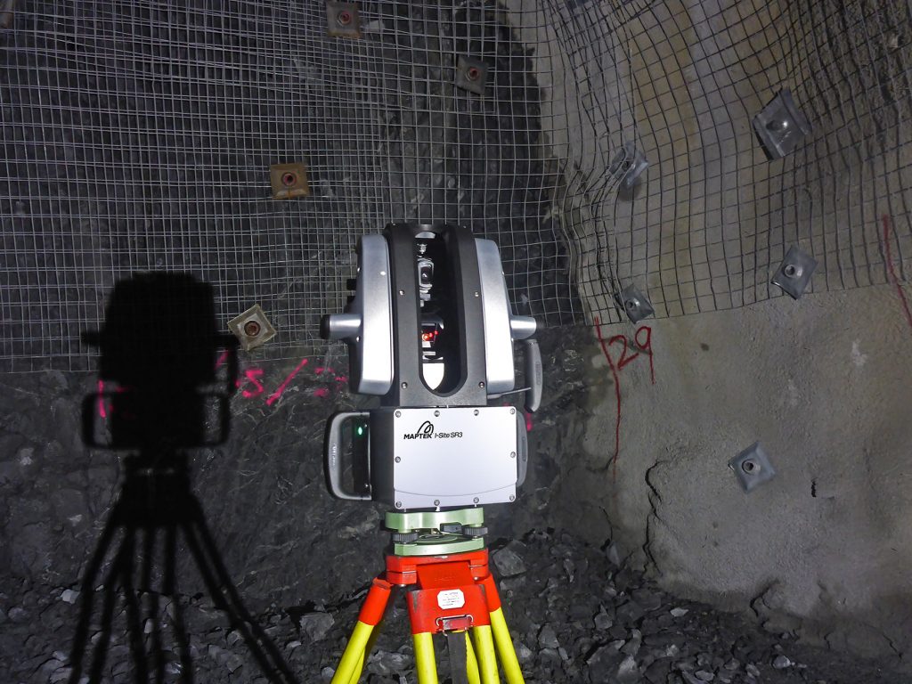
New Maptek I-Site SR3 rated to IP65 for reliable survey performance in damp, corrosive conditions underground
A high rate of accurate data acquisition, ease of use, IP65 environmental rating and wide field of view for underground survey are notable system advantages. The flexibility of vehicle and tripod mount compatibility is another persuasive aspect.
Modelling and filtering tools in the accompanying software are best fit for working with underground data. Versatile control over 3D data display and editing is a winner.
‘Old total survey practice technology is not able to compete with laser scanning for speed, accuracy, efficiency or safety. Why would an underground mine manager not minimise risk and safeguard personnel and equipment?’ commented Howarth.
Maptek understands the value of timely accurate survey to improving business performance. For the first time, surveyors will be able to log onto any web-enabled device and conduct a scan remotely.
‘A strong differentiator of our systems rest with efficient data processing, said Howarth. ‘Mine professionals are always under pressure to do more within limited time-frames, so streamlined reporting is a compelling reason to use Maptek.’
Maptek operates in the mining market, and has honed technical and professional know-how over 40 years to thoroughly understand customer issues. The SR3 is the culmination of 18 years of practical involvement in terrestrial laser scanning systems to improve mine survey.