Maptek GeoSpatial Manager
Your single source of survey truth
Your single source of survey truth
GeoSpatial Manager Contents
GeoSpatial Manager allows dynamic, automatic updates to any survey surface to produce a single source of truth for any point in time.
GeoSpatial Manager combines smart visualisation tools with a simple web interface. The result is an easy-to-use system for managing as-built surfaces that can be accessed securely by everyone in an organisation.
This unique solution dynamically updates and merges surveyed surfaces, allowing users to manage, visualise and download any as-built surface at any point in time over the life of a project and apply it to downstream tasks.
Defining your as-built surface now and at key points in time improves understanding, efficiency and collaboration.
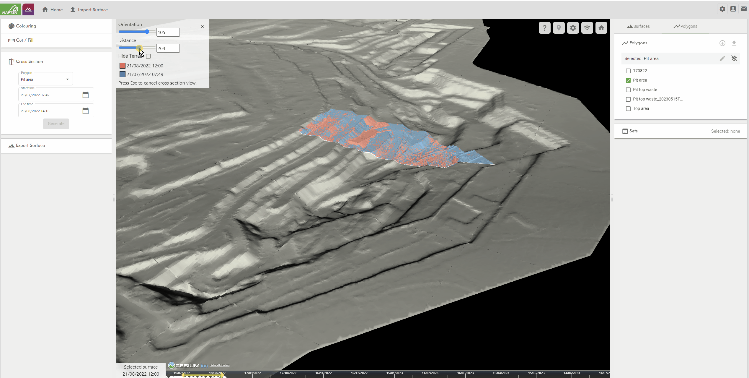
The solution allows all surfaces of a project to be accessed and dynamically visualised using a time slider. Centralised storage on a cloud or network server avoids frustration and risk arising from locating survey files that may be stored in various folders on a local or server machine.
Import survey surfaces
Import and dynamically merge new surface files for streamlined management
Surfaces timestamp
Updated surface represents a single source of truth for any given date and time across your project
Collaborate
Ensure the latest surfaces are easily accessible across your organisation for decision making
Analyse & reconcile
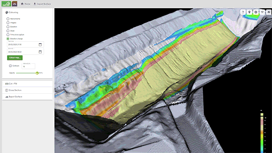
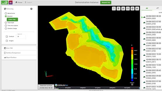
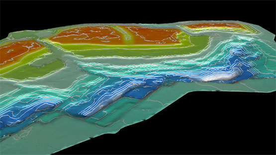
Visualise survey as-built updates, calculate cut-and-fill volumes and report on conformance to design

Decision support - Automatic as-built surface updates when new data is imported, for a single source of truth
Productivity - Single source of information that can be accessed and shared across your organisation
Volumetrics - Calculate volumes between nominated dates or elevations
Efficiency - Easily create polygons to download surfaces for specific tasks such as blasting and planning
Accessibility - Single licence covers unlimited users across your organisation
Source of truth - Know which surfaces are the most current and should be used to better manage your projects
Export - Export the selected surface to downstream packages for design and planning
Compare - Colouring options allow you to highlight areas of concern based on elevation, conformance, wall angle, date of upload
Highlight - Easily highlight areas for survey teams to address