Maptek provides a full range of services to help improve the safety, productivity and
profitability of your operation.
We deliver technical mining solutions across the mining life cycle that enable you to make better decisions
for better
business outcomes.
Maptek offers products and services to make you more effective and efficient, covering applications from
exploration
through to reclamation.
Maptek can develop an implementation plan for each site and guide the rollout of software, incorporating
custom training
for your team. We can analyse your current processes to ensure best practice, demonstrate the latest
developments
onsite, and train your staff to use them effectively.
Maptek can supply experienced staff to provide relief work or additional coverage to allow you to meet your
deadlines.
We can develop and integrate scripts to address your operational or site-specific needs, automate workflow
for
repetitive tasks and develop or modify functionality. Applications include real time monitoring, block model
optimisation, data import/export and end of month reconciliations.
Maptek can help organisations gain optimum value from their business drivers by identifying opportunities for
improving
mining processes and providing solutions that align systems with production goals.
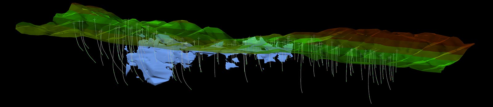
Geological modelling and
evaluation
Maptek can integrate disparate geospatial and geophysical data to build 3D orebody models that
accurately represent your
resource. This can be presented to stakeholders involved in the project acquisition and feasibility stages
of mining.
Evaluating your mine resource helps to determine mine constraints and develop an effective mine model. We
conduct
resource modelling using our broad range of modelling tools, including Vulcan, GeologyCore and DomainMCF.
Mine Planning and optimisation
Maptek can perform resource estimations, optimisations and pit designs efficiently and effectively. We
can help you
perform tasks such as site layouts, grade control, drainage planning, drill & blast design, section
plotting, block
modelling and pit optimisation and haul road design. Various statistical and simulation techniques,
including nearest
neighbour, unfolding and kriging tools can be applied for accurate grade estimation.
Scheduling
Maptek scheduling tools can be applied to analyse, manage and report mine production information from
weekly activity
plans through to life of mine schedules. We can help you easily investigate alternative schedule scenarios
and determine
key performance indicators for formulating and monitoring scheduling decisions.
Geology and Mine Planning
Maptek can apply the latest tools and techniques to prepare accurate resource models, feasibility studies
and mine
development plans and schedules.
Mine Survey and Monitoring
Maptek can provide consulting services to survey your site using the latest laser scanning and imaging
technology.
Accurate survey data is collected using safe, reliable and accurate systems mounted on tripod or vehicle.
Deliverables include up-to-date topographic maps, contours, toe and crest lines and volumes. Design
conformance and haul
road incline reports can also be generated.
Highwalls can be surveyed with point cloud data applied to stability analysis, monitoring wall movement,
geological and
structural mapping.
Monitoring can be conducted 24/7 using Maptek laser scanners and our dedicated stability monitoring
software. This
integrated system provides reliable decision support for managers and technical staff to ensure operations
are conducted
safely and productively. Data collected during monitoring can be readily applied to rockfall databases,
geotechnical
analysis and other risk management programs.
Underground survey and monitoring
Maptek can survey drives and stopes to generate an as-built model of underground workings and services
and report on
stope volumes. Results can be applied to drive development, and to determine the position and direction of
rib-bolts.
Geological mapping and geotechnical analysis can be performed in new drives where Shotcrete has not been
applied.
Shotcrete thickness and drive convergence analysis can be conducted over time.
Safe, reliable convergence and subsidence monitoring can be conducted 24/7. Remote monitoring allows
geotechnical and
operational managers to use accurate, current data to inform their decisions about operations underground.
Workflows and scripting
Maptek can develop, implement and integrate Python scripting for multiple applications. Automating
process workflows for
grade control, grade estimation and reserving can significantly reduce time for routine repetitive tasks.
We can help
set up and manage databases for drillhole, geophysical and geotechnical data.
Stockpile measurements
Maptek staff can attend your site to conduct surveys of silos, indoor and outdoor stockpiles and report
accurate
volumes. Our laser scanners can be mounted on tripods and vehicles, and from elevated positions such as
work platforms
or catwalks, and through hatches.
Truck trays and excavator buckets
Maptek can laser scan truck loads for bulk density studies, carry-back analysis and to establish loading
ability of
different tray types. Results can help ensure appropriate equipment allocation, reveal issues such as
under or
overloading of trucks and identify areas for improvement. Excavator buckets can be scanned for as-built
documentation
and to determine the maximum bucket load volume.
Plant works
Maptek can use high accuracy laser scanning to provide an as-built record of processing plants.
Deliverables include
comparison to design and as-built CAD models. Collision detection can be performed to determine if a new
piece of
equipment will fit with existing infrastructure.
Forensic applications
High accuracy photographic-coloured laser scanning can be used to record a crime or accident scene. The
data can be used
for crime scene reconstruction and forensic analysis such as determining line of sight or bullet
trajectories.
Animations, images, 3D PDFs and other deliverables can be produced for use in court.