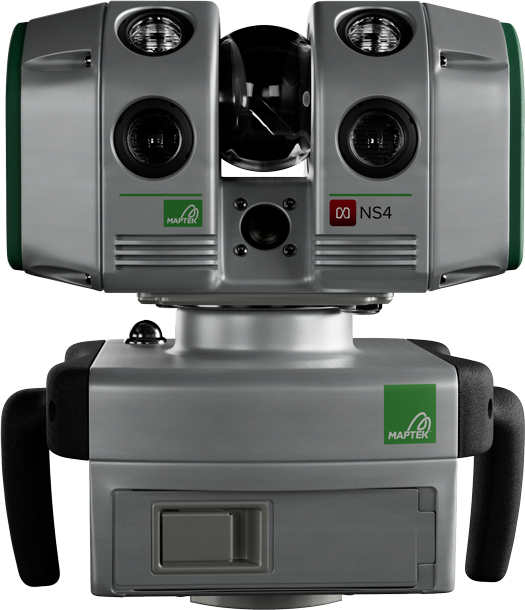
NS4 Laser Scanner
Long-range, high-accuracy laser scanning for versatile survey workflows
Long-range, high-accuracy laser scanning for versatile survey workflows
NS4 Contents
The NS4 is a long-range laser scanner used for accurate spatial data capture across surface and underground mining, civil, BIM, digital twin, and monitoring applications. It captures three-dimensional geometry and optional panoramic imagery to support survey validation, geotechnical assessment and operational measurement.
As part of the next generation of Maptek laser scanners, NS4 combines cloud connectivity, long-range laser measurement with built-in illumination (for underground and tunnelling where imagery is important), high resolution imagery and a high-sensitivity accelerometer for positional tracking. The NS4 is controlled through either the new FieldControl iOS or Android app or existing FieldHHC software.
Half the height and half the weight of previous-generation scanners, the NS4 captures high-accuracy point cloud data with optional panoramic imagery for underground and survey workflows where access and portability are critical.
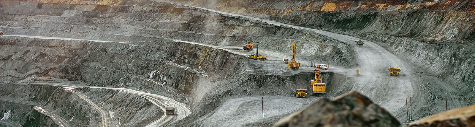
Scan open pit surfaces, highwalls, ramps, underground drives and faces, tailings dams, for survey, geological mapping, BIM and geotechnical analysis.
When combined with PointStudio or PointModeller processing software the user can experience a premium field-to-finish deliverable. One step further, integrates with Vestrex MDS for downstream workflows and automation of tasks.
Rated IP-65 for safe, reliable operation 24/7 in challenging environmental conditions.
Deploy NS4 on fixed bollards, transfer to vehicle for mobile scanning with Maptek Drive and combine with Maptek Sentry for stability monitoring.
Survey-grade performance in a compact system. The NS4 is optimised for mixed surface and underground workflows.
Long-range scanning for versatility.
Light-weight scanning capability.
Upload scans directly to Vestrex MDS for real time survey updates and instant sharing.