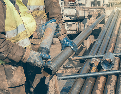
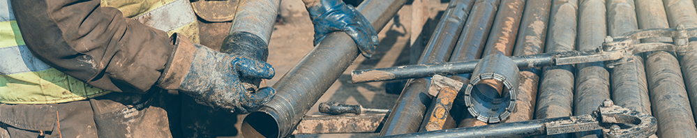
5 key strategies to avoid messy exploration drilling data
Your resource model is incredibly important.
Without it, there would be no mine plan. Or even a mine. It is the crucial puzzle piece that enables all downstream activity.
But in order for your resource model to really drive efficiency in production, it needs to be built from clean data.
Most sites have a vast amount of exploration drilling data, but deriving value from this resource is not always a simple task. Depending on who collected the data, how and when it was sampled, or even how it has been stored can lead to an unstructured mess. Or, the data could be considered “clean” for achieving a certain goal, but not another. This is an issue I run into frequently while consulting at various mine sites.
Luckily, there are a few actions you can take today to work towards cleaning your exploration drilling data and ensure it is as clean as possible moving forwards.
Top 5 ways to clean up your messy exploration drilling data
1. Unique collar location
Every drillhole should have a specific, unique collar location. However, this data can be confused if something goes wrong with the drilling of a hole—i.e. cave-ins, loss of drilling circulation, a bit spins off—and redrilling is necessary.
This can result in “twin holes”.
Twin holes with the same collar location but different sampled intervals can throw off your model and produce bad results. Because of this, it is imperative to verify the data when it looks like two of your drillholes have the same collar location. Don’t just move on with your model. Figure out if it was, in fact, a twinned hole, which is the correct hole and associated samples you should keep for your records, and remove the extraneous, sub-optimal data.
2. Total depth vs. final lithology interval
If a drillhole has a total depth (TD) that differs from its lithology log, that should put up an instant red flag to take a closer look at the data relating to that hole before moving forward with your model.
You can do this by going back to the drilling logs to verify the hole data. Did the drillers really drill to the depth that was logged? Or, did they stop taking samples after a certain depth even though the hole was longer?
And while going back to the drilling logs may be an option for some, in many cases, this type of verification is not possible. The hard copies might be inaccessible, or just not exist at all. In these cases, stop the total depth of the hole at the last logged lithology interval. This will eliminate bias by going off what you absolutely know vs. what you’re guessing on the drill hole depth.
3. Overlapping intervals
The top and bottom depths of your lithology and assay samples should form a continuous measurement.
However, you might see intervals that overlap between your samples (i.e. sample 1 has top and bottom depths of 12’-16’ and sample two is measured from 15’5”-20’), or others where a specific depth is missing (i.e. sample 1 is measured from 12’-16’ and sample 2 is 16’4”-20’). These discrepancies are usually caused by poor logging habits and lead to data that is sub-optimal.
If you come across sample intervals that overlap or have a gap, the best option is to use an additional data source to ensure that you are making the best geologic assessment possible. I would recommend using core data, chip sample or geophysical logs to help determine if your intervals are true.
4. Assay values not matching lithology
If your data is clean, your assay values should match your lithology units. When these values do not match, it is a sign that your data is of a lower quality. And while this data may not necessarily be invalid, it will make it harder for you to fully understand what’s in the ground.
For example, a lithology unit could end at 20’ but an assay sample ends at 21’. Is this a dilution sample or is there a bad lithology pick? Either way this causes uncertainty and could blur expected results.
Ensuring that this data is as accurate as possible is particularly important for stratigraphic deposits. If you have overlapping qualities or lab analyses, your model may not directly represent the quality of your deposit, making it difficult to accurately define your mineable units and causing numerous downstream inefficiencies.
To remedy this you should take advantage of a drillhole database manager solution, such as Vulcan, to run validation checks on your database. This will help you identify where you have issues and allow you to manually adjust the sample top depth and bottom depth of the lithology.
5. Collar topography placement
Occasionally, you may have to adjust your drillhole collar placements. This may be necessary because of a surveying error or if an older GPS unit was used to place the original collars and was not as accurate.
However, you cannot adjust your drillhole collars to just any topography. You need to ensure that you bring your exploration drillhole collars to the pre-mine topography and not to an active mining topography.
This may be difficult if newer data is mixed with older data, particularly if that data is from a time that predates your mine planning software. You may not have access to the original topography and snapping collars to the surface to accommodate for a discrepancy could throw off your data even more than when you started.
Unfortunately, for most cases, there is no way to get the original, pre-mine topo back if you do not have access to it. If you find yourself in a situation where you need to adjust exploration drillhole collars and do not have the original topography, only adjust collars that are in areas that have not yet been mined.
Better data. Better models. Better mine plans.
Data hygiene is key to creating better resource models, which lead to better outcomes once your mine moves into production. By keeping your data clean, or removing sub-par data from the equation, you are more likely to ensure successful downstream activity with a more informed mine plan from a more accurate resource model.