An interview with Project Mine Geologist Ryan Pinguely of OceanaGold Corporation
An interview straight from the boots on the ground.
Geologists in today’s mining industry are always looking for new ways to generate robust models in less time while still remaining confident in their interpretations. Increasing efficiency while upholding the standards of mapping workflows has a direct impact on the quality of these models and can lead to downstream improvements in resource estimation. In this blog post, we interview Project Mine Geologist Ryan Pinguely of the OceanaGold Corporation on his successful adoption of a Maptek digital mapping solution at the Haile Gold Mine in South Carolina.
Setting the scene:
As an experienced geologist, Pinguely recognized the value of converting paper mapping processes to digital ones. With coaching from the Maptek technical services team, Pinguely was able to use existing tools in Vulcan to develop a new digital open pit workflow. The technical services team was able to support the development of this workflow 100% remotely—working flexibly within Pinguely’s rigorous schedule to deliver the outcomes he needed. These outcomes included having access to digital datasets in the field, therefore allowing his team to improve their geologic interpretations.
Read the short interview below to learn more about Pinguely’s experience and his return on investment (ROI) since adopting a new digital mapping workflow in Vulcan.
Q: Please describe your background as it pertains to mapping skills:
A: My mapping skills were gained by open pit mapping in the Betze Post Pit at Goldstrike, underground mapping at Turquoise Ridge, and various field mapping projects in Nevada.
Q: Please describe the deposit type at your operations:
A: Sediment hosted disseminated Au deposit.
Q: What is your mining method? And how is mapping data used throughout the mining cycle at your operation?
A: Open cut mining. Our camp scale geologic model is based directly on pit mapping data and the model has a direct impact on resource estimation, drill and blast planning, and pit designs.
Q: What was your mapping method before using Vulcan?
A: Good old-fashioned air photo base maps with overlays.
Q: Has the new process saved you time?
A: I have seen a significant reduction in time due to a streamlined field workflow for both the office and field.
Q: Do you spend more time doing geology-related work in the field?
A: Yes, the majority of our time spent has shifted from organizing paper maps and plotting location points to accurately describing lithologies, alteration, and interpretations.
Q: Do you spend less time in the office since your maps are already digitized in the field?
A: Yes, mapping digitally has eliminated the repetitive nature of digitizing paper maps.
Q: Has the new process saved you money?
A: Yes, the reduction in time has certainly had indirect cost savings.
Q: Has the new process allowed for safety improvements?
A: The new workflow has reduced the amount of field equipment needed therefore making on-foot travel in an open pit less hazardous.
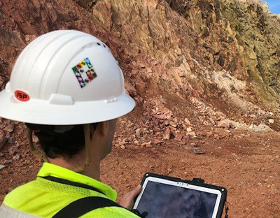
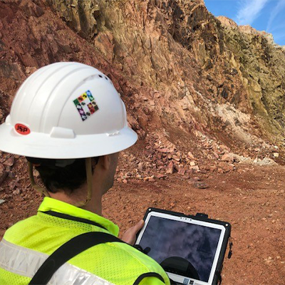
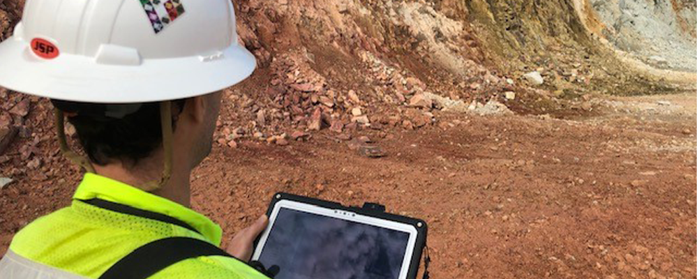
Digital mapping software provides geologists with access to important datasets out in the field.
Q: What would you say is the greatest benefit of digital mapping in the field?
A: I believe the greatest benefit from the digital mapping workflow has been having access to various digital datasets in the field while mapping new exposures and interpreting the geology.
Q: How do these improvements help the wider operation and meet the company’s goals?
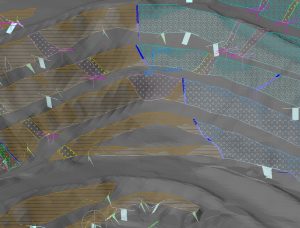
A: A simplified digital mapping workflow has improved our geologic mapping efficiency and quality. A more robust geologic model directly developed from geologic mapping can generate exploration targets, explain controls on mineralization, and assist with drill and blast planning.
Q: How has this new mapping process helped with reporting? Has it increased your communication with other teams or stakeholders?
A: The digital workflow has made the geologic pit mapping data immediately available to all interested parties.
Q: How has Maptek supported you when adopting this mapping solution?
A: Maptek personnel generated a python script that enabled Vulcan to utilize our tablet’s dedicated GPS and subsequent lava scripts for user functionality.
Q: How long has the new process been implemented?
A: 8 months.
Q: How was your experience working with Maptek?
A: Maptek personnel was and always has been a pleasure to work with. They are always professional, timely, and knowledgeable.
Key takeaways:
- Exploring new technologies that improve daily processes can save you time and increase confidence in your geologic interpretations.
- Digital workflows can easily replicate and replace traditional field mapping with a significant ROI like improved resource estimation, drill and blast planning, and pit designs.
- Digital workflows provide geologists with more time to do the vital geologic work they love while reducing time spent organizing paper maps and plotting location points.
Maptek would like to thank Ryan Pinguely and the team from Haile Gold Mine for being valuable partners in developing meaningful workflows and for their willingness to provide feedback.
Are you interested in learning more about digital mapping and its many benefits? Leave a comment below to receive more interesting stories on digital mapping with Vulcan.