How to use LiDAR scanners and drones cooperatively for better-quality survey data
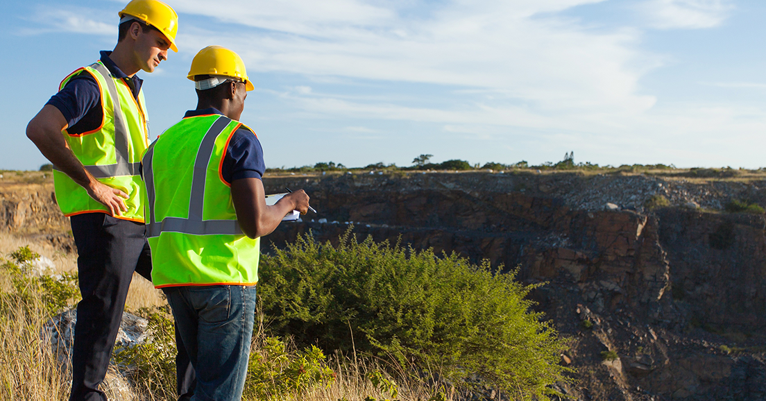
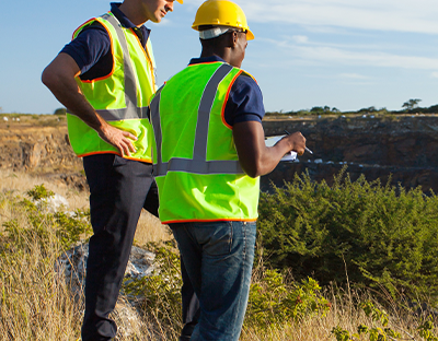
Accurate survey data is critical to any mining operation. Mining surveyors are responsible for collecting this data and they use a variety of tools, technologies, and techniques to get the job done. The data they collect helps mine planners, engineers, and geologists generate mine plans that are vital to the efficient extraction of material. The more accurate the survey data is, the better the adherence to the mine plan, meaning fewer downstream issues and costs. With such important data at stake, the tools, technologies, and methods used to collect it and subsequently analyse it are also of great significance.
Drones: The advantages and drawbacks
There are two popular technologies currently used to collect survey data; photogrammetric drones and terrestrial LiDAR. Photogrammetric drones range in price and capabilities, but all are used to capture photogrammetric data of the pit. They are controlled remotely and are capable of covering large areas in a relatively short time. And because of their agility in flight, there are virtually no shadow areas to contend with that would make it difficult to capture quality data.
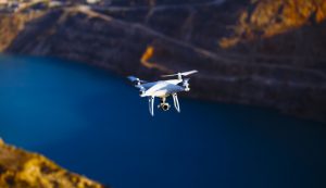
There are also safety benefits to consider as well. Drones can fly in places where it might be extremely risky for a human team to survey, such as rock faces and close to the highwall. But despite its advantages, there are some drawbacks to drones that make it difficult to rely on this one technology alone for survey data collection. These drawbacks include the time it takes to develop good flight plans, complete a survey control setup, and to process the photogrammetric data collected.
Using drones to collect survey data takes significant amounts of time before, during, and after the data collection. The accuracy of the acquired data is also completely dependent on the survey control coverage. Meaning that without enough survey control points and proper spacing in the field during flight, accuracy takes a major hit at the processing stage. In addition, seemingly little details like photo overlap, camera quality, and gimbal angle can actually make a big difference when it comes to data quality after processing.
Photogrammetric drones are also subject to being delayed by weather and are unable to fly in high winds. Additionally, it’s not uncommon for drone operators to sometimes lose contact with their drones. When this happens, the drone might crash-land somewhere non-retrievable or worse, it might land where mine personnel are working and pose a very real risk to safety. In order to minimize this risk, some sites will remove mining personnel from flight paths. And while doing this is a good idea, it can also have an operational impact that could negatively affect production.
Terrestrial LiDAR: The advantages and drawbacks
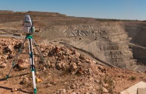
On the other hand, LiDAR scanners are set up on a tripod or mounted to a vehicle so there is very little chance of one causing injury. They have known accuracy and repeatability and can be easily set up in areas where survey data needs to be collected. They use time-of-flight laser technology to deliver multi-point returns while also collecting extremely high-resolution digital imagery at long ranges. Most scanners come with integrated software that makes for easy workflows and faster data acquisition and processing.
Perhaps the greatest benefit of having a LiDAR scanner is that they are a multi-purpose solution that can work towards meeting the goals of various teams across a site. They are useful not only for survey data acquisition, but are also vital to operations that value slope stability monitoring, design conformance, pre and post-blast analysis, blast optimisation, stockpile volumetrics, erosion studies, and geologic mapping. With cross-site team functionality becoming increasingly more important, mine sites prefer technologies that have a longer shelf life and can be integrated with other technologies thus helping to ensure their value in an unpredictable future.
That being said, there are disadvantages that exist for LiDAR scanners just as they do for drones. As with drones, weather can affect the quality of data collected. In addition, it can be difficult to capture data in shadowy areas, like on the tops of benches, due to the nature of line-of-sight technology. Luckily, there is a way to solve the issues that accompany both drones and scanners. It all comes back to integrating technologies and making full use of the tools you most likely already have on-site.
The hybrid approach
It’s very common for sites to have both drones and LiDAR scanners since they are two of the most popular survey technologies around. What’s not common, however, is their cooperative use. These technologies are generally used for separate purposes, stuck in their own siloed routines. But what would happen if you were able to use these two technologies cooperatively?
You could use drones to fly over large, inaccessible areas to capture photogrammetric data and compliment that by using a scanner to capture point cloud data for daily progression and volumetrics, or for mapping purposes. In this example, you could even use the point cloud data collected by the scanner as survey ground control, avoiding the lengthy process of setting up survey control points in the field. Since the accuracy of the points collected by the scanner is known, you could select multiple identifiable features across the scan area with known coordinates. These known coordinates and features from the LiDAR data could then be used to process the aerial data by selecting these same identifiable features in your photos.
Yet another way to use LiDAR scanners and drones cooperatively is to utilise scanners to quality check the data collected by your drone at regular intervals. That way you can make sure the photogrammetric data being collected is accurate and within acceptable standards. By using the scanner for QA/QC, you aren’t second-guessing the data captured by the drone and can avoid providing other parties with data that is inaccurate and could have downstream effects on profitability.
For sites that already possess these two technologies, there is very little to lose and much to gain by experimenting with the cooperative use of both LiDAR scanners and drones. Sure, it will take some time to develop a new workflow, but it’s worth it in order to steer clear of the disadvantages that are associated with each individual technology. Through the cooperative use of LiDAR scanners and drones, you can acquire a more comprehensive data set that are accurate and can be relied on for multiple mining applications.