Leveraging Vulcan and PointStudio to improve 3 everyday site problems
Everyone has favorite software that helps them succeed at work. These software favorites tend to have two things in common: 1) they’re easy to use and 2) they’re good at making daily tasks easier. And while these favorites are great, inevitably, a new software solution comes along claiming to make your work even easier.
Do you take a chance on adding the new software to your favorites or stick to what you know?
This is a tricky question for most, but especially for mine planners and surveyors who depend on well-tested tools and workflows to produce accurate results. With such high stakes, it can be difficult to try any software without proof that the new addition will actually be worth it.
Well if you’re a mine planner or surveyor, this blog has the proof you’re looking for. If you’ve solely been using Vulcan for the following 3 site problems, you can make your job a whole lot easier by also leveraging PointStudio. But first…
What is PointStudio?
At the very basic level, PointStudio is a software solution that takes point cloud data from laser scanners, drones, or other LiDAR sensors, georeferences it, and delivers stunningly visual results that help mine planners and surveyors perform their routine responsibilities on site. This includes generating the latest topography map, filtering out undesired surfaces, and performing geotechnical analysis.
And like all software favorites, PointStudio is easy to learn and use. The learning curve is short, especially if you’re already a Vulcan user. For example, transferring geotechnical data from PointStudio to a Vulcan database can be done with a simple drag and drop. In addition, the option to automate everyday workflows such as the processing and filtering of dig face advancement scans saves time and takes minimal effort from the user. This automation can be done in minutes using workflows created in the workflow editor and can help you determine what needs to be blasted and what grades and material to target next.
Leveraging both PointStudio and Vulcan in certain situations saves time and reduces errors. Here are 3 common situations in which to take advantage of their interoperability.
1. Producing the most updated topography for operations/planners
Providing an updated topo map to mine planners is a daily occurrence at most sites. Short term planners and drill and blast engineers always want the most up to date topo to work with for scheduling and blast pattern design. Since this is a daily situation, most survey teams already have a method for producing this deliverable. But just because it works, doesn’t mean it can’t be improved upon with the right tool for the job.
Using software that allows you to edit raw data quickly and easily helps to avoid generating invalid surfaces or gaps in your data when patching in the new with the old. Invalid surfaces and data gaps cause problems downstream when trying to perform further analysis.
Software with purpose-built tools for handling point clouds allows for quick editing of raw data before generating surface files. This is key. You can use PointStudio for this and also set up an automated workflow within the workflow editor to make this process even more efficient. The image below shows an example of a workflow set up to automate tasks like basic filtering or creating a surface.
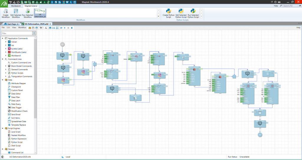
With the ability to automate workflows, you can get some much needed time back in your day.
2. Incorporating large amounts of drone data into the bigger picture
According to the 2019 Global Mine-Site Technology Adoption Survey from GlobalData, 41% of 179 surveyed mine sites are expecting to invest in drones over the next two years with 21% already fully invested in UAV technology. If your site falls into that 21% category, you might already be struggling with incorporating huge amounts of aerial drone data into the bigger data picture.
Drone data can mean huge data files that are hard to deal with because they contain undesired data like water reflection, power lines, equipment, and vegetation. Luckily, there’s a solution to this problem—filters! Choosing software with a huge swath of filters is important because it gives the user control over removing unwanted data before finalizing the model.
In addition to filters, you’ll want to make sure that there are tools within the software designed to help you identify areas of change. This will make it easier for you to model updated surfaces with new information. You can use PointStudio to do all of this; georeferencing the data from your LiDAR drone, filtering it, modelling it, and then merging any areas of change into your previous site model.
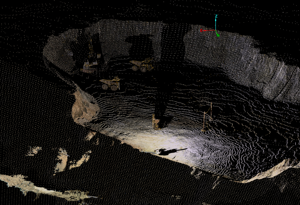
Take a look at this pre-filtered active mining area below. You can see that there is a lot of equipment in the point cloud.
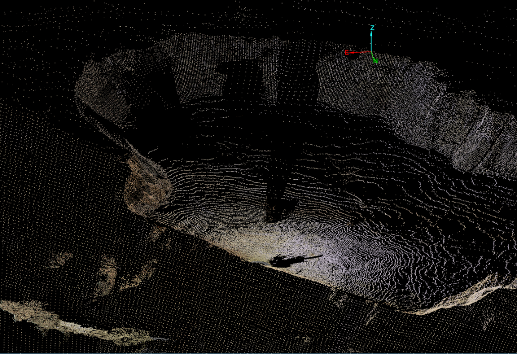
With some basic filtering, you can quickly remove the unwanted data (the equipment) from the point cloud so it looks like this.
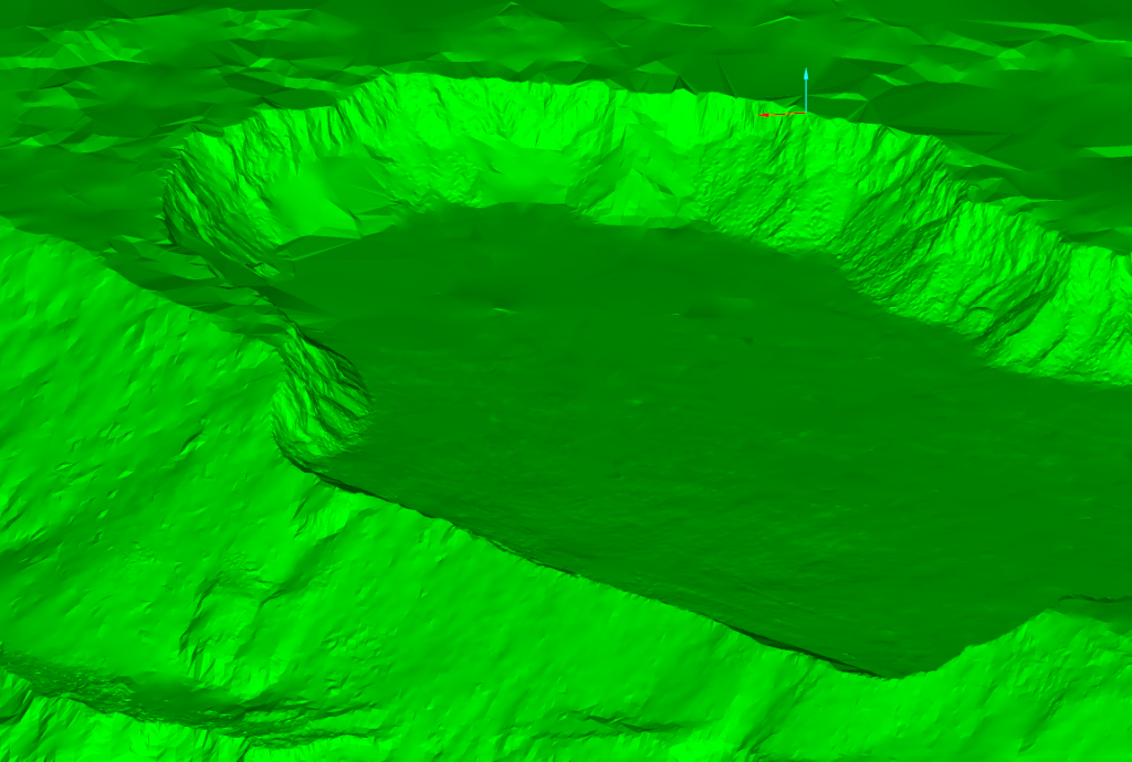
Finally, you can generate a surface rendered from the clean point cloud as seen in the image below. This surface can then be used in Vulcan for further design purposes like designing blast patterns or ramps.
3. Transferring geotechnical data from the field into the database
Getting your geotechnical data from the field into the right database can be challenging. To make life easier in this regard, look for software with an easy-to-use interface and the ability to handle large data files like a champ.
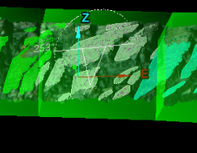
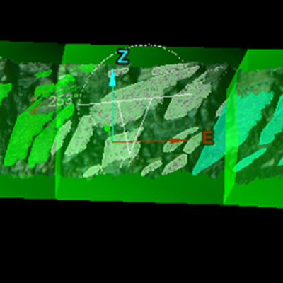
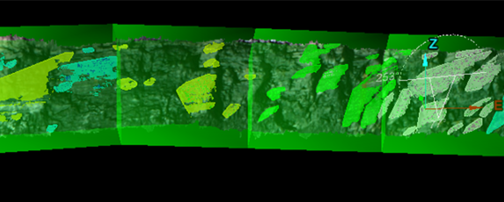
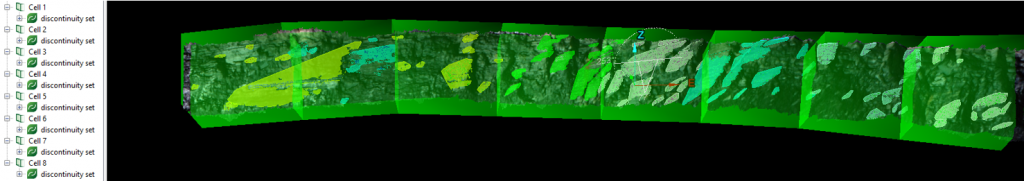
If you are using Maptek products, the recommended workflow would be to collect your data using a LiDAR scanner or other LiDAR sensor, georeference it, and perform any structural analysis or cell mapping within PointStudio. The image below shows cell mapping on a bench face in an open pit mine and gives you a good idea of what cell mapping can look like within our software.
After the geotechnical analysis is complete, you can export your data directly into your Vulcan database. This makes it easy to display your results with the rest of your geotechnical database and any other design information.
Want to know more about PointStudio in action? Check out this case study for an inside look at PointStudio underground at Fosterville Mine in Victoria, Australia.