Why surface management needs a single source of truth
In mining operations, change is constant, and so is the challenge of keeping track of it. Surfaces shift, projects evolve, and survey files multiply across teams and folders. Without a clear, up-to-date picture of your site, decision-making becomes slower, riskier, and more fragmented.
That’s where Maptek GeoSpatial Manager comes in.
This powerful tool delivers a single source of truth for all your as-built survey surfaces, combining automated updates with smart visualisation and secure access for your entire team in one centralised location. The result?
Smarter decisions, streamlined collaboration, and fewer delays.
Stop searching. Start seeing.
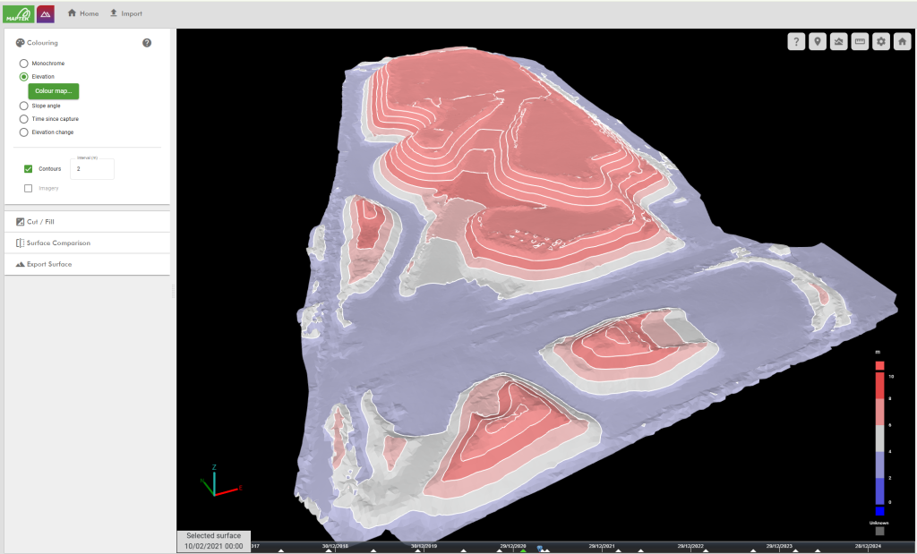
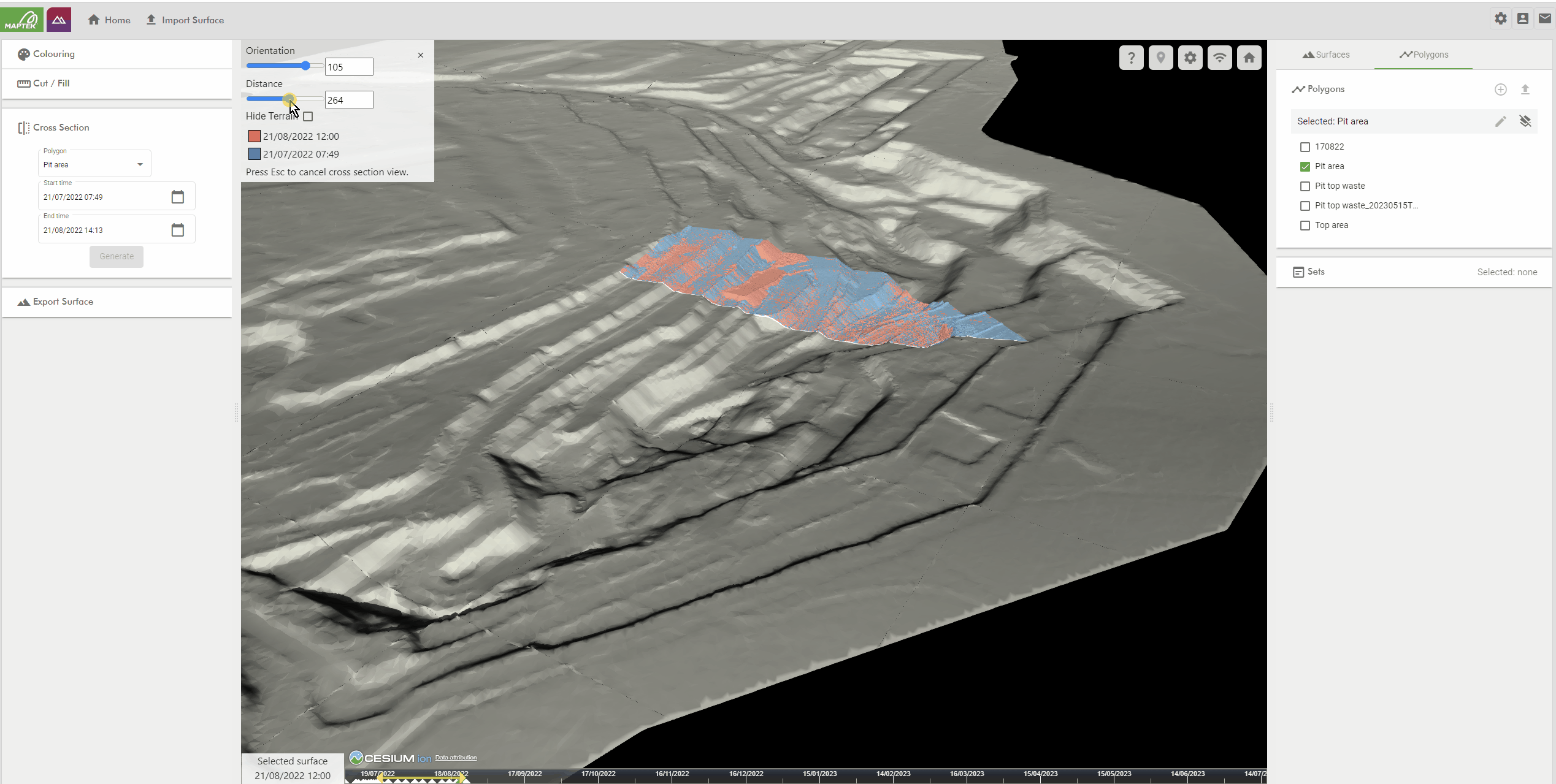
GeoSpatial Manager removes the guesswork from surface management by automatically merging and updating survey data. Whether you’re reviewing the current state of play or tracking changes over time, the dynamic surface model ensures you’re always working with the most accurate version of your site.
✔ Define and access key surfaces at any point in time
✔ Instantly visualise change using colour-based comparison tools
✔ Highlight conformance issues or areas of concern for survey follow-up
✔ Calculate volumes between dates, elevations or design surfaces
One platform. Unlimited users.
GeoSpatial Manager is built for collaboration. With one licence covering unlimited users, your entire organisation can access and share surface data whether they’re in the field, the office, or a different site entirely.
✔ View surfaces through a simple web interface
✔ Export surfaces to downstream packages for planning or design
✔ Apply insights directly to tasks like drill and blast, compliance or rehabilitation planning
Time travel made simple
Using the time slider, you can scroll through the life of your project and select any surface snapshot along the way. This feature supports better planning, historical review, and communication across teams.
Need to see what the site looked like last month before the rainfall event?
Planning a volume reconciliation between last quarter’s excavation and today?
You’ll find it in just a few clicks.
Test drive GeoSpatial Manager
Your site is constantly evolving. Make sure your surface data evolves with it accurately, automatically, and accessibly. Whether you’re tracking conformance, sharing data across teams, or planning your next move, GeoSpatial Manager is your single source of truth.
We offer two flexible, commitment-free ways to explore the platform. No credit card required.
30-day guided access using Maptek data
Get to know GeoSpatial Manager at your own pace using Maptek’s pre-loaded demonstration data. It’s a great way to explore key features without setting anything up.
7-day full access using your own data
Want to see how it works on your site? Use your own files to experience the full power of GeoSpatial Manager.
Ready to see GeoSpatial Manager in action? Click below to get started.