Maptek solutions capture and model spatial data for effective decision making
Monday, March 2nd, 2015
At PDAC this week, technology developer Maptek will showcase dynamic 3D visualisation tools which aid mineral exploration projects.
‘Powerful software tools bring together spatial data for analysis and detailed 3D modelling to guide projects in the resource/feasibility phase,’ said Zach Savit, Vulcan Technical Solutions Engineer, Maptek. ‘Maptek has honed this functionality during30 years of engagement with our mining customers, giving them confidence in the modelling process and the outcome.’
Vulcan Implicit Modeller handles complex geological settings, modelling faulted geometries and on-the-fly combinations of geological database elements. Ready access to section views provides for fine tuning of modelling parameters in real-time. Implicit modelling can be automated via scripts so designs update when changes occur in drillhole data. ‘What if’ scenarios can be previewed prior to building a robust model which can be relied on during design and planning.
Maptek spatial systems offer comprehensive data capture and processing tools, and services across survey, data modelling and volume calculations.
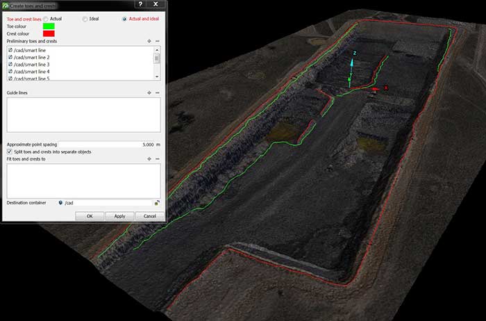
I-Site Studio software handles dense UAV/lidar data with ease, turning detailed point cloud data into practical deliverables. Smart filtering and processing workflows allow users to accurately extract and model surfaces and solids that will support their project objectives.

Maptek also provides cost-effective survey services. I-Site laser scan technology can be applied to pre-mining tasks such as topographic survey, drainage line and vegetation recording, infrastructure placement and environmental studies. Large areas are surveyed quickly and safely, with customised deliverables ready within hours of data capture.
Specialist drillhole and geophysical data modelling tools in Eureka software support exploration geologists to better interpret project data. Interacting with all spatial data on one dynamic 3D platform improves confidence when analysing disparate data types. Eureka’s powerful drillhole editing and seismic interpretation tools help geologists to identify connections between their geospatial project data and regional trends.
‘Maptek is well-versed in solving critical challenges in the mining domain, from pre-mine exploration and feasibility through mine planning and production,’ added Savit. ‘We equip companies to collect and analyse spatial data that will benefit their project outcomes and help them communicate effectively with stakeholders. An intuitive environment for modelling data, plus tools embedded in effective workflows ensures the best chance of success.’
Visit Maptek at Booth 1039 to find out more.


