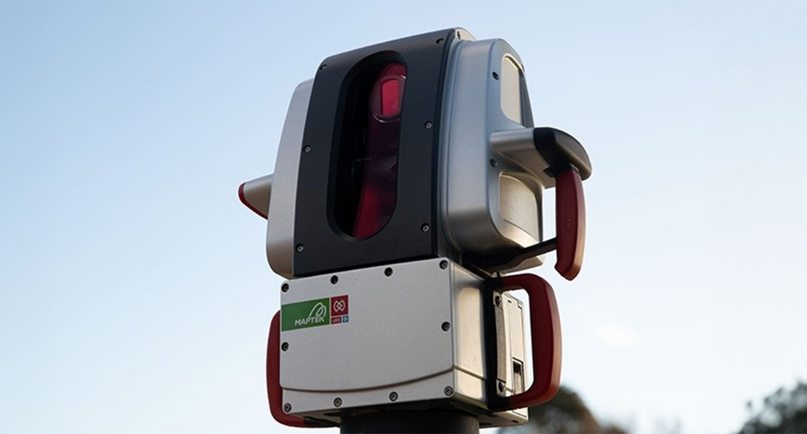
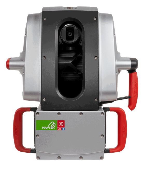
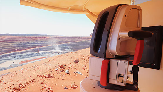
Maptek UR3 Laser Scanner
Survey and monitoring for large projects
Maptek Data System
Maptek Compute Framework
Maptek Orchestration Environment
Join our early access program to unlock value for your organisation.
Drill & blast management
Interconnected mine scheduling
Reliable proximity awareness underground
Dynamic survey surface updates
3D mine planning & geological modelling
Streamlined geological modelling workflow
Machine learning assisted domain modelling
Material tracking & reconciliation systems
3D laser scanning & imaging
Point cloud processing & analysis
LiDAR-based stability & convergence monitoring
Derive value from airborne or mobile sensor data

Survey and monitoring for large projects
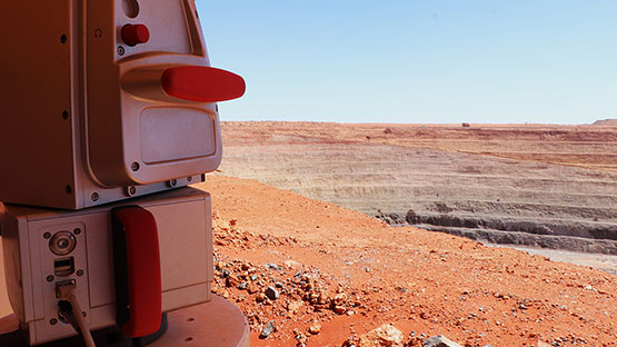
The Maptek UR3 mkII laser scanner features the high end engineering specifications of Maptek laser imaging systems, with an extended range ideal for large mining and civil engineering projects.
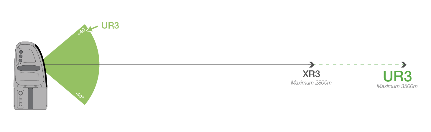
The ultra long range scanner is ideal for survey applications at large open pit mines and excavation projects. Sites can also take advantage of the system for monitoring surface movement of highwalls, benches, ramps and tailings dams.
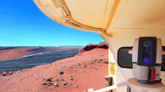
The UR3 can be mounted on tripod or fixed bollard for in-pit survey, and deployed with the Maptek Drive Kit for mobile scanning to quickly capture roads, highwalls and ramps from a moving vehicle.
Accurate, detailed data
Scan pit surfaces, highwalls,
benches,
ramps and tailings dams and acquire detailed data for survey, geological mapping
and geotechnical analysis.
Reliable operation
Rated IP-65 for safe, reliable operation
24/7 in
challenging environmental conditions, with cold climate option for
extreme temperatures.
Fast field to deliverables
Laser scanner and accessories
developed
alongside Maptek PointStudio processing and modelling software to provide the
fastest, most intuitive survey workflow.
Flexible set up
Deploy UR3 on fixed bollards, transfer to
vehicle
for mobile scanning with Maptek Drive and combine with Maptek Sentry
for stability monitoring.
| Weight | 12.1 kg |
| Max. range | 3500 m |
| Min. range | 4 m |
| Accuracy | 5 mm |
| Repeatability | +/-4 mm |
| HDR camera | 147 MP digital |
| Rating | IP-65 (EC 60529) |
ReCAPTCHA has failed to load! Try reloading the page to submit this form. ReCAPTCHA no se ha podido cargar. Intente volver a cargar la página para enviar este formulario. Não foi possível carregar ReCAPTCHA. Tente recarregar a página para enviar este formulário. Не удалось загрузить ReCAPTCHA. Попробуйте перезагрузить страницу, чтобы отправить эту форму.
ReCAPTCHA has failed to load! Try reloading the page to submit this form. ReCAPTCHA no se ha podido cargar. Intente volver a cargar la página para enviar este formulario. Não foi possível carregar ReCAPTCHA. Tente recarregar a página para enviar este formulário. Не удалось загрузить ReCAPTCHA. Попробуйте перезагрузить страницу, чтобы отправить эту форму.
We use cookies to enhance your browsing experience and analyse our traffic. By clicking "Accept all", you consent to our use of cookies. You can customise your cookie preferences by clicking 'Customise Preferences'.
We use cookies to enhance your browsing experience and analyse our traffic.
Our website may store cookies on your computer in order to improve and customise your future visits to the website. By using cookies, we can track information about your usage of the site and improve your experience with anonymous and aggregated user data.
Review our Privacy PolicyEssential for the website's functionality, without which the site cannot operate smoothly.
Remember user preferences and choices to provide a more personalized experience.
Collect data on how users interact with the website, helping to improve user experience.
Used to deliver targeted advertisements to users based on their browsing behavior and preferences.