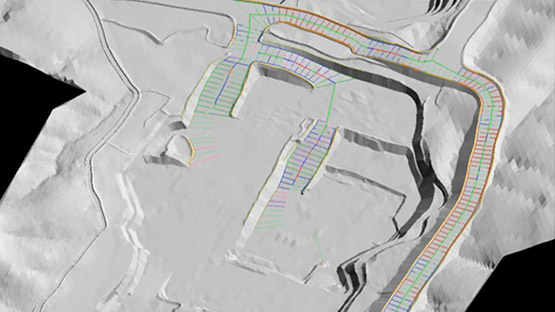
Build and evaluate a variety of mine scenarios to ensure you produce operationally viable plans and schedules.
Learn MoreKeep track of key activities across your processes to continually increase production, efficiency and safety.
Learn MoreThe free quarterly Maptek Forge newsletter includes case studies, product and corporate news.
Maptek blogs cover a range of industry topics, sharing insights from across our global network.
Keep up to date with the latest product solutions and news about Maptek global activities.
An online repository of all Maptek learning resources, from white papers to blogs and case studies.
An overview of Maptek, our products, solutions and operations.
A brief history of Maptek, including milestones of our 35 years of operation.
Information about careers at Maptek and current vacancies.
Find conferences, seminars and tradeshows where Maptek is exhibiting and/or presenting papers.
Discover the features and benefits of Maptek solutions in these overview videos.
Watch webinars on various topics and learn about the latest solutions from Maptek subject matter experts.
Watch tutorials outlining ways to apply various tools. Learn the latest techniques for efficient workflows.
Short bite size videos include tips and tricks for applying common tools and solutions.
PerfectDig is intuitive software for evaluating and supporting design conformance. It is designed to foster real time decision making by comparing as builts with designs in the field or in the office.
Two PerfectDig applications have been designed to allow sites to work in different ways.
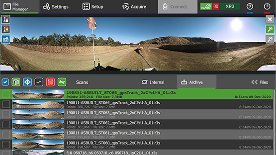
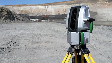
PerfectDig Field works with ‘real time’ data from an I-Site 8800, 8810 or 8820 laser scanner. A ruggedised tablet has an easy to use interface for immediately comparing mining to design in the field.
PerfectDig Office uses existing image data (laser scans, surfaces, airborne lidar point clouds or UAV data) and compares this with the mine design on an office PC.
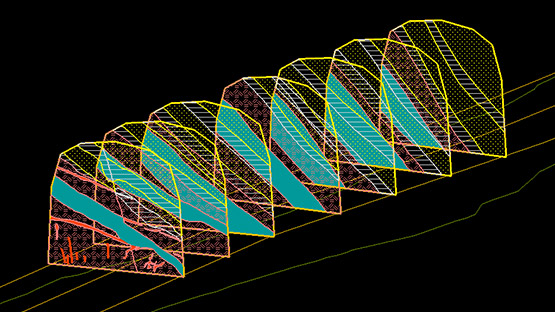
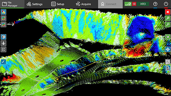
PerfectDig takes 3D image data and compares it with a mine design to generate pictures that clearly show areas of conformance, underdig and overdig. The result is augmented reality for the mining industry.
The pictures produced by PerfectDig use a photograph - the current reality - augmented with various overlays to provide extra information.
Typically these show areas of conformance, underdig and overdig. The user can turn on additional layers to display underdig and overdig volumes, and how the design surface looks in-situ.
This approach of overlaying extra information in its correct spatial location on an image or a display is known as augmented reality.
PerfectDig Field requires input data from an I-Site laser scanner in order to facilitate near real time processing.
PerfectDig Office accepts image data such as laser scans, existing surfaces, airborne lidar point clouds or UAV data.
The mine design must be in .00t, .dxf or .dwg format for both PerfectDig Field and Office.
Drive to the area of interest and scan the area. The PerfectDig software communicates with the I-Site laser scanner and GPS.
PerfectDig automatically registers the scan data to the design by using existing reference data of the surrounding area. If this is not available, a scan taken from two or more overlapping locations will register the data.
PerfectDig automatically processes the scene, and generates high quality conformance layer imagery. This allows users to see problem areas at a glance.
Cross-sections, distance to design and two-point distance queries can be made in the vehicle or in the office.
The intuitive wizard interface readily creates conformance reports.
Scenes and conformance reports can be uploaded to PerfectDig Online through a single click (on the tablet) in the vehicle (subject to internet connectivity) or in the office.
PerfectDig Field requires an I-Site 8800, 8810 or 8820 laser scanner and GPS connection. The tablet is included in the PerfectDig Field package.
For safe, in-vehicle operation, the standard I-Site vehicle mount is recommended. Using PerfectDig Field with tripod setup is also possible.
PerfectDig Office uses existing image data from various sources, and is designed to be run on a desktop PC.
The design is specified when creating a PerfectDig scene, either by importing a .00t, .dxf or .dwg file or using a design stored in the software.
The scene is ready for viewing in 5 minutes. Where greater accuracy is desired, users may perform a higher resolution scan. This results in a corresponding increase in time; 10 minutes is typical.
Tools in PerfectDig include cross-section, blockline and distance to design options to help users easily measure and report volumes, depth and width of areas of non conformance.
Any type of mine where there are exposed excavation surfaces, including dredging operations.
The conformance report wizard is launched from within PerfectDig, and guides users through the process of specifying the input (design, blocklines and as-built data) and defining the area of interest. The report preview allows users to further annotate report sections.
The report may then be published directly to PerfectDig Online through a single click, or saved to a PDF.
PerfectDig Online enables scenes and reports to be published online. These are hosted on a secure server and available to an unlimited number of internal users.
The scenes hosted on PerfectDig Online maintain the same interactive views. Cross-sections can be queried through a web browser. Snapshot links allow the exact view of a scene to be shared through a short link suitable for email or SMS.