Maptek Laser Scanners
3D laser scanning & imaging
3D laser scanning & imaging
Scanners Contents
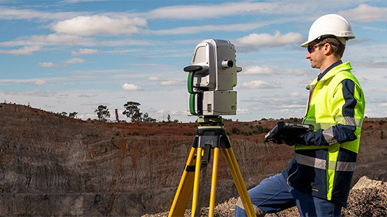
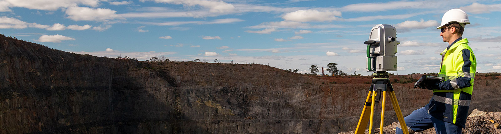
Maptek laser scanners combine fast accurate sensing, high resolution digital imagery and powerful modelling software for safe, efficient site survey.
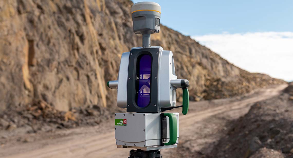
Maptek R3 mkII series laser scanner data capture is supported by high quality image acquisition that allows survey teams to be confident that accurate, current topographic and volumetric data is guiding mine planning and geotechnical applications.
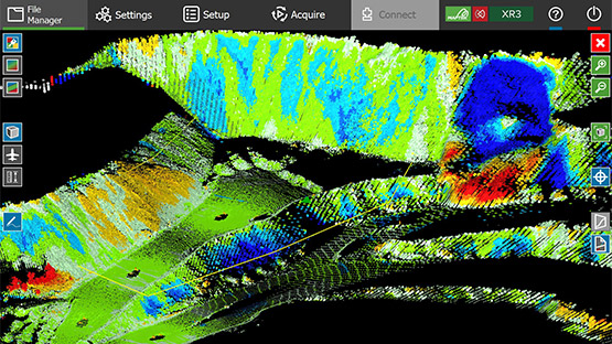
Imagery and lidar scan points are acquired simultaneously thanks to the built in HDR digital camera, ensuring high resolution images are immediately available for geotechnical analysis and visualisation.
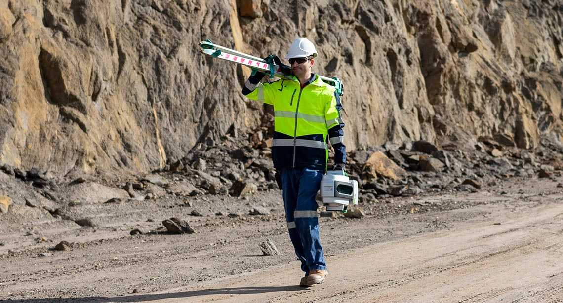
Maptek FieldHHC combines a powerful, simple GUI with intuitive features for controlling survey workflow in the field. It follows standard survey setup and scan georeferencing, enabling users to enjoy the most efficient survey experience.
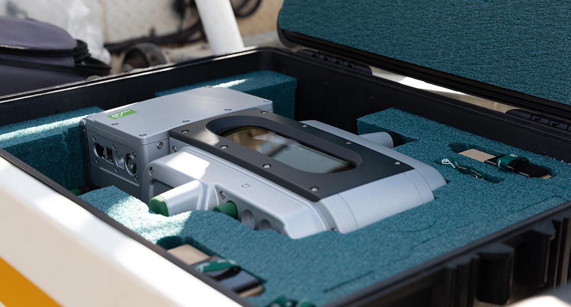
Maptek laser scanning solutions are founded on our 40 years of experience in mining technology, and are supported and serviced by our team of survey and mining specialists.
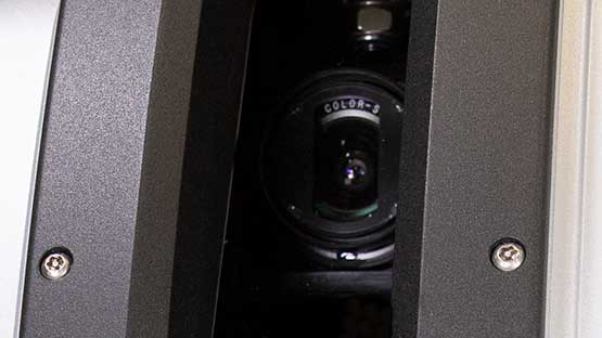
Internal high dynamic range 147 megapixel panoramic camera captures superb quality digital imagery.
Supports geotechnical analysis, geological mapping and high impact communication with stakeholders.
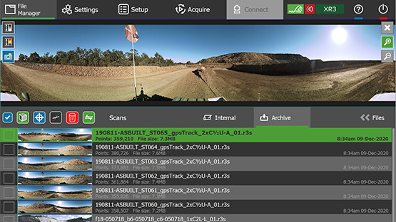
Queued scans, dedicated FieldHHC controls and data workflows ensure maximum field efficiency.
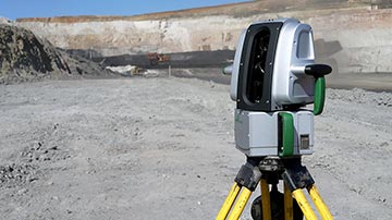
Laser scanner setup on bollard or vehicle-mounted for stop-go or continuous survey.
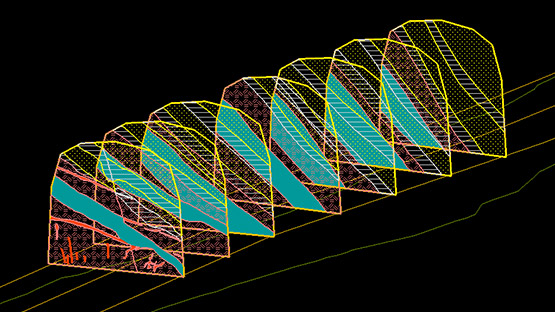
Value-in-use functionality includes design conformance, slope monitoring, fragmentation analysis and reporting add-ons.
Automated, built-in survey workflows for surveyors, geotechnical engineers, geologists and mining engineers.
Maptek PointStudio software is an intuitive point cloud processing and modelling package for mining, civil, geological and survey applications.
Maptek Sentry provides a safe, laser based spatial solution for monitoring surface stability and convergence above and below ground.
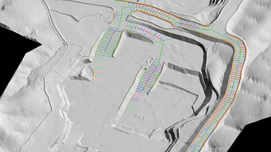
Maptek Drive allows the continuous acquisition of laser scan data with a Maptek laser scanner mounted on a moving vehicle.
Maptek FieldHHC provides a superior survey experience for controlling, acquiring, registering and processing laser scans.
| UR3-C | XR3-CT | XR3-C | XR3-D | XR3-CD | SR3 | |
|---|---|---|---|---|---|---|
| Range | 5 - 3500m | 2.5 - 2800m | 2.5 - 2800m | 2.5 - 1200m | 2.5 - 1200m | 1 - 600m |
| Accuracy | 5mm | 5mm | 5mm | 5mm | 5mm | 4mm |
| Repeatability | 4mm | 4mm | 4mm | 4mm | 4mm | 4mm |
| Data acquisition rate | 40kHz 80kHz 160kHz 320kHz |
50kHz 100kHz 200kHz 400kHz |
50kHz 100kHz 200kHz 400kHz |
50kHz 100kHz 200kHz 400kHz |
50kHz 100kHz 200kHz 400kHz |
100kHz 200kHz 400kHz |
| Camera | ✔ | ✔ | ✔ | ✔ | ✔ | |
| Telescope | ✔ | |||||
| Vehicle mounted operation | ✔ | ✔ | ✔ | ✔ | ✔ | ✔ |
| Class 1 laser pointer | ✔ | |||||
| Dual window | ✔ | ✔ | ||||
| Cold climate option | ✔ | ✔ | ✔ |
| UR3-C | XR3-CT | XR3-C | XR3-D | XR3-CD | SR3 | |
|---|---|---|---|---|---|---|
| Open pit, topographic and civil projects | Good | Premium | Good | Premium | Premium | Good (tunnels) |
| Underground stopes and drives | Premium | |||||
| Exterior stockpile volumes | Good | Premium | Good | Premium | Premium | Good |
| Interior stockpile volumes | Premium | |||||
| Stability monitoring and rockfall analysis | Premium (OC) | Premium | Premium | Premium (UG) | ||
| Design conformance | Good | Premium | Premium | Good | Good | Good |
| Pre/post-blast analysis | Good | Premium | Premium | Good | Good | Good (short distances) |
| Geological mapping | Good | Premium | Premium | Premium | Premium (UG) | |
| Geotechnical/kinematic analysis | Good | Premium | Premium | Premium | Premium (UG) | |
| Rockbolt identification and shotcrete analysis | Premium | |||||
| Erosion and deformation studies | Good | Premium | Premium | Good | Good |
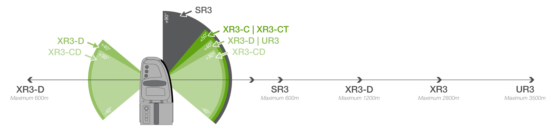
The XR3-D dual window system captures data from both sides simultaneously, halving the data acquisition time when scanning from the safety of a moving vehicle.
Survey crews can scan surrounding terrain in both directions while travelling to capture specific mine measurement data for seamlessly acquiring haul roads, gradients and infrastructure.
The XR3 and UR3 MkII cold climate laser scanners allow operations to conduct survey and monitoring tasks for hours in extremely low temperature conditions.
Systems are developed to operate at temperatures down to -20°C, with a limited operating time below that. A removable neoprene jacket protects the laser scanner against wind chill.