
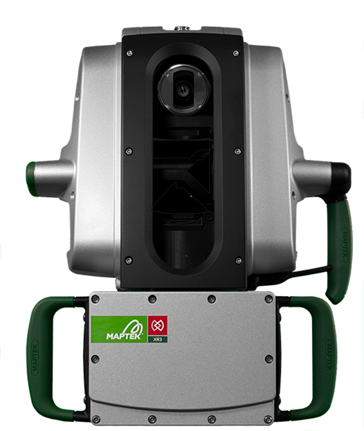
XR3 Laser Scanners
Specialised long-range (XR3) or dual-direction (XR3-D) scanning for mining and civil survey
Specialised long-range (XR3) or dual-direction (XR3-D) scanning for mining and civil survey
XR3 / XR3-D Laser Scanners Contents
The Maptek XR3 mkII Scanners support specialised survey and monitoring workflows across large mining and civil environments. Two configurations are available: XR3 for extended range, and XR3-D for dual-direction acquisition.
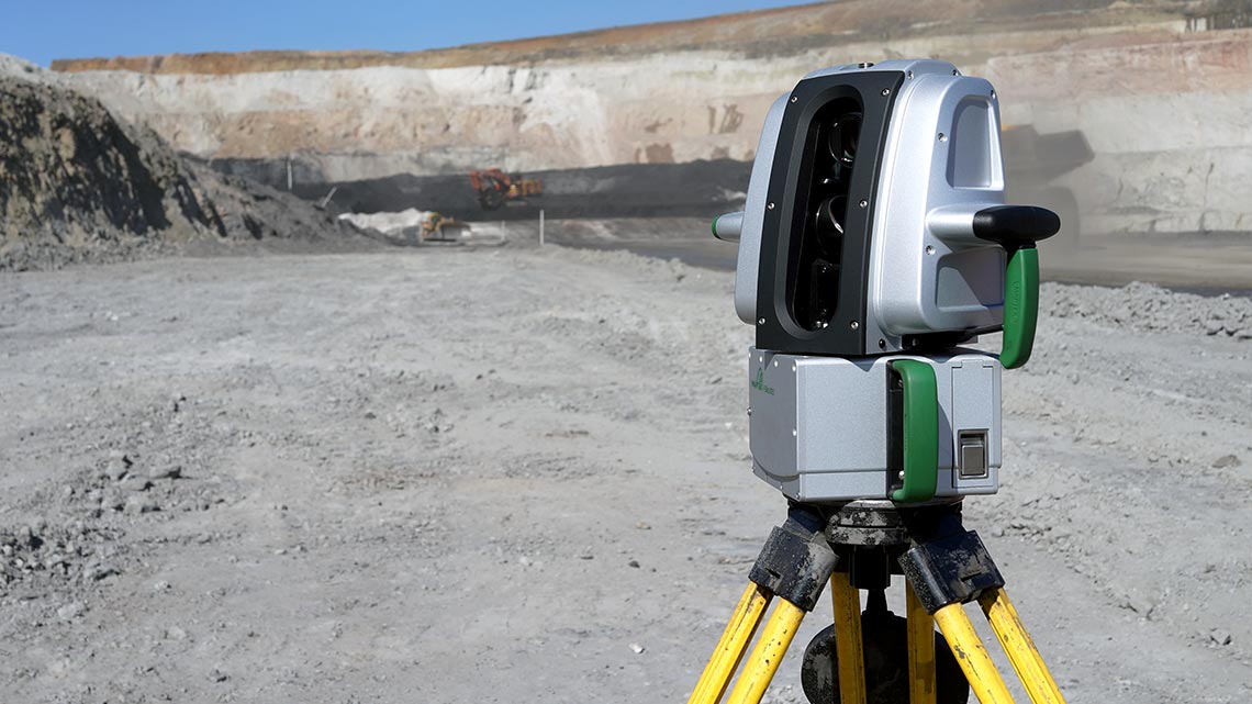
XR3 mkII captures accurate spatial data at distances up to 2,800 metres, supporting long-range monitoring and large-scale survey workflows.
XR3-D mkII captures forward and rear scans from a single deployment, delivering up to 1,200 m forward range and 600 m dual-direction range for workflows that benefit from broader directional coverage.
Both scanners integrate with Maptek software for field capture, processing and analysis.
Common applications, operating priorities, and expected deliverables.
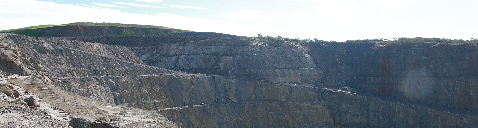
Large mining and civil projects requiring long-range scanning, repeatable monitoring and dependable spatial data capture.
Capture spatial data from extended distances where scanner placement is constrained or repositioning is less practical.
Use XR3-D to collect forward and rear data from a single deployment where broader coverage improves field efficiency.
XR3 supports accurate long-range scanning from fixed positions. XR3-D adds forward and rear acquisition for workflows that require broader coverage from a single scanner.
Capture accurate spatial data from known scanner locations where distance, access or operating conditions make repositioning less practical.
Use XR3-D to acquire data forward and rearward from a single deployment, improving efficiency in workflows that require coverage in multiple directions.
Features
Benefits
XR3 provides extended range for large-scale survey and monitoring applications, while XR3-D supports forward and rear data capture from a single setup.
Common applications
Contact Maptek to discuss XR3 and XR3-D scanning capabilities, configuration options and support for long-range survey and monitoring workflows.