Maptek Vulcan
3D mine planning & geological modelling
3D mine planning & geological modelling
Vulcan Contents
Maptek Vulcan, the world’s premier 3D mining software solution, allows users to validate and transform technical data into dynamic 3D models, accurate mine designs and operating plans.
Whether developing day to day or long term mine plans, operations need to know where and when to mine. The Vulcan 3D visualisation environment helps better understand mining projects, with interpretations and results providing decision support for productive and profitable mining operations.
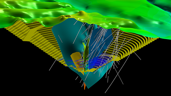
Vulcan can manage and visualise very large and complex datasets, process the information and rapidly generate models. Sophisticated algorithms enable virtually instant validation of models, allowing users to build a continuous and up-to-date picture of a deposit.
Running animations and exploring alternative scenarios based on various resource and economic values is the most productive approach to developing practical mine plans that maximise resource recovery.
Vulcan offers geologists, surveyors, mine and geotechnical engineers the tools for processing, modelling and reporting on their technical data.
A range of specialised add-ons deliver functionality relating to roles and operational tasks for more detailed analysis and reporting.
Powerful block modelling and integrated tools for survey, drill and blast, grade control, geotechnical analysis, scheduling, optimisation and geostatistics make Vulcan the complete mining software package.
Geology & Estimation add-on includes Vulcan geology tools, Base Geostatistics and estimation tools for open pit metalliferous and stratigraphic mines.
Open Pit Design add-on includes Vulcan Open Pit Design and Drill and Blast design tools, for open pit metalliferous and stratigraphic mines.
Underground Design add-on includes Vulcan Underground Design and Underground Drill and Blast Design tools.
Multivariate & Simulation add-on includes Vulcan Multivariate Estimation and Simulation tools.
Open Pit Optimisation add-on includes pit optimiser and cut-off grade optimisation, and haulage profile tools.
Scheduling Suite add-on includes integrated Vulcan Gantt Scheduler and Short Term Planner.
Grade Control Suite add-on enables geologists to accurately define ore and waste to deliver optimum grade and tonnage to the mill.
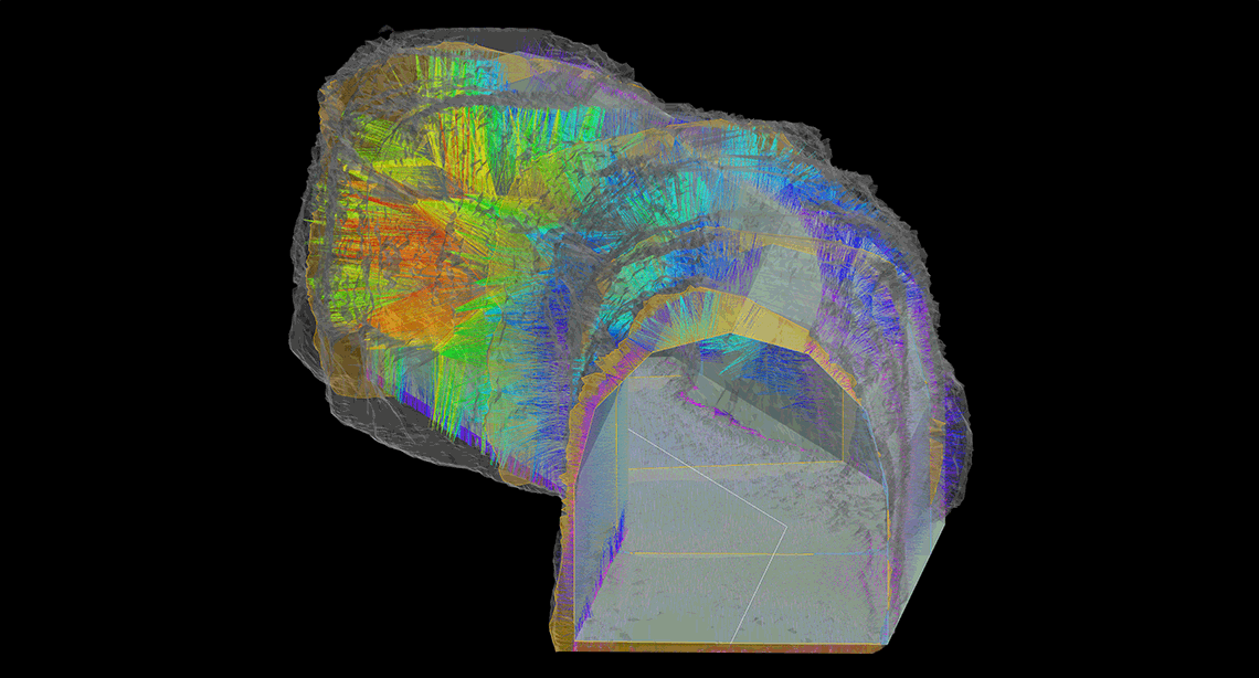
The Geotechnical Suite add-on enables accurate, informative geotechnical analysis and reporting to guide mine design and planning decisions.
Drillhole Optimiser allows exploration projects, and open pit and underground operations to easily develop infill drilling plans that maximise resource recovery.
The Stope Optimiser add-on contains integrated tools for quickly assessing multiple underground scenarios for producing optimised mineable regions.
Maptek’s Software Development Kit gives organisations the tools to build, extend and integrate advanced spatial data capabilities into their own mining workflows.