What’s new in Vulcan

Vulcan delivers an end-to-end solution for geological modelling, mine design, planning and scheduling, providing holistics benefits across the mining lifecycle.

Customers create value and work more effectively with their digital mining data by using Vulcan, which is populated with practical tools that help modern mining operations generate value from their technical information. These translate into increased productivity for specific applications - such as geological modelling, automated pit design and grade control processes - as well as improvement to the mining business in terms of cost efficiencies.

Vulcan 2024

Colour triangulation by attributes Enhanced

Colour triangulations with static legend to quickly understand the data. Improved workflow removes the guesswork behind attribute value ranges for faster process.

Interactive Cut Planner Enhanced

Quick Mode panel now seamlessly supports Advanced Reserves specification files, simplifying configuration for a more intuitive and efficient planning process.

Grade Control attributes New

Calculation rule for attributes now includes time variables for easier, more precise calculations and reconciliation.

Drillhole collar symbols Enhanced

Take advantage of drillhole collar symbols when loading drillholes, for a more comprehensive view of geological data.
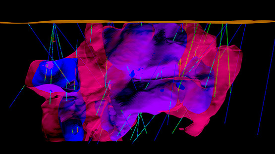
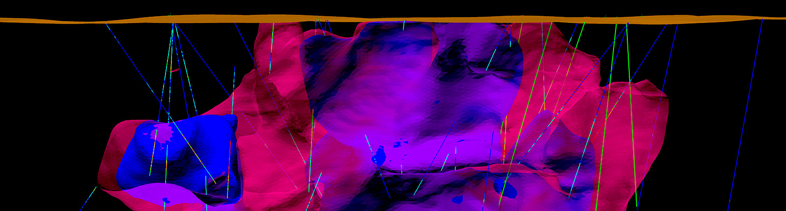
Variogram display New

New variogram display selection in Vulcan Data Analyser for easily distinguishing between variograms, improving confidence regarding tolerances, range and direction applied for specific studies.

Swath plotting Enhanced

Swath Plot spatial graphs in Vulcan Data Analyser now include a feature that averages the points on the graph, offering a dynamic option for spacing between each point on every analysed axis.

Vulcan Data Analyser User Experience

Drag and drop functionality makes it easy for users to add variables to charts for quick comparisons.

Gaussian tools Enhanced

Vulcan Data Analyser now allows users to execute transformations and simulations in Gaussian space as command files for more efficient workflow.

Geotechnical tools Enhanced

Scale geotechnical structures based on fields in your database, allowing for quick identification of important structures.

Vulcan 2023

Level Layout New

Create and modify underground development networks and easily connect mineable stope shapes to existing development.

Plotting Enhanced

New tabbed layout for easier, more intuitive plotting.

Context menu option New

Zoom context menu for block models, grids, triangulations, design layers and drillholes adjusts the screen extents to your loaded data.

Log scale histogram New

Allows Vulcan Data Analyser users to better detect mixed domains when resource modelling.

Zoom context window New

Adjust the screen extents to the respective selected item through the Vulcan File Explorer context menu. Available for block models, grids, triangulations, design layers and drillholes.

Grade estimation Enhanced

New option in the Block Model Utility tool allows users to export the block estimation file (.bef) parameters to a CSV file.

Vulcan Data Analyser New options

New Grade Capping option in Vulcan Data Analyser helps users determine capping values. Variography cone display and other improvements for data visualisation.

Data Spacing histogram now reports the number of neighbours in the search radius.

Samples Count Histogram has been added to Swath Plot charts.

Plotting Enhanced

New Solid Shading provides the option to plot triangulations with solid shading or as a wireframe with a pattern.

Moving windows New

Added multiple moving windows to accommodate local features when creating an anisotropy model using the variable method.

Relimit by solid Enhanced

Users can now relimit multiple surfaces at a time against a single solid to streamline the process.

Unfolding options

Estimation files now restrict specific inputs when parameters are included in the provided tetra file and when using unfolding options.

Integrated stratigraphic modelling Enhanced

Users can generate dummy drillholes from points specified in a layer, as well as new options for Grid generation and Import from layer to the Survey Data tab.

Stope Optimiser Enhanced

Users now have access to the latest Stope Optimiser engine, including parallel processing with multi-threading for faster run times.

Vulcan 2022

Integrated stratigraphic planning New

New pit design and workflow tools for creating pit or highwall surfaces with ramps. Pit design dynamically updates as parameters change and snapshots can be saved for later use. Fully attributed solids are produced ready for scheduling, creating a seamless workflow across design and mine planning.

Graphics Enhanced

Broader graphics card support, improved graphics hardware handling and card selection, card-specific settings for best performance, slicing with additional toolbar options and significantly faster label rendering performance.

Interactive Cut Planner

Performance improvements and panel changes for short/medium term planners include direct use of triangulations for cut generation; apply an advanced reserves specification (RES) file; improved output including reports into Excel spreadsheets and object labelling; and new Quick Mode for rapid cut generation when working with polygons and/or triangulations.

Vulcan Data Analyser New options

New project templates with pre-configured charts, chart settings and data types. Users can call templates from a script, shell or the Workflow Editor to streamline the process for starting a new project or updating statistics when new data is available.

A new option for Contact Profile Analysis allows users to determine hard/soft boundaries.

Over/under break Enhanced

New features include triangulation outputs, reserving functionality, additional section naming controls, and specification file support.

Pit optimisation Enhanced

Faster creation of Pit Optimisation Analysis reports.

Unfolding Enhanced

Multithreading has improved the performance of the LVA unfolding method.

Integrated stratigraphic modelling Enhanced

Improved performance when using faulting and the addition of a new modelling method.

Automated Pit Designer

Updates include phase design functionality reintroduced under the Strategic Designer menu option.

Drillhole Optimiser Enhanced

Updates include additional controls over outputs and enhancements to flagging and reporting.

Vein-type solids Enhanced

A new option allows users to create a mid-surface for thin solids.

Estimation editor Enhanced

Three sub-menus improve setup and user workflow - Univariate Estimation Editor; Multivariate Estimation Editor and Validation Editor, with all options continuing to save to IDs within a BEF file.

Fixing triangulations

Users can now save failing triangulations to a selection file for remediation. Closure results are clearly flagged to better highlight outcomes.

Digitising lines

A new selection mode allows users to select polyline objects to digitise a line. When using a counter, the objects will be named in the order in which the line first intersects with the object.

Drillhole viewing New option

A new option allows users to view multiple traces alongside the drillhole when in section view.

Vulcan 2021

Ring design

Improved overall efficiency of Ring Design work. Users can now create ring profiles with direct links to the stope and drive triangulations and reference lines, removing the need to select polygons when utilising the existing tools.

Users can also adjust hole lengths on multiple rings while seeing a preview of the length and angle.

New compliance functionality

Users can now directly use their planned solids against the actual period start and end topography to know the total plan differences.

Build road

Improvements to the Build road tool allows users to dynamically know the cut and fill volumes necessary for the construction of a road. Additionally, slope problems can be identified and fixed on the fly.

Geostatistics

Graphs in Vulcan Data Analyser now refresh automatically when the input data is changed, ensuring they are always up to date with the latest information. In variography for block models, different graphs can be generated for each direction of our analysis.

Merge Surface Models

This new option allows users to vary the resolution of surface models (grids or triangulations) to reflect the input data and combine multiple models into a single multi-resolution surface.

Faulting Block

Users employing Block Faulting can specify a polygonal extent to their faulting and the resultant surfaces will be a ‘merge’ between the Block Faulted surface and an unfaulted version of the same surface, removing artefacts in the process.

Vulcan 2020

Automated Pit Designer

Modify designs, insert ramps and interact with your designs dynamically. Intuitive interface now supports dump design. You gain a dramatically improved pit design process, reducing the time to go from pit optimisation outputs to a final pit design complete with ramps.

Watch the Automated Pit Designer video

Open Pit Compliance

End of period reconciliation of volumes for short and mid term planners is now easier than ever. Automatic comparison of multiple surfaces against solids helps identify how well plans have been followed. You can now filter by area, thickness and/or volume and work without the Block Model.

Short Term Planner

Improved animation, filtering and assigning of attributes allow you to quickly compare and better visualise equipment schedules for weekly and monthly planning horizons.

Gantt Scheduler

New pivot table reporting functionality in Vulcan Gantt Scheduler allows you to analyse the schedule in a more streamlined fashion, eliminating the need to export the information.

Drillhole Optimiser

Exploration, open pit and underground operations can now develop optimal infill drilling plans that maximise resource recovery for a given budget. Consider various scenarios in planning the optimal drilling plan and can evaluate options before allocating the drilling budget across your sites and operations.

Watch the Drillhole Optimiser video

Simple Kriging and Simple Co‑Kriging

Vulcan offers a wide range of advanced geostatistical methods. Additional parameters have been added for Simple Kriging and Simple Co-Kriging in grade estimation, allowing you to specify values for samples out of the model definition.

Vulcan Data Analyser

A faster, better method for incorporating charts into documents, creating swath plots and defining domains for estimation. New options include swath plots for checking results, easier definition of direction for orthogonal variograms and multiple display histograms.

Herco Analysis

Herco Analysis (previously Support Analysis), features improved panels, layout and workflow with multiple graphics output for more intuitive comparison of economic mineralisation scenarios.

Dynamic Reserves

A fast, interactive tool that shows reserve information for your nominated regions on the fly. Work with your composites database, including directly with your drillhole database.

Foundational Tools

Get basic or advanced reports, charts, and fast reserves of solids simply by picking them. Enhanced reporting and visualisation options help you evaluate if solids meet planning goals.

Triangulation RepairPreview

Quickly repair invalid triangulations without changing volume characteristics. You can apply this option when creating or importing triangulations.

Plot Builder Preview

Faster and more intuitive plotting, with no need to export data. See exactly what your plot is going to look like as you create it.

Projection Algorithms

An improved projection algorithm reduces unwanted segments, crossovers or other issues which require manual manipulation when working with stratigraphic deposits.

Coal Washability

Easily and efficiently incorporate washability data with your structural, run of mine and quality data to optimise your mining operation for product.

Vulcan 12

Coal Washability

New menu with a modern interface for easier set up and operation, new database formatting and ways of interacting with data. Users can optimise on product rather than simple factors like tonnage, and generate grid models that can be taken into Evolution for scheduling.

Stratigraphic ROM aggregation

Geologists can now specify hard boundaries and exclude seams when setting up HARP ROM aggregation routines, saving considerable time to produce results and reducing the requirement to run the ROM process multiple times.

Stratigraphic modelling

New dual faulting option combines Block Faulting with Angled Throw Faulting to build more accurate models within a smaller domain. Users can take advantage of precise fault location and geometry and auto generate throw, as well as the simple create and edit tools.

Advanced Reserves Weight by Yields

Calculating reserves weight by yield can be used by all operations with variable recoveries. Running reserve reports directly from the model without the need for Excel manipulation saves time and minimises excessive processing.

Block Model Flagging

A new option allows users to save polygon selections to the specification file. This opens the option to scripting functionality for automation of routine tasks.

Drillhole Assistant tool

Drillhole assistant converts objects for drillhole planning and allows for interactive editing of drillhole traces in Vulcan.

Samples database drag-drop

Users can now quickly load samples databases into Vulcan through drag and drop.

Geostatistics toolbox

Users can now apply global kriging (simple and ordinary) and multi-gaussian simulation to geostatistical studies.

Data Analyser update

New data analysis options include box plots, log normal probability plots, correlation and covariance matrices, full 3D fan variography, back transforms and enhanced user interface.

Mining Block Generation

Support for multiple pits and projects, and automated attributing of solids such as tonnage and grade will aid users preparing mining blocks for scheduling in Maptek Evolution.

Triangulation Expand by Distance

Users can expand solids or surfaces to create exclusion zones, areas of influence and dilution halos for risk assessment.

Triangulation Model Adjustments

Users can now apply multiple surfaces or solids for automatically updating surfaces such as topography or pit shells.

Pit Splitter

Users can now split multiple seams and benches into blocks that match mine designs. Horizontal benches are also supported and the preparation of information for scheduling is enhanced.

Variable Mining Widths

Users can now specify different parting and mining thicknesses for different seams. Selective customisation of the final model without the requirement to run the ROM process multiple times saves time.

Overlapping Material in Centerlines

Improved reporting for overlapping material in Vulcan Gantt Scheduler reduces manual design work and minimises errors arising from double handling. Operations can spend less time on CAD work and data preparation, and focus on producing quality long range or life-of-mine schedules.

Third-party design apps

Third-party underground design tools that interact with Vulcan functionality have been upgraded. Stope Optimiser 3.1 includes changes to gradient strings, seed shapes and processing. SOT for optimisation in Vulcan Gantt Scheduler has been updated to SOT 3.0.

3D as-built models

Enhanced capability when generating 3D as-built models of underground drives.

Underground reporting

Improvements to over/under break reporting for identifying unnecessary development and pre-blast issues.

Point cloud data interoperability

Better data sharing and workflows for managing point cloud data between Vulcan and PointStudio.

Python Macro Functionality

Users can now write and modify macros using Python scripting. Note this now requires Maptek Extend licensing.

Design database speed

Significant increase in speed for object selection in design databases.

Import/Export options

Support added for KML and KMZ file formats for interacting with Google Earth and other packages, and STL file format for 3D printing.

Maptek Workbench

Easier setup, visualisation and running of Workflows for automating multiple steps into a streamlined task. Improved technical support, including self-service case management. Note running workflows now requires Maptek Extend licensing.

Maptek Account

New dedicated service for flexible application licensing, faster software deployment and enhanced customer experience with Maptek applications.

Learn More

Vulcan 11

Geostatistics

New Kriging Neighbourhood Analysis is fully integrated into the Vulcan grade estimation process. Charts are readily saved for reporting and it is fast and intuitive to set up and run.

Watch the webinar Learn More

Variogram analysis

Vulcan 11 includes updates to variogram modelling and many visualisation enhancements. Variogram properties can now be saved for use between variograms and projects. Variogram cloud charts show variations between all samples at each lag.

Watch the video Learn More

Multivariate transform

The projection pursuit methodology is added to the Vulcan suite of multivariate transformation tools for analysis and manipulation of sample data. This method provides the capability to reduce any dataset to an uncorrelated multivariate Gaussian distribution.

3D geological sculpting

Modifying models using a freehand or snapping mode in 3D Geological Sculpting now allows incorporation of production data and samples databases. Search and filter algorithms perform up to 40 times faster, and auditability has also improved.

Watch the video Learn More

Stratigraphic reconciliation

A new tool allows users to directly compare or reconcile an entire suite of grids or triangulations representing the site resource model against previous output. The process is saved as a specification which can be rerun for reconciliation year-on-year.

Python scripting

Wider application of Python scripting links site data science frameworks to Vulcan, helping users to customise solutions for working with large data arrays in block models, databases, mapfiles, grids and triangulations and improving run times.

Watch the video

Panel Caving Designer

Panel Caving Designer allows users to efficiently plan, design infrastructure and output operational stages for scheduling. The automated process for creating 3D CAD level production and sink level mining designs incorporates geometric, technical and operational parameters.

Watch the video Learn More

Highwall ramps

Engineers can now create highwall templates with improved flexibility in ramp design, including the ability to incorporate multiple ramps. Reserving is improved, with flow on to more accurate scheduling in Evolution. The update supports dragline passes.

Dragline

Updates include automated bench templates, the ability to follow floor undulations more closely when creating the maximum spoil profile, options to doze to RL and doze as flat as possible, and unlimited offset blocks for the spoil report.

Watch the video

Mining Blocks Generation

A simple, repeatable approach allows any accumulation variable, such as insitu metals or volume, to be selected and applied as a target. Users can also populate Vulcan block models with the results from Evolution optimisation, enabling the creation of end-of-period maps and animation of the scheduling phases.

Watch the webinar Learn More

Open Pit Solids

Strip mines benefit from greater control and flexibility over how pits are split. Users can stipulate colours, devise formula-created attributes from generated attributes; and support for amalgamated projection methods, projection on grids, stacking and splitting in any sequence.

Learn More

Vulcan Gantt Scheduler

Spatial precedences and resource levelling performance has been significantly improved. Users can now report detailed information by period. Utilities include resource charting complete with histograms, easier precedence arrow navigation, Gantt bar colouring and labelling.

Grade control

Dramatically increased speed for resolving samples, additional date formats and the ability to use Perl and Python scripts feature in Vulcan 11. Plotting output has been improved, bench plans can be saved, blast reporting panels re-sized and grade blocks edited by a pick list.

Grade Control Optimiser

The latest update to Grade Control Optimiser includes enhancements to the core optimisation engine, an option to apply different mining widths and the time limit now applies to the entire problem, while recognising that the problem is split into multiple pieces.

Watch the webinar Learn More

Overbreak/underbreak

Surveyors and engineers can easily compare designs and as-builts to calculate overbreak and underbreak in underground voids. Clicking on each cross-section displays dimensions for as-built, design, overbreak and underbreak as well as percentage of deviation.

Watch the video

Block variable visualisation

Dynamically visualising multiple block variables allows quick assessment of all realisations of a simulation. Users can set up animations to run through all equiprobable solutions and better understand spatial distribution of grade variables in relation to one another.

Dynamic ellipsoid display

Dynamically updating samples that will be selected for use in grade estimation as the ellipsoid boundary changes promotes understanding and finetuning the impact of estimations. Strike, dip and plunge orientations, and search lengths can be easily manipulated on screen.

Vulcan 10.1

Automated Pit Designer

Enhancements in Vulcan 10.1 makes Automated Pit Designer easier and faster to use, with greater flexibility for engineering design impact analysis, including sensitivity studies.

Learn More

Statistical analysis

New statistical, graphing and display options in Vulcan Data Analyser allow resource geologists and engineers to gain a better understanding of technical data for resource modelling.

Open cut drill & blast

Upgrades in Vulcan 10.1 enhance manual drill design and significantly reduce time to create or update designs. Users can merge rows when combining blasts and conduct minimum burden adjustments.

Dragline tools

New options in Vulcan 10.1 automate the creation maximum dragline spoil topography and spreadsheet template setup to compare available spoil room against actual volumes.

Mining block generation

A new mining block generation tool combines design and reserving tools, streamlining preparation of mining blocks for scheduling. The new option is simple to set up and run, and supports multiple pits.

Stope Optimiser

New features provide greater flexibility and control over final stope shapes for mine planning and scheduling.

Underground scheduling

Enhanced integration sees the Vulcan Gantt Scheduler directly reading Vulcan block models. Multiple vgantt files can be imported and exported for scheduling shorter range plans from LOM. Schedule Optimisation tool can be added for creating long-term underground schedules that maximise NPV.

Learn More

Decline optimiser

Decline optimiser integrates with level Designer to generate multiple underground development scenarios for consideration in mine planning.

Vulcan 10

Automated Pit Designer

New

Vulcan Automated Pit Designer allows engineers to quickly iterate preliminary mine designs based on output from pit optimisation runs.

Vulcan Data Analyser

New

Vulcan Data Analyser provides enhanced functionality for variogram analysis, allowing users to gain a better understanding of their geological and analytical data.

Implicit Modelling

Implicit Modelling gains Uncertainty Modelling and Faulting, as well as Radial Basis Function estimation. Geologists can choose an implicit modelling technique tailored to their deposit, or cross-reference results between techniques, leading to greater confidence in the final model.

Large Block Model Display

View regular block models of hundreds of millions of blocks, enabling visualisation of entire block models without sacrificing resolution or data quality.

Uniform Conditioning

New

Uniform Conditioning, now available in the GeostatModeller bundle, reduces the tension between producing a model with accurate, well-informed local estimates and a model that predicts global resources and produces reliable grade-tonnage values.

Grade Control

Grade control is the first application written in the new Maptek Workbench framework, and offers more robust functionality that streamlines data management and workflow.

Interactive Block Planner

New

This new Open Cut Design tool allows users to easily cut up a bench into mineable areas for short to medium term planning and report the results.

Open Pit Solids

New

A new addition to the Open Pit menu presents a workflow-based approach to creating solids for scheduling in Vulcan Gantt Scheduler and Maptek Evolution.

Maptek Workbench

New

Vulcan 10 will be delivered within a new platform, the Maptek Workbench, providing a new architectural backbone enabling enhanced workflows and data sharing between Maptek products.