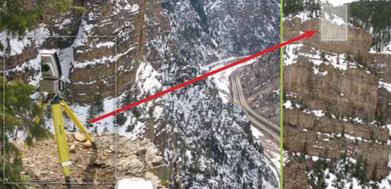
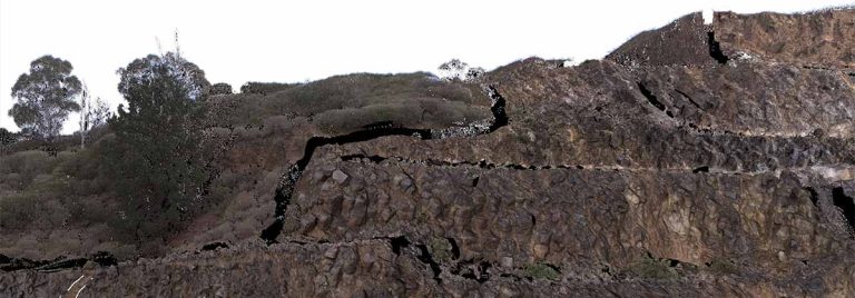
The Maptek I-Site 8800 laser scanner was used to scan and develop a 3D digital terrain model for monitoring canyon walls surrounding Colorado’s busy Interstate I-70 Highway.
I-Site 8400 laser scanning system
The new Maptek I-Site 8400 medium range laser scanner is a streamlined solution for topographic survey and stockpile calculations.
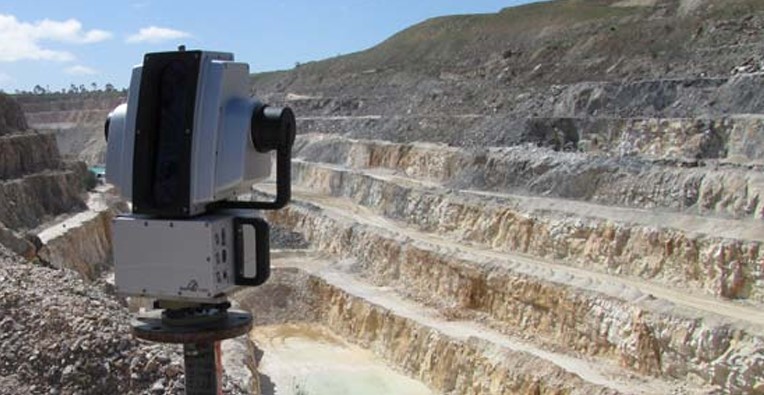
Scanning the Pilbara
Atlas Iron has realised the benefits of using the Maptek I-Site 8800 laser scanner to acquire detailed topographic data for new mining projects in Western Australia.
Moving underground at Argyle
The I-Site laser scanner provides Argyle Diamond Mine with vital survey data for underground design as the open pit approaches the end of its life.
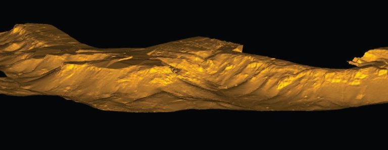
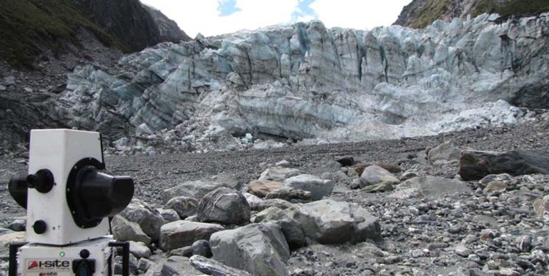
Measuring glacial movement
Maptek I-Site laser scanning technology was used to help researchers measure the advancing face of New Zealand’s Fox Glacier.
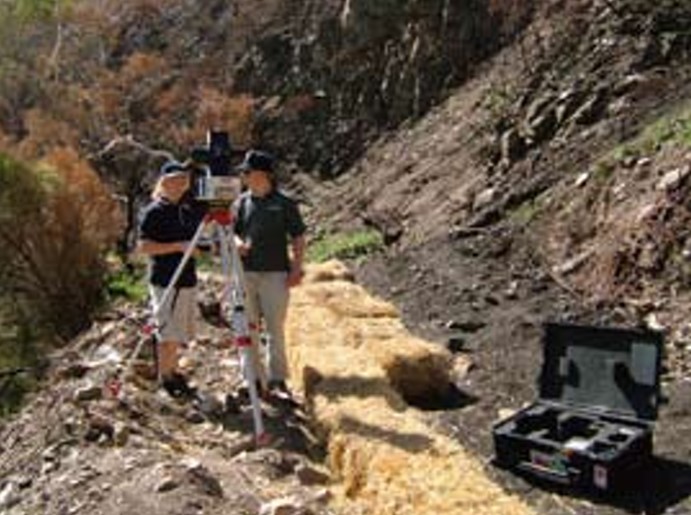
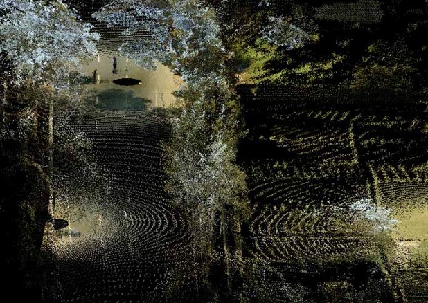
Measuring sediment movement
The Maptek I-Site laser scanner was used to measure erosion following a bushfire for quantifying and modelling sediment movement to help protect waterways.
Blast analysis
The Maptek I-Site laser scanner was used for pre-explosion survey, providing results which can be used to review building standards and design for high-risk locations.
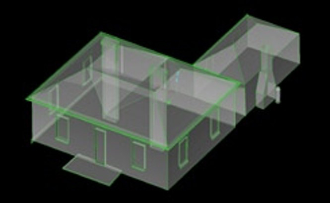
Generating 3D profiles of building facades
The Maptek I-Site laser scanner can be used to accurately and quickly produce 3D models of buildings.
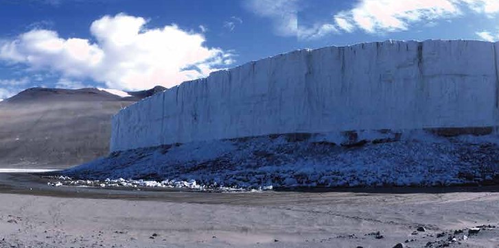
Scanning Antarctic glaciers
The Maptek I-Site laser scanner was used to record the position of an Antarctic glacier to trial the potential of laser scanning for monitoring long-term glacier movement.
Laser scanning for stockpiles
The Maptek laser scanner is quick and easy to operate. The level of data detail leads to improved volume accuracy and the data capture has distinct safety benefits for stockpile surveys.
Interior stockpile management
Adelaide Brighton Cement calls on Maptek to accurately record exterior and interior stockpile volumes. I-Site technology overcomes the challenge of scanning in the dusty environment.
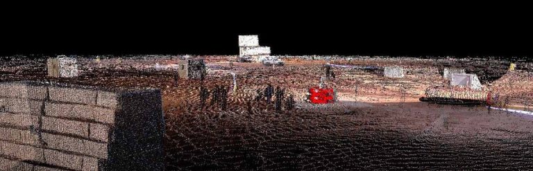
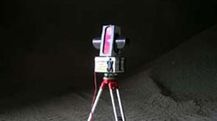
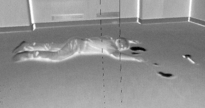
Forensic applications
Maptek I-Site Scanner technology captures complex scenes quickly and accurately in true 3D. I-Site Forensic software includes tools for editing, viewing, modelling and analysing laser scan data.
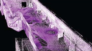
Devastation scene mapping and modelling
The speed and versatility of laser scanning combined with Maptek I-Site Forensic software provides detailed 3D data ideal for intensive forensic analysis.
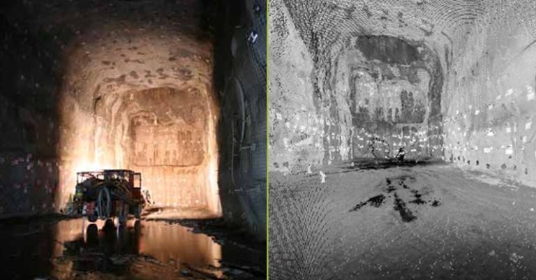
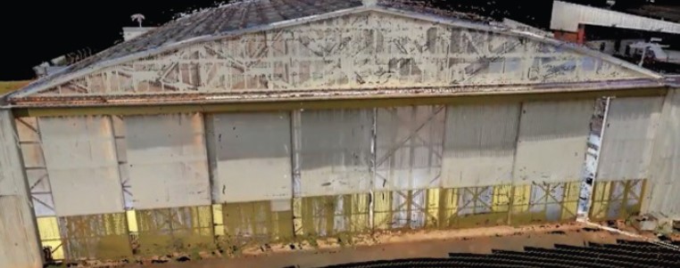
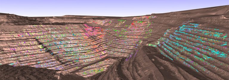
Highwall mapping for mine geology applications
User friendly systems and workflow allow surveyors to scan highwalls quickly and easily, capturing data at the same time as daily or end of month surveys.
Scanning Charleville WWII site for virtual tourism
Maptek I-Site is helping virtual tourism become a reality at Operation Charlie, breathing new life into Charleville’s historic airfield.
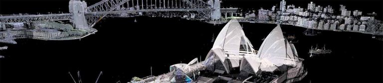
Scanning the Sydney Opera House
Maptek I-Site high performance laser survey technology proved its value during the recent Scottish Ten project to record the Sydney Opera House and its surrounds in 3D.
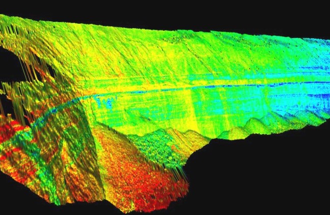
Understanding shear zones
I-Site laser scanning helped AECOM to extract geotechnical information on shear zones in this quarry in southeastern Australia.
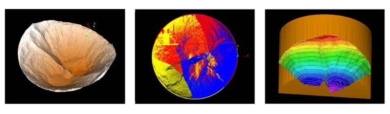
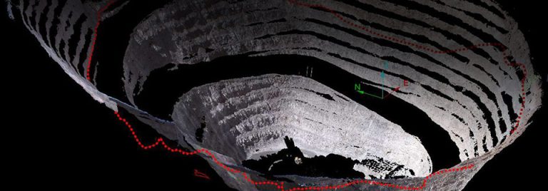
Modelling cement silo profiles
Maptek I-Site laser scanning technology was used to profile material inside the silo at Melbourne Cement to help improve the emptying process.
Defining structures at Esperanza
Geotechnical engineers used I-Site technology to define structural domains for the primary mineralisation of the Esperanza mine in Antofagasta.
Data collection and analysis synergy
A copper mine in Mexico benefits from the combined expertise of specialist consultants for laser scanning and geotechnical analysis.