June 2025 Issue Index
Creating a safe transportation network
Maptek Sentry supported a survey department to safely reopen a commercial highway in Canada after a landslide.
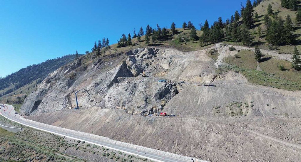
In August 2023 a landslide caused the temporary closure of Highway 97 between Summerland and Peachland in British Columbia, Canada, with 3000 cubic metres of rock blocking traffic in both directions.
The British Columbia Ministry of Transportation and Transit (MOTT) wanted to reopen the highway safely and efficiently. Leveraging Maptek Sentry achieved the necessary assurance to allow public access and restore commercial traffic.
MOTT is tasked with enhancing transportation networks and constructing new infrastructure across the province, with a primary focus on the safe and efficient movement of people and goods.

The MOTT Department of Survey and Geomatics specialises in conducting pre-engineering surveys and design, including installation of continuous monitoring stations to detect slope movements that could jeopardise roadways.
After the landslide event, geotechnical engineers discovered tension cracks extending further upslope beyond the rockfall area. Tension cracks up to 2m wide and 20m deep suggested that the initial rockfall was part of a larger event that required mitigation to protect road users and the highway.
To manage the initial emergency, a 22m high temporary soil and rock berm was constructed along the toe of the slide to resist further slope movement. This berm acted as a buttress until long term stabilisation measures can be implemented.
A robust solution was needed for continuous monitoring to enhance confidence in reopening the highway.
During berm construction, a 24/7 landslide monitoring program was established. Early detection of movement means the highway can be closed on short notice to protect road users and site workers.
Trevor Key, Provincial Manager of Survey and Geomatics, said that deployment of the Sentry mobile monitoring system marked a significant turning point.
‘Implementing Sentry raised confidence and safety to an all-time high. Monitoring with Sentry is mobile, reliable and fast. BC MOTI was able to reopen Highway 97 after a three-week closure following the Peachland landslide,’ said Key.
The tension cracks above the rockfall indicated the presence of a larger slide, and geotechnical engineers determined that additional long-term stabilisation measures were required.

Blasting operations were conducted to unload a portion of the slide mass to reduce the pressure on the hillside and protect the road from further rockfalls. More than 46,500m3 of material was removed from the slope to off-site storage.
By July 2024, blasting and removal of unstable material was completed, allowing crews to transition to stabilising the slope. Stabilisation involves installing steel rock anchors (32mm to 75mm thick and up to 30m long) in the slide zone.
After rock bolting, the temporary berm was replaced by a Mechanically Stabilised Earth retaining wall, forming a buttress to complement the anchors.
The site shut down during winter, with long-term repair work planned for spring 2025.
Managing highway safety
Before Sentry was installed, monitoring stations required a substantial on-site team to handle setup, monitoring and dismantling. This approach posed significant resourcing challenges, with health and safety impacts.
Implementing Sentry significantly decreased the number of site personnel required on-site and enhanced team safety by enabling remote operation.
‘Sentry has allowed us to reduce the number of workers active on the slopes. Having a team member on-site to run the scanner 24/7 was a health and safety concern,’ said Dace Heide, Senior Survey and Geomatic Supervisor for the Southern Interior Region.
Operating four continuous monitoring stations across the province is part of the strategy to ensure the safety of major transportation networks.

‘While these stations play a crucial role in risk management, a mobile system that can be rapidly deployed in emergencies such as landslides, is also necessary,’ said Heide.
Integrating Sentry gave BC MOTI an efficient continuous monitoring solution for delivering real-time alerts for slope movements. Sentry also generates daily reports displaying displacement data for monitored zones. Reports are typically available by 6 am before construction crews arrive on-site.
‘With Sentry, we can email reports to relevant personnel, enabling crews to start with a safety meeting, providing context for a productive workday,’ said Heide.
Sentry reporting plays a crucial role in identifying the cause of movement and distinguishing between rockfall and construction-related activities.
This information allows BC MOTI to respond effectively to address specific problem areas—deploying survey prisms with total stations or adjusting monitoring zones within Sentry. Custom alerts can then be configured for these areas, notifying the appropriate teams such as highway and construction.
‘Tailoring alerts to specific needs helps our team devise solutions to complex issues,’ Heide said.
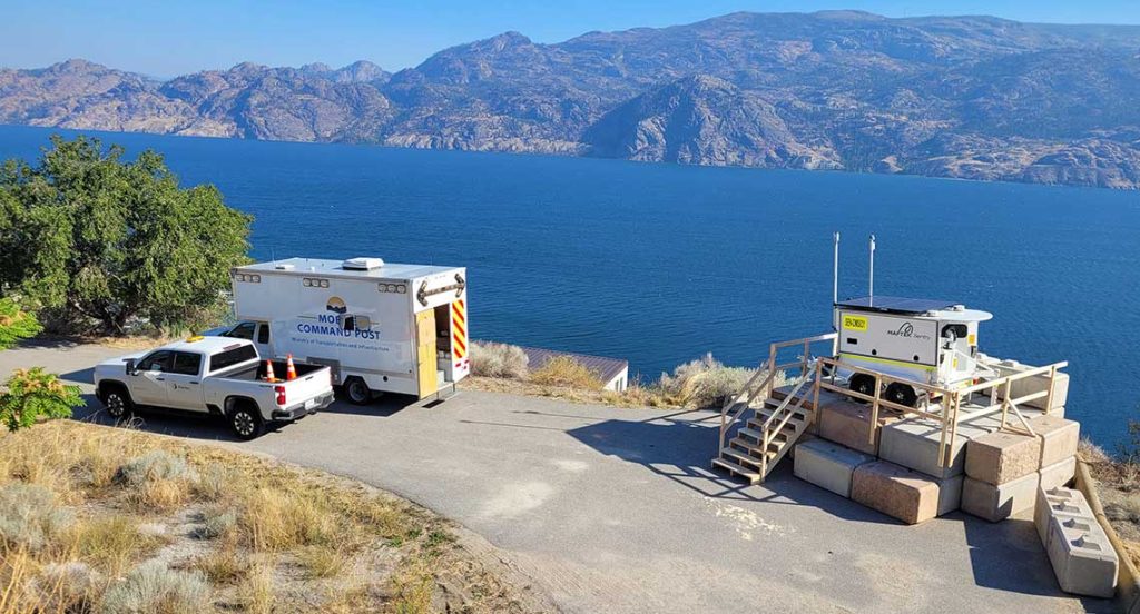
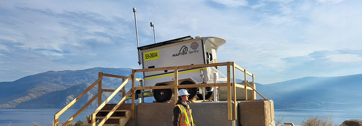
Storing Sentry in a central location enables BC MOTI to deploy it within hours to meet demand. Key credits the reopening of the highway to fast deployment and dependable results.
‘I would 100% recommend Sentry. The combined scanner–trailer system is great. I don’t think there’s another terrestrial scanning solution like it in the market.’
BC MOTI prioritises the safety of team members and the public. The collaborative efforts of the highway and construction teams facilitated the swift restoration of commercial traffic flow on Highway 97.
Thanks to
Trevor Key, Provincial Manager of Survey and Geomatics
Dace Heide, Senior Survey and Geomatic Supervisor for the Southern Interior Region
British Columbia Ministry of Transportation and Transit
- Maptek Sentry was used to monitor a landslide, allowing the safe reopening of Highway 97 in Canada
- Using Sentry allowed the monitoring team to decrease the number of on-site personnel, enhancing overall safety and reducing risk
- Sentry provided real-time alerts and daily reports, improving efficiency and informing decision making for crews
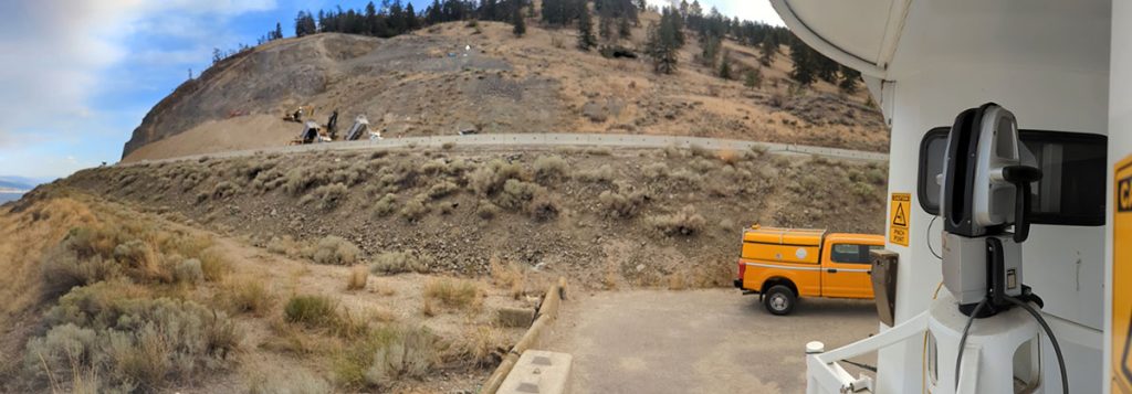
Maptek Sentry was deployed overlooking Highway 97 in British Columbia after a 2023 landslide. The point cloud data captured from the 24/7 remote monitoring system was used by the survey department from the Ministry of Transportation and Transit to support decisions about restoration work while helping to keep site work crews safe.

