June 2025 Issue Index
Software release 2025 highlights
Discover the highlights from the latest Maptek software releases and ways to streamline your mine survey, modelling, design and scheduling tasks.
New features and functionality are always of interest, and a stable experience ensures customers can unlock value.
A good illustration is the more efficient use of local data caching in Vulcan to improve design database integrity, providing faster access to data with design menu options. Another is the graphics rendering enhancements that have reduced dependence on graphics card settings and driver updates.
Feedback is very important to inform Maptek product development, and recent surveys indicate that functionality and stability remain the highest customer priorities. To that end, Maptek has improved crash report analytics during testing, allowing us to investigate and resolve issues early.
Vulcan 2025 and 2025.1
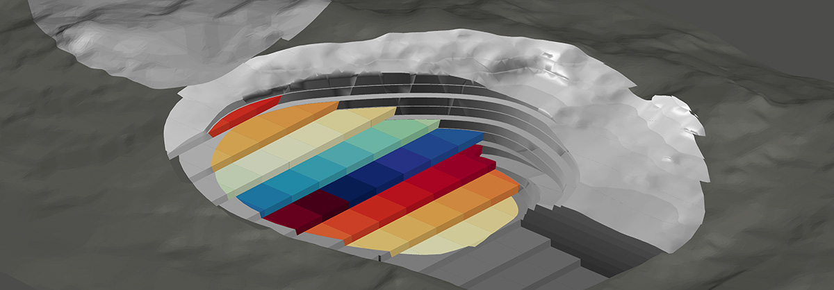
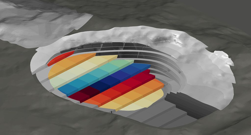
Vulcan 2025 introduced Mining Solids, a streamlined method for cutting phase solids as an alternative to the available Mining Blocks functions.
The Drillhole Optimiser engine is updated to enable both Kriging and Ellipsoid classification methods.
An improved interface and workflow for Gaussian Transformations and Simulation panels in Vulcan Data Analyser enhances the geostatistical analysis experience. Violin plots combining box plots and histograms are new in version 2025.1, simplifying comparison of grade distribution between different domains.
Customers using Vulcan Gantt Scheduler can now apply Python scripts to automate processes and unlock expanded functionality.
Vulcan 2025.1 sees an enhanced Build Road option in the Open Pit menu, allowing users to set a custom road profile shape, define parameter files and save outputs individually via a dockable side panel. Users can dynamically preview their design as they change parameters.
Users will also notice substantial improvements when using large ISIS databases, with some routines running 20 times faster. Mapfile creation is similarly enhanced.
Evolution 2025
Evolution 2025 delivers an enhanced user experience alongside core functionality and reporting tools.
Dynamic Solids in Evolution Epoch combines block and solid models to support classifying materials and aggregating both accumulation values and grade information on the fly as users dynamically create new shapes for scheduling while maintaining access to underlying block model information.
Featuring a modular setup, the Epoch interface displays only relevant information based on schedule complexity. Users can now import linework directly into the Epoch 3D viewer to guide scheduling decisions.
Evolution Strategy optimisation engine has been improved to process grade values directly, streamlining project setup and improving optimisation results.
Microsoft Excel reporting capabilities have been enhanced, with charts exported as native to Excel including underlying data, and live reporting is extended to Excel for dynamic updating of each period.
BlastLogic 2025
BlastLogic2025 introduces BlastMCF—a new add-on for designing blasts that comprises drill pattern, charge plan and timing design. BlastMCF revolutionises open pit blast design with a web-based platform for rapidly generating multiple design scenarios to trade off competing objectives, for example cost, fragmentation and vibration.
The module is available via web browser and users can fine tune results with drill pattern editing tools in the browser interface while leveraging existing workflows through BlastLogic integration and export options.
GeoSpatial Manager
With enhanced usability, powerful new visualisation tools and smarter data sharing, GeoSpatial Manager puts spatial insight at the centre of your operations. With an intuitive, web-based interface, the May 2025 release makes it even easier to visualise, compare and communicate surface changes across sites.
Dynamic, automatic updating to survey surfaces produces a single source of truth for any point in time, and can be accessed securely by everyone in an organisation.
GeoSpatial Manager is now available for trial, with two options to choose from.
- Explore core features in the free Global Demonstration Instance using Maptek-supplied data
- Test the full power of GeoSpatial Manager with a 7-day trial using your own data
Visit maptek.com to find out more.
PointStudio 2025
This release brings powerful new performance upgrades driven by customer feedback, to help analyse, report and share spatial data with greater accuracy and efficiency.
Photogrammetry and Haul Road html reports now allow surveyors to confidently deliver clearer, quality-driven insights to operational and production teams.
Individual failure labelling provides superior clarity for haul road analysis, where conformance to design is critical for operational safety.
Enhanced Digital Surface Model GeoTIFF export allows upload to drone flight planning software.
Improved DXF/DWG output now fully supports the transfer of edge properties to downstream applications, and users will enjoy better performance in Topographic Surface and Volume tools.
GeologyCore 2025
This release sees the addition of a new Radial Basis Function (RBF) engine, enabling key enhancements to implicit modelling, Modelling Manager and DomainMCF machine learning functionality. GeologyCore customers will now easily be able to access modelling methods for fault, vein, vein network, erosion, deposition, intrusion, numeric RBF models and machine learning.
Radial Basis Function enhancements aid interpolation and surfacing across several tools, including Vein Modeller and Fault Manager.
Modelling Manager now supports depositional and erosional surface types, enhancing accuracy of modelling stratigraphic units. Additional enhancements, such as better CAD labelling, make this the most capable GeologyCore version.
DomainMCF
The latest DomainMCF functionality is available via the GeologyCore 2025 add-on. Multivariate data imputation handles missing data, text values, numeric or assay data. Preprocessing predicts values prior to uploading into DomainMCF for training, with both text and numeric data supported.
Users can also now upload solid wireframes to provide spatial control to the machine learning process. Multiple solids are allowed and each can be assigned a priority to manage any overlapping volumes.
Solid wireframes representing fault blocks can also be uploaded and prioritised, enabling independent models within each fault block based on the input data within each solid volume. Models within fault blocks are automatically merged into a single block model output.
Multiple block model outputs can be generated in a single pass, each with different spatial location, block and subblock parameters. Improved block coalescing honours domain boundaries, with more efficient allocation of subblocks. Users can define sub-blocking differently in each (x, y, z) dimension. DomainMCF machine files are now faster to upload and download.
Maptek recommends downloading the latest software to access new features and enhanced performance. Release notes for all software solutions are available in the Download Manager when logged in to Maptek Account.
- Maptek 2025 software releases aim to streamline mine survey, modeling, design, and scheduling tasks for increased efficiency
- Vulcan 2025 introduces Mining Solids, Drillhole Optimiser updates and Python scripting for Gantt Scheduler automation
- Evolution 2025 delivers an enhanced user experience with Dynamic Solids, modular interface, and MS Excel reporting improvements