
July 2026 Issue Index
When millimetres matter
Discover how Elk Valley Resources used PointStudio to reveal subtle ground movement, strengthening geotechnical confidence through integrated monitoring technologies.
Elk Valley Resources (EVR) operates four steelmaking open-pit coal mines in the Elk Valley region of southeastern British Columbia, Canada, where proactive geotechnical hazard identification and risk management are critical components of safe and efficient operations.
To support these objectives, EVR employs a combination of in-ground instrumentation and remote sensing technologies to monitor ground conditions, assess slope performance, and identify early signs of instability.
As part of a long-term slope deformation assessment at one of EVR’s operations, multi-epoch aerial LiDAR and satellite-based InSAR datasets were integrated to evaluate ground movement across waste rock dumps, natural rock slopes, and historic pit wall exposures.
Maptek PointStudio software served as the primary platform for integrating, visualising, editing, and analysing these large multi-source datasets within a single three-dimensional environment.
The software enabled efficient integration of LiDAR surfaces, InSAR displacement measurements, geological structures, georeferenced field photographs, and site observations, providing valuable geological and spatial context for interpretation.
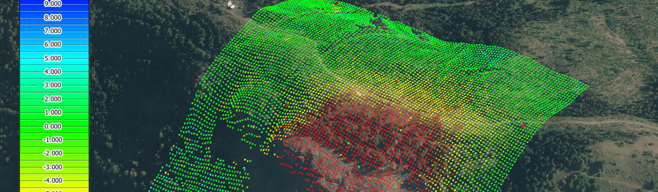
Analysis undertaken within PointStudio revealed that year-to-year comparisons generally indicated minimal movement; however, assessment over the full 15-year monitoring period identified measurable cumulative deformation that would not have been readily apparent through shorter-term evaluations.
No significant movement was detected within the monitored waste rock dumps, providing confidence in their long-term stability.
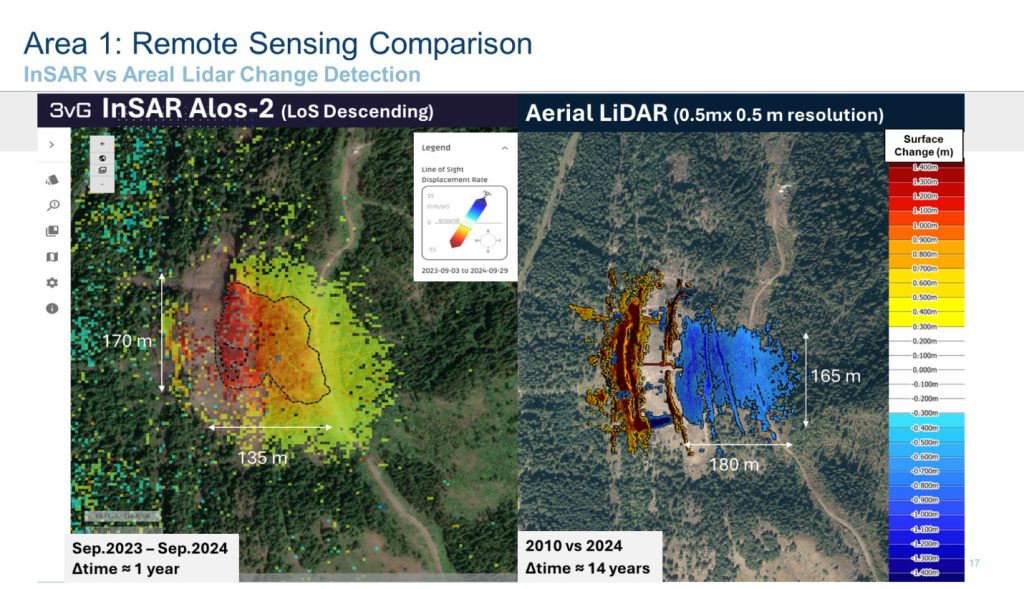
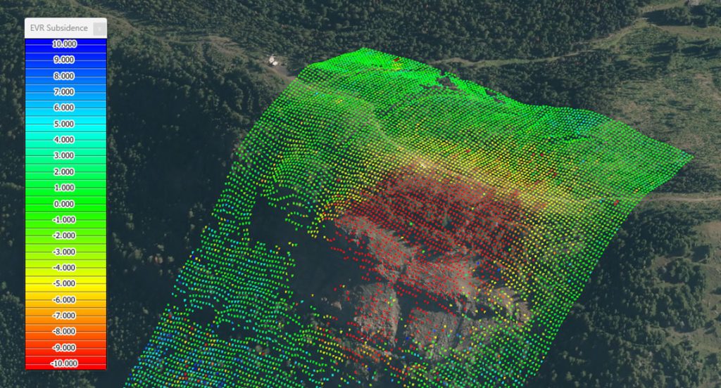
In contrast, a distinct subsidence hotspot measuring approximately 150 m x 200 m was identified and independently validated using both LiDAR and InSAR datasets.
The deformation feature is located directly above historical underground coal workings developed during the late 1960s.
The observed deformation pattern is characterised by very slow, long-term surface subsidence and is interpreted to represent a delayed ground response associated with progressive weathering, degradation, and localised yielding of remnant pillar-supported underground workings.
Based on these findings, in-ground monitoring systems, including prism and GPS instrumentation, have been deployed and are being actively monitored to continuously track deformation trends in the area of interest.
Maptek PointStudio has proven to be a valuable tool for EVR’s Geotechnical Department by providing an intuitive and efficient platform for managing, integrating, and visualising large volumes of monitoring data.
The workflow supports data-driven geotechnical decision-making, enhances hazard identification, facilitates validation between independent monitoring technologies, and significantly improves confidence in the interpretation of long-term slope and ground performance.
- Discover how Elk Valley Resources used PointStudio to reveal subtle ground movement.
- See how integrated LiDAR and InSAR data revealed subtle ground movement invisible through short-term monitoring.
- Learn how long-term monitoring supports safer, more informed ground stability decisions.