
July 2026 Issue Index
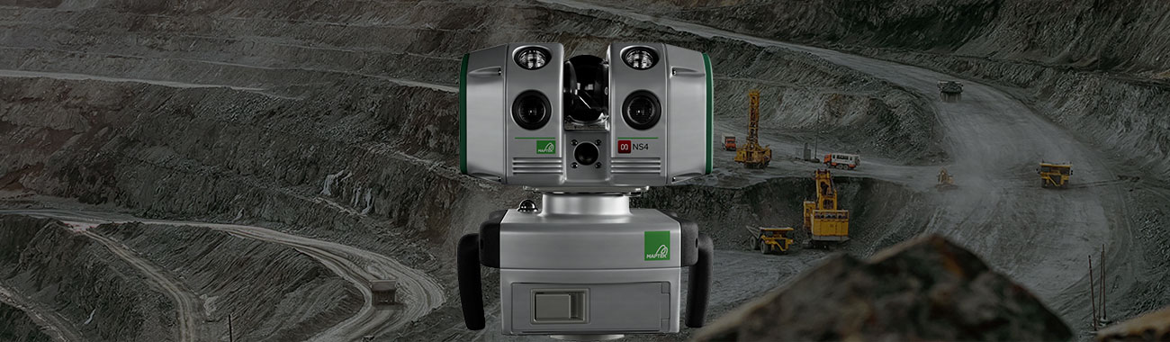
Introducing the Maptek NS4
Meet the new NS4 laser scanner, delivering the accuracy, flexibility and connectivity needed for modern spatial data capture.
What if a single scanner could support underground mining, surface operations, tunnelling and civil projects – while making field-to-office workflows faster and more connected?
That’s the thinking behind the new Maptek NS4 laser scanner, a compact, survey-grade laser scanner and image sensor designed to deliver accurate spatial data capture across a wide range of environments and applications.
Combining long-range measurement, high-resolution imagery, positional tracking and built-in illumination for low-light environments, the NS4 captures reliable three-dimensional geometry and optional panoramic imagery to support survey validation, geotechnical assessment, operational measurement and engineering review.
Smaller. Smarter. Connected.
Designed for versatility and ease of deployment, the NS4 brings together powerful scanning capability and a lightweight, portable form factor.
Whether operating underground, on a surface mine, within a tunnel or on a civil construction project, teams can quickly capture the information they need with confidence.
A wide 360° × 260° field of view enables faster data acquisition in complex environments, while built-in LED illumination supports reliable operation in underground and other low-light conditions.
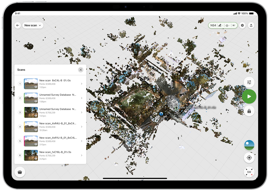
The NS4 can be controlled using the FieldControl app on Apple and Android devices, providing flexible mobile operation in the field. Existing users can also continue working with FieldHHC software, helping teams integrate the scanner into established workflows.
One scanner, multiple applications
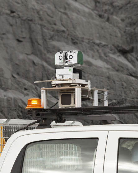
The NS4 has been developed to support collaborative workflows across mining, tunnelling, civil construction, BIM, engineering and forensic applications.
The combination of survey-grade accuracy, portability and wide-angle acquisition makes it suitable for everything from routine survey tasks to specialised investigations.
Teams can efficiently move between scanning locations, reduce setup time and capture comprehensive site data with fewer repositioning requirements.
By using a single system across multiple environments and applications, organisations can simplify equipment deployment while maintaining consistency in data quality and workflows.
From data capture to decision-making
Capturing data is only the first step. The NS4 is designed to support more connected workflows that improve how information moves from the field to the office.
Using MDS, the Maptek Data System – scan data can be pushed from the field control devices to the cloud, enabling office teams or preconfigured workflows to begin processing, reviewing and analysing data while the scanner remains deployed in the field.
This reduces delays between capture and interpretation, allowing surveyors, geologists and engineers to identify issues, validate coverage and make informed decisions sooner.
By connecting field operations with office-based processing, organisations can streamline data handoff, minimise downtime and accelerate the delivery of actionable results.
Integration with Maptek workflows enables efficient collaboration across sites and disciplines, helping teams move seamlessly from data capture to modelling, analysis and decision-making.
The Maptek NS4 delivers the accuracy, flexibility and connectivity needed for modern spatial data capture – helping organisations collect better information, streamline workflows and gain greater value from every scan.
- Discover more about this compact and lightweight laser scanner.
- See how cloud-connected workflows accelerate the journey from field data to decision-making.
- Learn why portability, flexibility and survey-grade performance make the NS4 ideal for modern operations.
Key elements of the NS4
- Compact and lightweight for easy transport and deployment
- Survey-grade accuracy and long-range measurement capability
- Wide 360° × 260° field of view for faster capture
- High-resolution imagery and positional tracking for enhanced context
- Built-in LED illumination for underground and low-light environments
- Mobile-device operation via the FieldControl app