March 2019 Issue Index
Continuous monitoring in cold climates
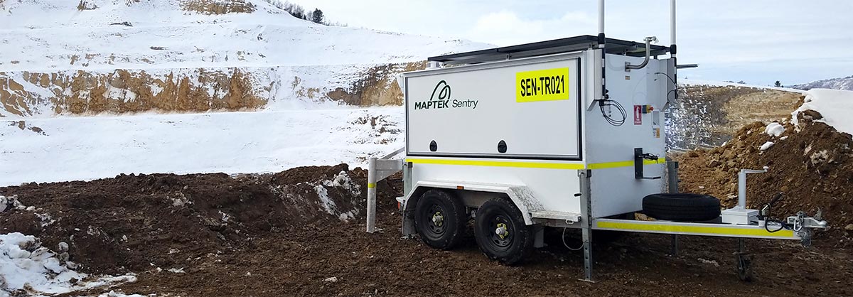
An exciting addition to the Maptek technology portfolio answers the need for continuous, reliable surface monitoring in extreme environments.
The Maptek Sentry cold climate system can operate continuously in temperatures from -20°C to +50°C, and for a limited operational time below -20°C.
The generator, hydraulics and electrical systems have been adapted to maintain energy efficient, cost-effective operation. The redesigned battery pack and housing is insulated to keep the unit at a stable operating temperature.
To operate at the lower temperatures, Sentry requires a cold climate XR3 laser scanner, which has also been redesigned. A removable neoprene scanner jacket provides extra protection against wind chill.
Sentry is a mobile remote monitoring system that uses laser scanning to continuously measure ground movement with extremely fine spatial resolution and accuracy. Housed in a self-contained unit with autonomous power and communications capabilities, Sentry relies on sophisticated software to monitor, analyse and report in real time.
The 3D point cloud data collected while monitoring can be used for geotechnical analysis and other applications. The laser scanner can also be redeployed from monitoring for routine survey tasks.
Sentry is available in four configurations to suit mobile, fixed, open pit and underground monitoring applications.
Why use Sentry
- Safe, remote monitoring of pit walls, floors, tailings dams and mine access ramps
- Cost-effective monitoring and survey solution for managing operational safety
- One-person operation to set up and start monitoring in minutes
- Set alarm thresholds and notification protocols to meet your site safety programs
- Local technical support from mine survey and geotechnical experts