September 2023 Issue Index
Deformation mapping and modelling
Maptek has assembled a comprehensive suite of tools for underground geotechnical and survey applications within an intuitive menu-driven workflow.
The new Underground Tools add-on in Maptek PointStudio and PointModeller has evolved from our existing underground point cloud processing tools and a new dedicated Underground menu offers a faster and improved workflow.
Geotechnical and civil engineers know that deformation and relaxation as the rock mass adapts to an excavation over time can become a risk to equipment and personnel. The right information at the right time is crucial for site safety.
Capturing underground data from tunnels, drives and crusher chambers is time consuming for geotechnical engineers, surveyors and technicians. Post-processing can be just as arduous. Release of the new Underground Tools sees the whole process, including registration, cut down to a few minutes.
With an intuitive workflow menu, the new Underground Tools add-on allows users to fast track deliverables, report to stakeholders, update production teams before shifts and allocate time saved to other tasks.
Point clouds are imported rapidly in the required file formats. Existing registration using the matching point pairs tool and survey locations has been the go-to choice for many years and registration is seamless. An alternative option uses automated initial positioning to register recently captured point clouds to those previously registered. This is useful when scanning times are tight, targets have not been set up, or the level of deformation has significantly altered the survey locations of targets.
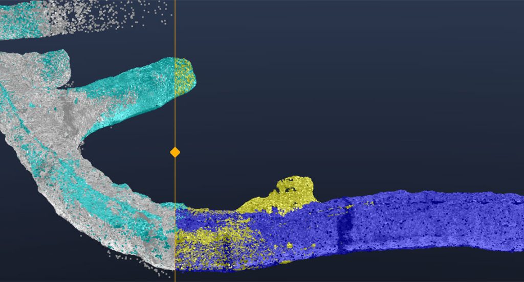
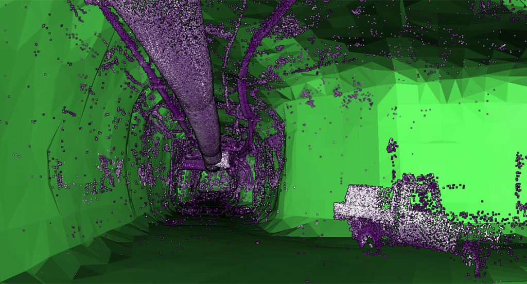
A highlight of the new tools is the ability to filter out services including cables, pipes, machinery and people – a once tedious manual process can now happen in seconds. In addition, the new centreline option ensures complete tunnel coverage when generating smoothed surfaces. Both tools result in a single hull surface tool for a single click deliverable covering hundreds of metres of tunnel development in minutes.
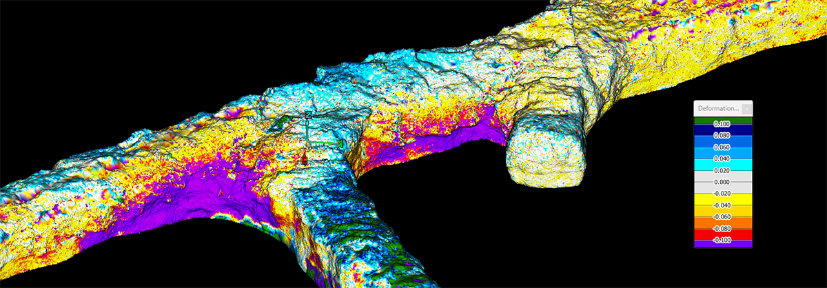
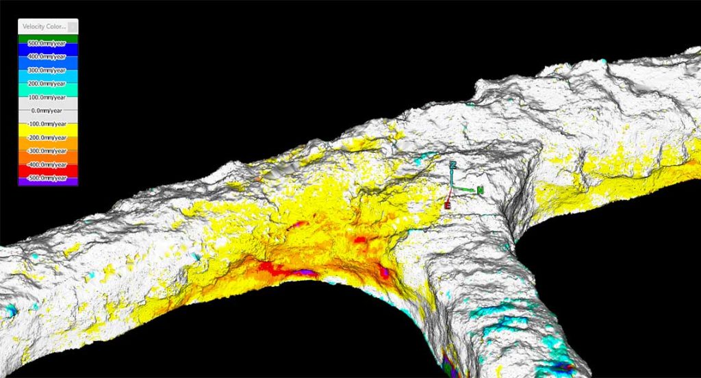
Complex 3D surfaces can then be generated as representative surfaces to identify areas of deformation, key block risks and rates of deformation using velocity heat maps.
The underground report tool seamlessly compares the level of change between multiple surfaces at set intervals or cross sections. This is particularly useful for delivering reports to management, focusing their attention in 2D section to complement the 3D heatmap surfaces.
Survey deliverables include volume and tonnage from excavated tunnel surfaces, as well as overbreak and underbreak costs. This is essential for evaluating tunnel design to as-built surfaces, allowing operators to identify causes of overbreak/underbreak and potentially reducing costs for future development.
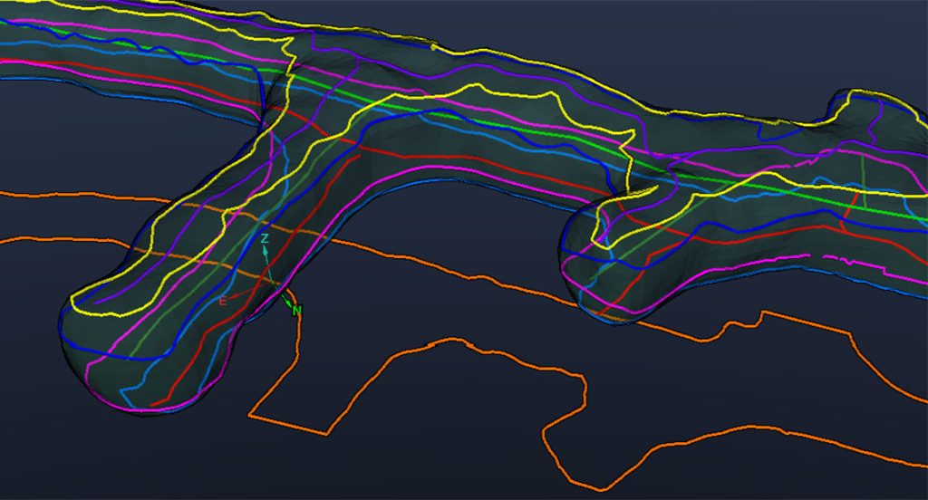
Game changing multi-grade tunnel strings, including sidewall strings with a customisable height, are available for 2D reporting. A new plan view boundaries tool for complex tunnel scenarios such as pumped-hydro multi-chamber and bord and pillar mines, is also essential for 2D reporting.
The new tools complement the PointStudio and PointModeller suites. Maptek solutions meet point cloud processing expectations at operations around the world, with seamless, modern platforms allowing users to efficiently and accurately complete daily tasks. Maptek aims to help make operations safer and enable them to make better decisions.
- A menu-driven workflow improves the user experience for underground survey and geotechnical data capture and reporting
- Easily filtering out underground services and mesh provides a cleaner point cloud for modelling and analysis for downstream tasks
- Benefits include fast tracked deliverables, stakeholder reporting, production team updates before shifts and allocating time to other tasks