September 2021 Issue Index
Rock bolt analysis
A new tool applies laser scan data to reconcile rock bolt distribution and effectiveness, improving safety in underground environments.
A new tool that automates the spatial distribution and analysis of rock bolt effectiveness will be available to Maptek customers later in 2021.
The rock bolt solution includes extraction, analysis and reporting options for evaluating the stability of structures and surrounding rock mass to maintain safe working conditions underground.
Support and reinforcement of rock structures is a safety priority for underground mining operations and civil tunnelling projects.
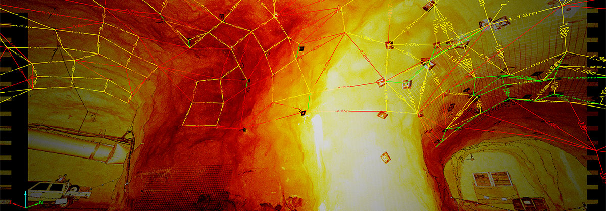
Rock bolts are installed in mines and tunnels to support exposed structures and prevent rock collapse. Current practice involves personnel visually inspecting the placement, distribution and condition of rock bolts to assess their effectiveness.
The new Maptek approach automatically identifies and counts the bolts on the laser scan, removing the need for manual or digitised recording.
Rock bolt assessment is easier, faster and safer. Underground operations can determine whether the location of planned or installed bolts is correct and take remedial action as required.
Benefits
- Improve underground safety through understanding rock mass support requirements
- Design placement of rock bolts to prevent key block failures and meet site safety regulations
- Accurately represent rock bolt location for more efficient design and reduce costs related to surplus placement
- Confirm placement of rock bolt patterns through 3D visualisation and reconcile payment for installation contractors
- Reporting and visualisation features support better decisions by surveyors, geotechnical engineers and mine management
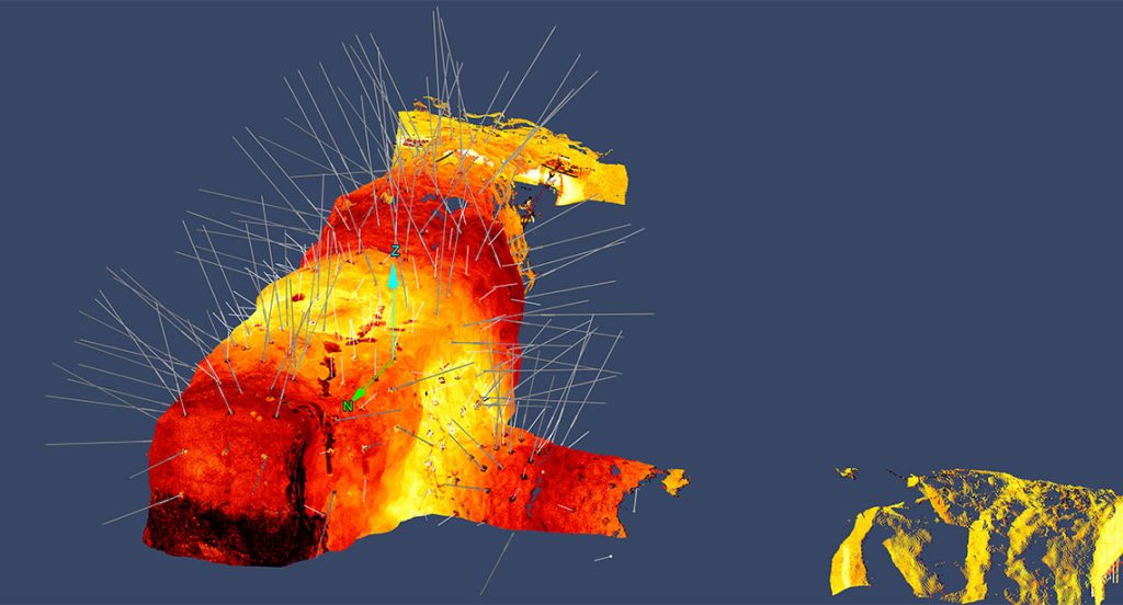
Rock bolt analysis is run on point clouds captured by Maptek laser scanners. The Maptek SR3 system is ideal for underground scanning and can be deployed to capture rock bolt data weekly or monthly, depending on the extent of underground headings and installation areas.
Future development includes incorporating output from SLAM (Simultaneous Localisation and Mapping) data sources.
Rock bolt analysis will be available by subscription for PointStudio and PointViewer licences.
- Underground safety is the key objective for understanding and implementing rock mass support
- Laser scan data is a safe, effective method for analysing spatial distribution and effectiveness of rock bolts
- Reporting and visualisation features provide decision support for geotechnical engineers and mine management