December 2019 Issue Index
Stockpile topographic survey
Maptek laser scanning technology is being used for calculating stockpile volumes at a gold mine in Mexico.
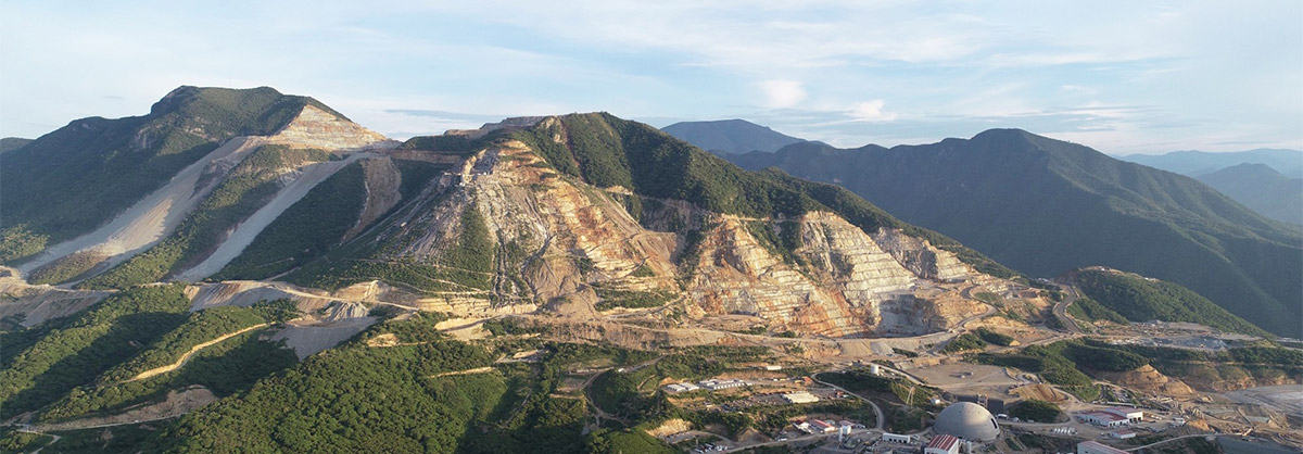
The Torex Gold property lies 180 kilometres southwest of Mexico City, in Guerrero state. The El Limón Guajes (ELG) Mining Complex comprises the El Limón, Guajes and El Limón Sur open pits, and the Los Guajes El Limón underground mine, processing plant and infrastructure. Media Luna is a development project.
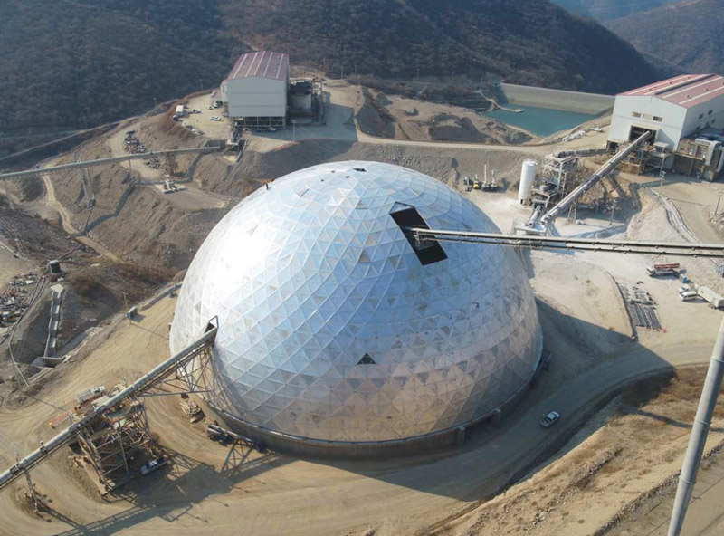
Enclosed stockpile survey at the ELG complex was one of the most important tasks. The main challenges were environmental conditions, poor lighting, excessive dust, temperature and humidity.
Surveyors needed to be able to efficiently gather accurate information and deliver high quality results in a timely manner. The goal was to know the volume of material and the shape of the stockpile.
Torex surveyors have been working for several years with the Maptek 8820 laser scanning system for data acquisition, together with the Point Studio software.
Surveying is done without control points within the enclosed stockpile structure. Local coordinates and global coordinates obtained with GNSS receiving antenna are used as well as orientation with the physical infrastructure.
Stockpile surveys can be carried out quickly, due to the speed of the laser scanning equipment, simplicity of use and inbuilt workflows.
Surveys with global coordinates are oriented in the post-processing stage. Multiple scans must be performed to gather sufficient information. Global registration provides quick and reliable information to guide surveys. The result is used as the basis for the orientation of the rest of the scans.
The Automated Initial Positioning tool in PointStudio allows scans to be moved in seconds from their initial local coordinate position to global coordinates. This allows automatic orientation of the scans with local coordinates.
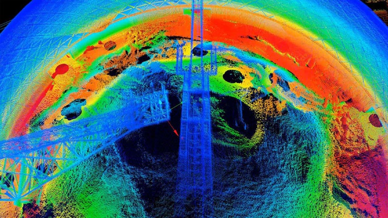
After initial positioning, surveyors perform a global orientation to ensure that all elements are fully adjusted. Scans with the best fit in relation to the main scans are defined as the stockpile base. For best results, scans are divided into sectors with the closest possible correspondence between elements.
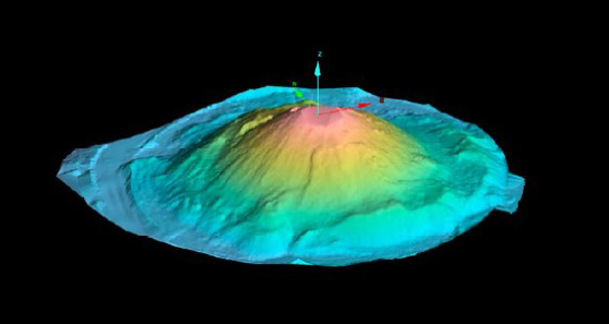
The main survey objective is to calculate the total volume of material contained under the dome. Unnecessary elements can be filtered out using a range of options.
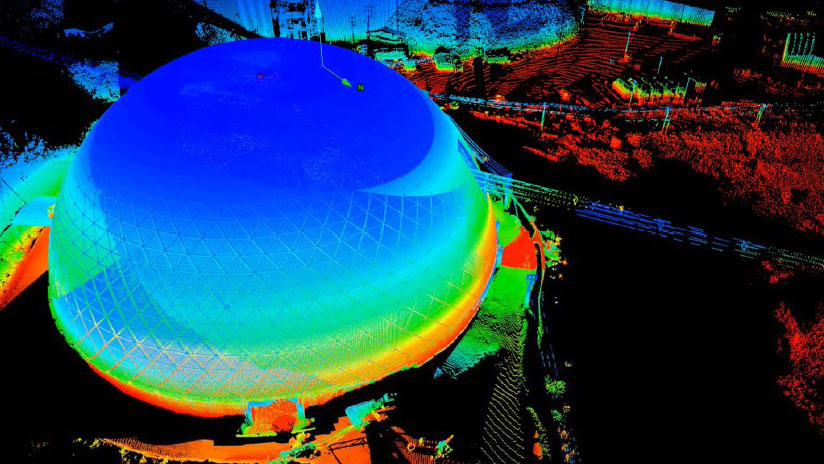
Automatic identification of a terrain (topographic) surface and quick removal of all non-surface elements (structures) is fast and efficient. This complex work is completed in seconds and provides a visually attractive report for head office.

Data that cannot be filtered automatically is manually removed. The final stockpile surface is created from the coordinated and filtered information.
The highly detailed surface generated in PointStudio is an accurate representation of the stockpile shape. The volume of the contained material is then calculated.
Benefits of the Maptek solution are:
- Fast and accurate survey
- Information with a high level of detail,
adjusted to reality - Simultaneous use for other survey activities
- Multidisciplinary survey system
- Adaptable to any environment
- Automated processes
- Powerful, simple software tools
- User-friendly workflow
Thanks to
Jonathan Barajas
Short term Planning Engineer
Torex Gold Minera Media Luna
- Environmental conditions, poor lighting, excessive dust, temperature and humidity provide challenges for enclosed stockpile surveys.
- Maptek laser scanners help Torex surveyors efficiently gather accurate data on stockpile shape and volume and deliver results quickly.
- Identifying the topographic surface and filtering structures is fast and efficient with Maptek PointStudio.