June 2018 Issue Index
Integrated modelling with Eureka 5
Updates in Maptek Eureka 5 and the Maptek Workbench will deliver enhanced modelling, correlation and mapping tools.
Maptek Vulcan and Eureka users have been operating on the Maptek Workbench for a year, with positive feedback to date. Toolbars, menus, command lists and shortcut keys can be created to suit work patterns. Universal access to text and spreadsheet editors, database and scripting tools make working with exploration and project data a better overall software experience.

Sharing the Maptek Workbench environment with Vulcan, and with other applications coming in 2018-19, opens up integrated drillhole modelling and visualisation, tied and tiled views and cross-product workflows.
Drillhole data changed in one application is shared in the other applications.
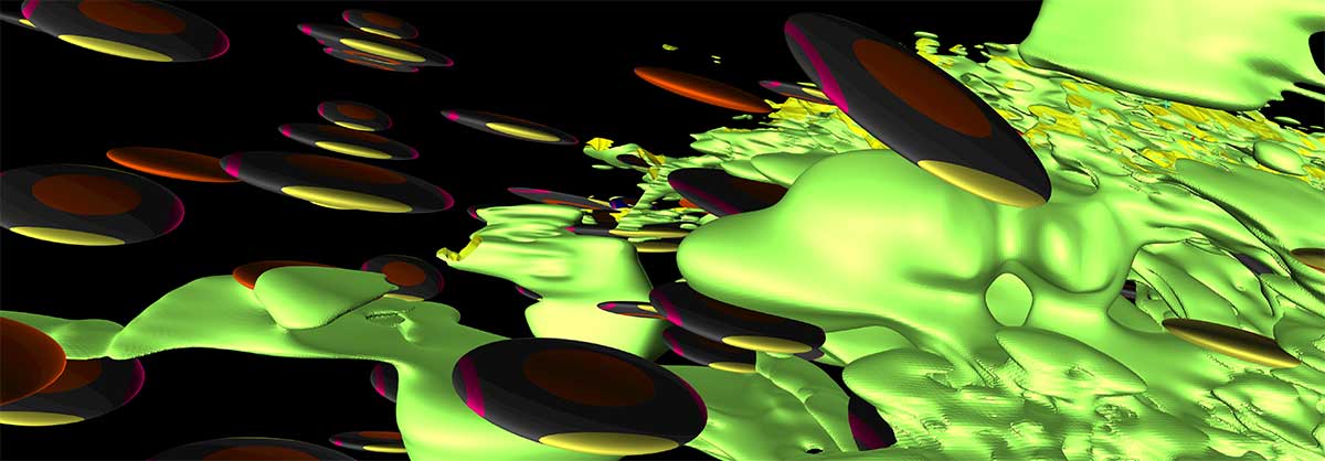
Taking a function-based approach to implicit modelling, Eureka also allows a wide range of input data types including triangulations, attributed points, direct drillhole intercepts and line-based ribbons.
Multiple orientation ellipses can be used simultaneously to control models in structurally complex situations for enhanced orebody interpretation. This is ideal for elongate and variably sampled modelling, as well as modelling veins as hanging walls and footwalls.
A different methodology is tailored to modelling thin, steeply dipping vein-type deposits, whereby the hanging and footwall models are created as Radial Basis function surfaces rather than solids.
With Eureka 5, users can create implicit surfaces from categorical attributes on point data, for example, modelling rock codes. Multiple rock code attributes can then be modelled as a single surface.
Selecting values to model string attributes on drillholes or attributed points is simply done via displayed attribute legends. Colouring is automatically carried across to matching surfaces. A multi-threading option improves performance.
A single streamlined option allows users to create dynamic global or local maps using the Mapbox service, including automatic selection of appropriate coordinate systems and zooming in to selected objects.
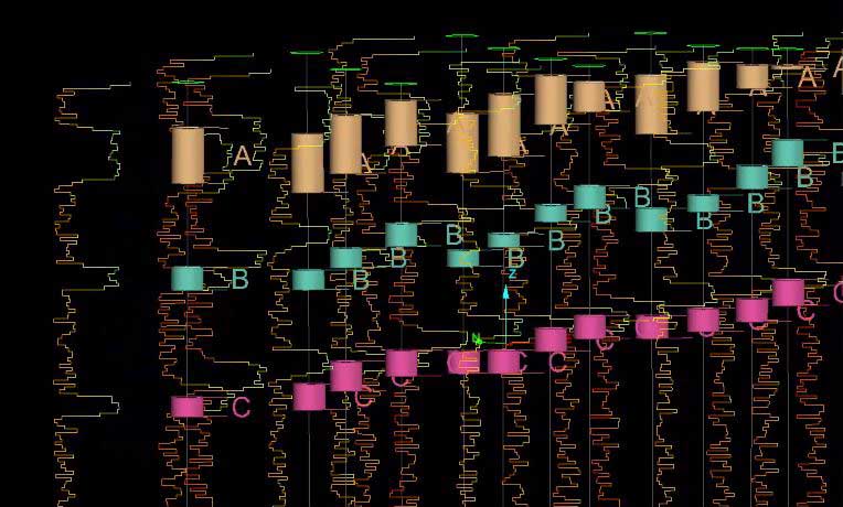
Automatic seam labelling from downhole data makes it easier to assign seam names to coal units. A slider bar controls the number of seams generated, and the tool now works on selected edges of the drillhole to allow label refinement.
Eureka allows spatially located data to be put into context to better understand the inter-connecting relationships between disparate information. The latest tools enhance viewing and correlation of the data as well as in-depth analysis of areas of interest.