June 2018 Issue Index
A single solution for underground mapping
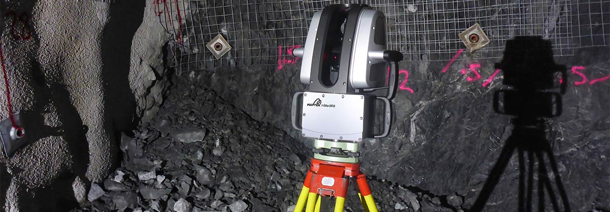
The new Maptek SR3 laser scanner has been designed to effortlessly accomplish underground spatial mapping tasks.
Taking a Maptek third generation laser scanner underground is a totally satisfying experience. For a start, the Maptek SR3 weighs less than 10 kg, and can be easily carried by its ergonomic handle. Flexible mounting options include tripod, underground vehicle or extendable boom.
Efficiency
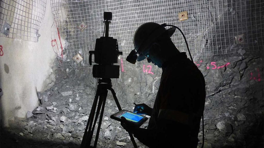
Setup and registration is a seamless exercise. Using multi-backsight to known targets ensures accurate scanner positioning. This enables users to easily view digitised CAD files and compare design strings to as-builts underground.
The Maptek SR3 can capture a 360-degree scan in less than a minute.
Imagination becomes reality with fast, safe collection of accurate survey grade data underground, accompanied by intuitive tools that streamline geological mapping and detailed geotechnical analysis.
‘Customers have reported a high level of satisfaction using the SR3,’ said Product Manager James Howarth. ‘One of the new features allows access to the user interface through any web-enabled device to conduct scans.’
Imagery
While the internal 147 megapixel HDR camera is optional, many operations will appreciate the benefits of acquiring high definition digital imagery and scan data simultaneously.
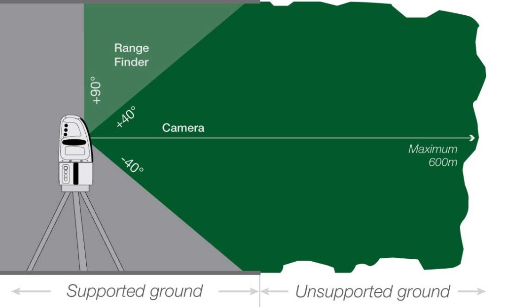
With the SR3 users can capture accurate digital imagery of unsupported ground in drives and development headings prior to treatment. The 3D point cloud and matching imagery can be used for geological and geotechnical applications with no extra time spent underground.
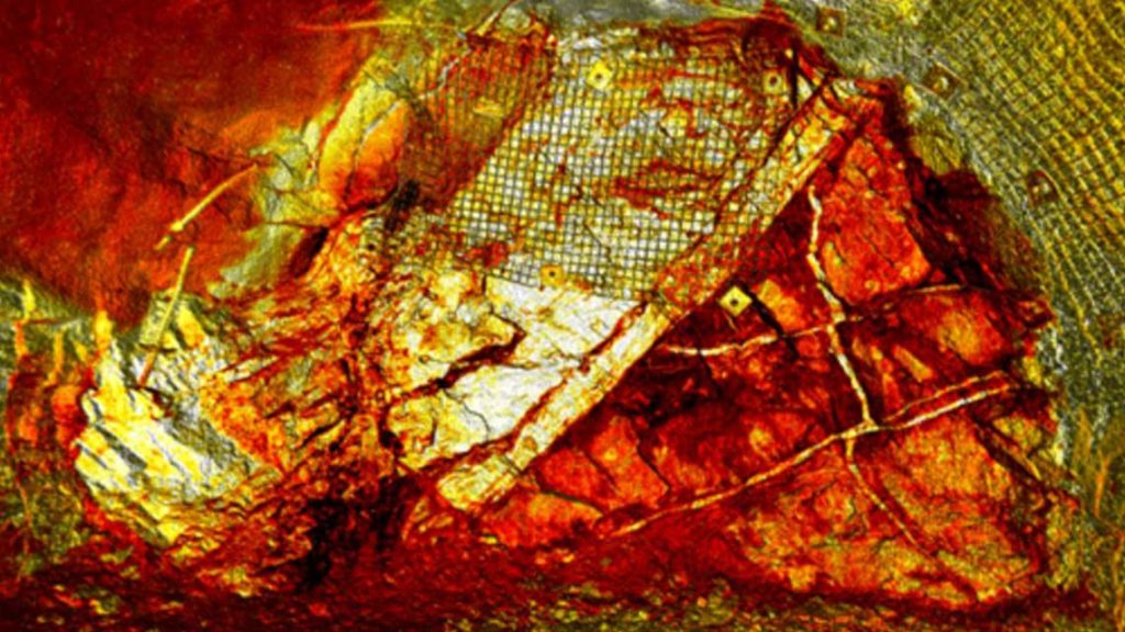
Overlaying imagery on high resolution point clouds allows enhanced recognition of structures, joints and boundaries.
One of the easiest ways to map geology is to switch between imagery and scan spectrum intensity. ‘The SR3 significantly reduces the time and manual effort for geological mapping underground,’ said Howarth. ‘One customer reports that turnaround time on mapping has improved from 2 hours to 15 minutes.’
Detailed high resolution imagery is a key asset for geological and geotechnical applications, as well as useful for communicating with stakeholders.
A new feature allows import of mine CAD strings and surfaces for visualisation on scans. Users can also view grade shell boundaries and fault zones as surfaces alongside a scan to assist with identification of structures at the rock face.
‘We spent a lot of time getting the tablet workflow as efficient as possible,’ said Howarth. ‘Geologists can load a scan, turn on the design layers and compare the design strings to as-builts while underground. This is a massive advantage over other systems.’
Processing/reporting
A wide scan window captures surfaces of underground drives without the need for complicated configurations. Whatever the orientation of the scanner, integrated levelling automatically corrects scans before processing.
The seamless experience continues on the reporting side. A soon-to-be-released Underground Reporting Module provides the workflow for easily comparing a design solid with an actual surveyed solid to identify overbreak and underbreak.
Benefits include reducing grade dilution, highlighting unstable areas and reducing costs by identifying unnecessary development and pre-blast issues.
Whether you are a surveyor, geologist or rock engineer, the SR3 can smoothly handle your spatial mine measurement tasks underground.