March 2021 Issue Index
Survey keeps airport project on track
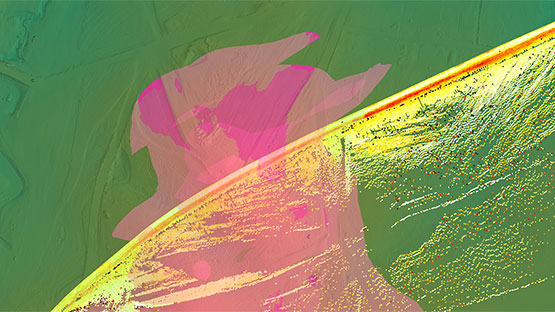
Maptek mine measurement technology helps ensure bulk earthworks meet design for the Western Sydney International Airport.
Maptek survey technology has increased data acquisition capability and quality, and decreased the data processing time for the joint venture earthworks partners.
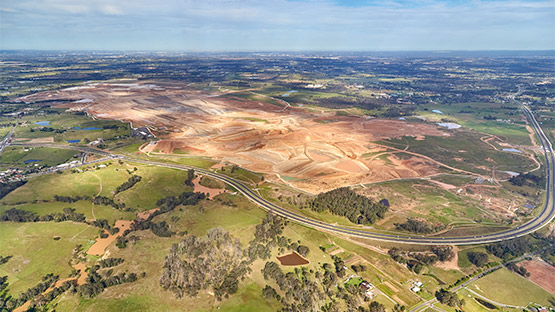
In April 2014 the Australian Government designated Badgerys Creek in Western Sydney as the site for the city’s new airport and geotechnical investigations began in 2015.
The government later committed $5.3 billion in equity to build Western Sydney International Airport, and the CPB Contractors and ACCIONA Joint Venture was awarded the contract to undertake the earthworks.
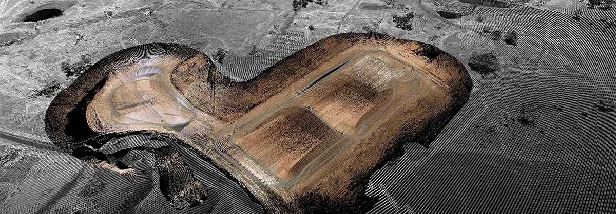
At 800 hectares, the project is one of Australia’s largest ever earthworks infrastructure projects outside of the mining sector, and will excavate and place a total of 25 million cubic metres of earth.
The site is currently running 73 heavy dump trucks (42 rigids and 31 articulated) and has had up to 76 scrapers running at any one time.
Maptek equipment is built to handle the rugged mining environment, so applying it to a large scale civil project was a natural fit.
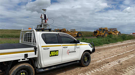
In 2019 the site began using a Maptek LR3 laser scanner to track material movement using a stop-go data collection method.
As the cut and fill project progressed, with 300mm of fill being laid every day and the need for precise measurement to ensure the right material, thickness and compaction was achieved, speed of data capture and processing became a key issue.
Given the lack of elevation change in the terrain and therefore elevated positions to scan from, it was challenging to capture and process the data quickly, prompting a fresh conversation with Maptek and a trial of Maptek Drive.
Maptek Drive allows the continuous acquisition of laser scan data with a Maptek laser scanner mounted on a moving vehicle and removes the need for any scan registration.
Since March 2020 the site has been running two Maptek Drive systems with LR3 scanners, along with Maptek PointStudio point cloud processing and analysis software, and using them daily.
The mobile scanner has proven itself on site, with continual daily use over 12 months in rough terrain, with no breakdowns.
All equipment accuracy checks continually exceed site expectations and meet site tolerances.
Large inaccessible areas can be quickly captured and processed, giving the team greater confidence in the results as all surfaces are captured.
Turnaround time for data capture and processing has been drastically reduced.
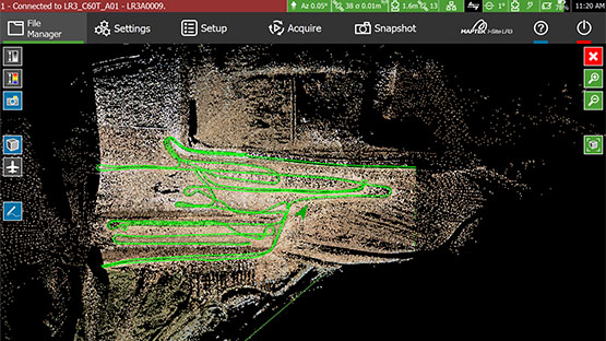
The previous method saw multiple static scans captured, processed and stitched together. Now a single drive captures a massive amount of data which is processed within minutes of getting into the office.
Custom workflows have been set up to convert the raw scan data to a smoothed surface and extracted via a polygon. Using workflows allows automation of repetitive processes, improving the time taken to process data, and allowing new users to quickly grasp the software.
The CPB Contractors and ACCIONA Joint Venture recognises the value of embracing new technology.
The laser scanner produces accurate repeatable data. Importantly, it also exceeds safe working distances for the survey team, keeping them away from heavy machinery and not slowing production.
The site has found Maptek easy to work with, and always interested in providing innovative solutions to meet the end goal.
- Better, faster and safer data acquisition helped engineers meet design for the Western Sydney International Airport bulk earthworks project
- Precise spatial survey measurements were critical to ensure 300mm of fill being laid every day was the right material, thickness and compaction
- Maptek laser scanners were operated from moving vehicles, well within safe working parameters for the survey team