March 2024 Issue Index
Face mapping underground
A customised Maptek Vulcan underground face mapping solution helps acquire critical geological information for production modelling at a Nevada gold mine.
Owned by i-80 Gold Corp, the Granite Creek Project in Nevada, USA hosts high grade open pit and underground mineral resources that remain open for expansion.
As the production modeller in a small mine, Lead Project Geologist Kris Alvarez also helps with production geology, using data generated by the ore control geologists.
‘Our company aims to be a mid-tier gold producer and the Granite Creek mine is a key part of producing that gold,’ said Alvarez.
Her team provides knowledge of the location, grade and volume of gold ore so the miners can extract it safely and economically.
‘At the end of the year, the key questions are how much gold was produced, how much did it cost and did everyone go home safely?’
Granite Creek began using the Maptek Vulcan underground face mapping solution early in the mine’s production in May 2022. Maptek helped customise it to the mine workflow, and suggested how to most efficiently optimise the solution for their specific deposit.
Alvarez came on board in 2023 and used a senior geologist’s how-to notes and tips from production geologists who used the solution daily to get up to speed.
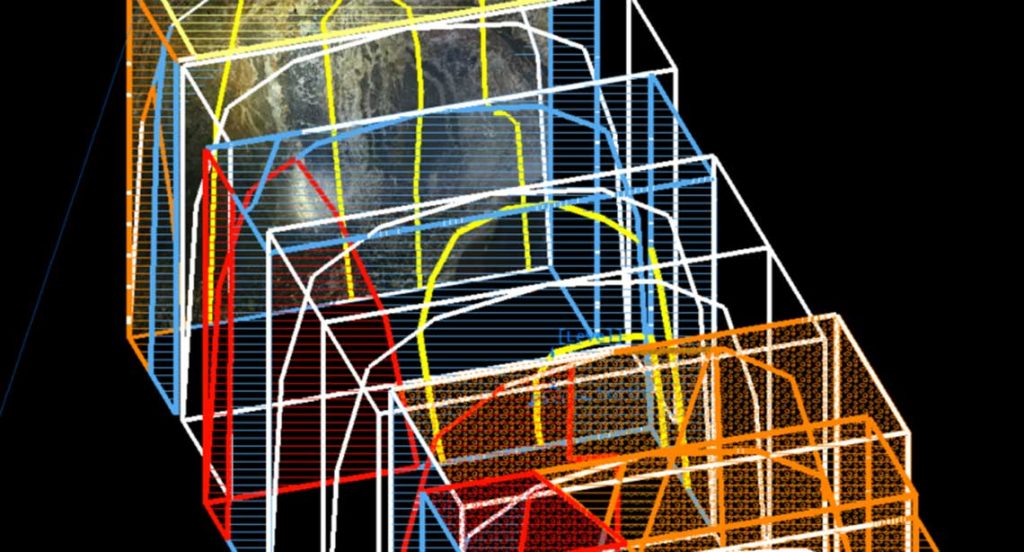
The solution is used for ore control mapping and tracking the rounds. The location and volume of each round is fed into an acQuire database. Assays and other laboratory results are also uploaded into the database, enabling almost real-time tracking of the grade and volume of each face as it is mined.
‘As soon as the lab loads the data, the production team can tie the grade to the location in space and view it in 3D,’ said Alvarez.
The mine design is predicated on the resource model, which is based on a drill spacing of greater than 100 feet. Mining at 15-foot widths means that any information to pinpoint the location of the ore more precisely is valuable.
‘We don’t exist to mine waste!’ commented Alvarez.
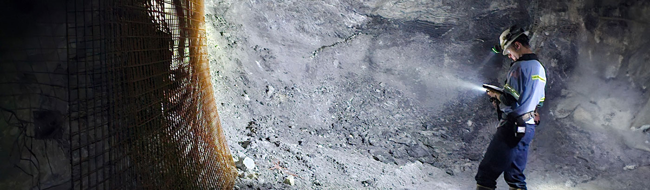
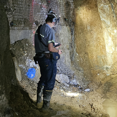
Economic mineralisation depends on both lithology and structure, so mapping geology at the face is vital. Geologists underground can see and interpret the underlying and overlying structures and test how the mineralisation is behaving in 3D.
Alvarez initially thought that digitising data at the actual face would be slower but realised the ore control geologists who do it daily can map as rapidly on the tablet as on paper. All it takes is practice and the right equipment.
Without this solution, geologists would use hybrid methods – map on paper, convert data, upload it to Vulcan and/or a database. Reducing duplication in data input saves time and potential errors.
Time spent converting field structures into digital data in the office is better spent on higher value tasks – interpreting the data, talking with engineers and designing drill programs.
Alvarez commented that the face mapping solution gives the most immediate value through data integration – seamlessly linking the assays to volumes in space.
‘My experience suggests it saves at least half an hour per face. That adds up in a production geologist’s day.’
‘Having the database integrated with lab results as soon as they are generated removes duplicated data entry. Being able to see the data in 3D and share it with the team enables collaboration to build better designs,’ said Alvarez.
Maptek worked with the mine database team to overcome the challenge of integrating the maps with the assay databases.
‘The lead person at Maptek stays on our support team. She helped build our custom system and her deep understanding of all the parts involved facilitates fast improvements or fixes.’
Benefits to the mine extend beyond face mapping. Because Maptek staff have wider experience in process enhancements, they have identified other ways to process or apply data.
‘I also like that my junior geologists keep thinking of improvements, and the Maptek team can implement them rapidly,’ Alvarez said.
A customised solution has served the Granite Creek mine well, improving the speed and quality of face mapping, and streamlining communication between teams.
Thanks to
Kris Alvarez
Lead Project Geologist
Granite Creek Mine
- Geologists at Granite Creek mine have adopted a face mapping solution for ore control mapping and tracking the rounds
- Maptek customised the solution to optimise the collection of geological data for production modelling and provides ongoing technical support
- Geologists can see and interpret the underlying and overlying structures on their tablets and test how the mineralisation is behaving in 3D while underground