September 2020 Issue Index
Survey joy at greenfields gold mine
The Gruyere gold mine is increasing productivity and safety by adding Maptek laser scanning, point cloud processing and stability monitoring to its technology mix.
The Gruyere gold mine, 200 km east of Laverton in the Western Australian goldfields, is a 50:50 joint venture between the operator, Gold Fields and Gold Road Resources, who discovered the project in 2013.
Mining commenced in November 2018 and first gold was delivered in the June quarter of 2019.
The 140 mt deposit has a grade of 1.3 g/t for 5.8 m oz of contained gold, making it one of the largest virgin gold discoveries in Australia.
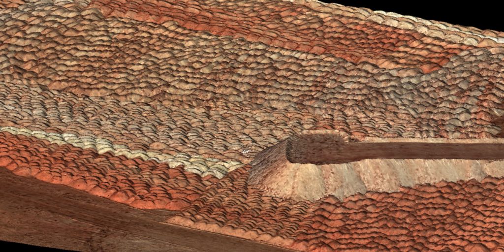
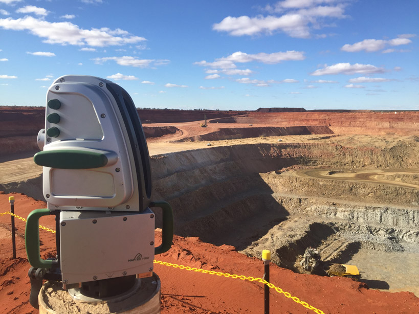
Gold Fields began using Maptek PointStudio point cloud processing software at Gruyere in 2018 to handle the large-scale site data captured by UAVs. It has since acquired two Maptek XR3 long-range laser scanners with a vehicle mount and a Maptek Sentry stability monitoring system for the site.
Senior Surveyor Mining at Gruyere, Hamish Pryde has helped champion innovation at the site.
‘I drive survey innovation and as a new mine everyone who’s come on board understands innovation is one of our core values,’ he says.
‘Once we identify new technology that improves the efficiency of the survey team and allows us to operate in a safer environment, we look to implement it. The benefits of this new technology are shared beyond the survey team.’
Faster results
As a new operation, Gruyere began with a new survey team. Many came from outside the mining industry – such as engineering construction – and were keen to work with a fresh approach.
Pryde says surveyors were able to immediately start using the hardware and software because it was so intuitive and straightforward.
‘My team were new to scanning technology. Within two or three hours they were able to be up and running with the XR3 and PointStudio. Having a system that the user can feel comfortable operating sooner, leads to greater production efficiencies.’
Surveyors use the UAVs together with laser scanners for wall conformance, twice weekly pit face updates, drill floor topographies, ROM stockpile reconciliations, and end-of-month runs across the 12 sq km active mining area.
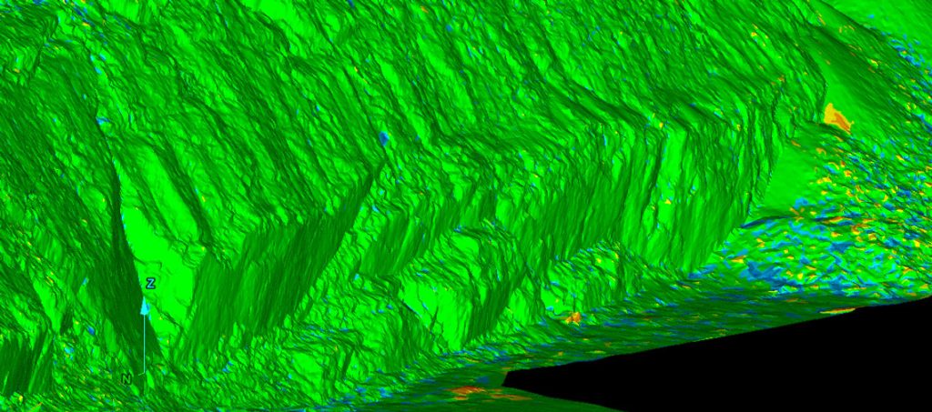
Pryde highlighted the marked difference in the speed of data processing in PointStudio compared to other packages.
‘Using the PointStudio conformance module when completing wall sign-offs is a 20 minute job versus three hours. The conformance reports are consistent, have an understandable format and include heatmaps for visual representation.’
Stop-go scanning using the vehicle-mounted laser scanner has expedited capturing the surface of the tailings storage facility.
A process which previously required eight UAV flights, taking two days, now takes less than half a day.
‘Our tailings storage facility is 1.6 km in diameter. We can drive around the perimeter with the roof mounted scanner, process in PointStudio and have a final surface in less than half a day. I enjoy using the software – the fast editing, creation and merging of surfaces is just fantastic.’
Made for mining
Maptek hardware is designed and built in Australia, which was an attraction to Gold Fields.
‘We like the fact it’s designed for our conditions,’ Pryde says. ‘The workflow in the field and the office is so easy. Once a mine has a scanner you can’t do without it.’
The long-range scanner and vehicle mount, combined with the UAV, are keeping surveyors away from potential harm.
Pryde says this safety aspect is invaluable.
‘There’s no reason why surveyors should be on the ground or put themselves in potentially hazardous positions now.’
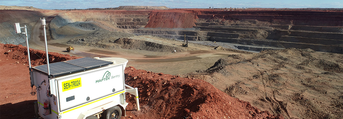
The Maptek Sentry system, which uses a scanner to monitor surface movement, is adding to site safety.
Deployed in a custom trailer with power and communications module, cellular and wifi networking, Sentry was purchased following a six-week trial and is used alongside a radar at Gruyere.
‘The team were impressed by the details shown in the movement graphs and heatmaps. The benefits the system provides to the safe operation of the pit are invaluable.’
‘Like the scanner and PointStudio, Sentry is well made for our environment and you can see that thought has gone into the design.’
Unrivalled support
Maptek National Technical Services Manager, Simon Johnston has worked to help ensure the mine is getting the best out of its technology.
This communication benefits Maptek too, says Johnston.
‘We’re constantly trying to improve and getting real-world feedback is incredibly important,’ he says.
‘We want to ensure the technology is being used and being used properly. We need to know what works well and what doesn’t, so we can help people get full value from their Maptek systems.
‘We delivered on the suggestion of adding a camera to the Sentry system to deliver a real-time video feed of the pit. We may now be able to implement this for others.’
Maptek has been pleased to work with a forward thinking company that embraces innovation. The survey team at Gruyere thinks outside the box and, by pushing mine measurement technologies to their full potential, is able to ensure continuous improvement in their operation.
Thanks to
Hamish Pryde
Senior Surveyor Mining
Gruyere Gold Mine
- Gruyere gold mine takes advantage of the latest, most advanced survey and stability monitoring technology for safe, productive operation
- Surveying the 1.6 km tailings dam perimeter now takes less than half a day, compared to two days for multiple UAV flights
- Ongoing communication has resulted in optimum technology use at Gruyere alongside improved systems for all Maptek customers