March 2023 Issue Index
Managing safety in limestone caves
Laser scanner and UAV geotechnical data is instrumental in identifying potential risk and managing visitor safety in limestone cave formations in Victoria, eastern Australia.
Impressive limestone formations are a major tourist attraction in the Buchan Caves Reserve. The limestone was deposited about 380 million years ago, and dating of sediments and speleothems indicates cave formation occurred more than 750,000 years ago.
Most of the caverns and passages have no engineered rock support, relying on the arching effect of the host rock to maintain stability. No rockfalls or natural cavern instability have been recorded since the caves were opened to the public about 100 years ago.
Breakdown events pose potential risks to visitors, although lack of historic data means that quantitative assessments of size and frequency cannot be estimated using traditional methods. There have been no formal assessment criteria or operations plans for identifying and managing geotechnical risk.
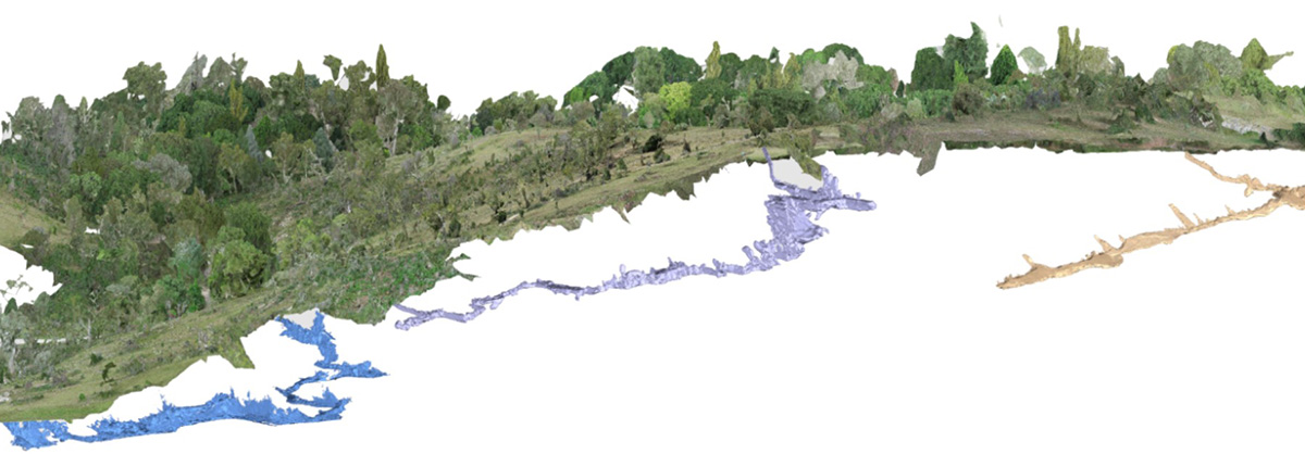
Underground laser scanning and UAV photogrammetry were used to map the 3D spatial relationship between the cave system and the surface. The resultant model allows accurate identification of areas where breakdown events may be more likely, and provides baseline data for future monitoring.
Risk-based approach
AECOM used the digital model to develop a geotechnical risk framework to provide Parks Victoria with a formalised approach to understanding cave breakdown and managing visitor safety.
Site observations during cave inspections can identify hazards and inform subsequent risk assessment. Various factors must be considered when planning how to manage breakdown events in identified high-risk locations.
Such factors include the proximity to ground surface, the presence and condition of breakdown, natural variability in geological structure and material properties, and human modifications to the caves.
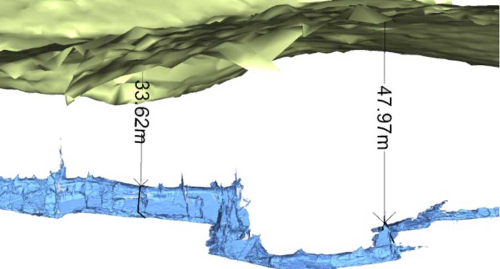
Cross-section dimensions and thickness of rock cover help identify areas with greater likelihood of breakdown due to a reduction in compressive stresses above the crown of the cave.
Shallow caves have been identified as having greater likelihood of reduced compressive stresses compared to deeper caves. The proximity of other caves can also influence stress distribution in structures.
Data acquisition
Accurate measurements of cavern width, shape and depth below surface were required to complement geological observations to better understand relationships between the physical dimensions of the caves, rock cover, and the potential for further breakdown.
Preserving as much detail as possible for data analysis is especially important in areas that cannot be safely accessed.
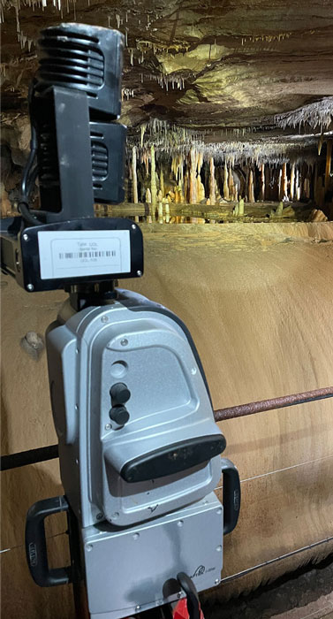
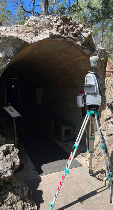
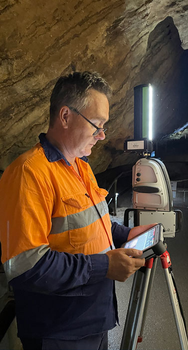
Maptek SR3 laser scanners captured high resolution, accurate 3D point clouds with simultaneous photo realistic imagery. Overlapping scans produced a continuous model for identification and recording of key geological and geotechnical features.
A DJI Phantom 4 Pro V2 UAV captured photogrammetry of the topography over the caves, with imagery processed to produce a spatially correct surface.
Managing safety
The combination of in-cave laser scanning and above-ground UAV photogrammetry provides a rapid, repeatable way to develop an accurate 3D digital model of natural underground caves and how they relate to surface topography.
The consolidated 3D georeferenced dataset allowed easy measurement of cave width and depth of cover to identify unsafe or high-risk areas for further attention.
Areas with a rock cover thickness to width ratio of 0.7 or less were assigned a higher likelihood of breakdown. Caverns lying within three cave diameters of the surface were assigned an intermediate likelihood, while deeper caves nominally have a lower likelihood.
Observable features associated with cave breakdown include the presence of exposed bedding units in the roof and piles of debris in the caverns. Laser scanning provides data for rock mass measurements, which allows geotechnical analysis and design of ground support.
The point cloud has been used to estimate the size, volume and mass of boulders suspended over public access paths, to quantify hazards and plan remedial engineering design and stabilisation works.
Supplemented with visual geological assessments, the digital model provides an understanding of historical cave formation and the processes that continue to influence cave erosion. Authorities are now able to better manage geotechnical risks associated with limestone caves, improving visitor safety.
Thanks to
AECOM and Parks Victoria
- Ensuring visitor safety is behind the project to capture baseline structural and geological data at the Buchan Caves in eastern Australia
- Mapping the 3D spatial relationship between the underground cave system and the surface is crucial to developing a risk management program
- A digital model augmented by visual assessment helps stakeholders better understand cave formation and cave erosion influences