September 2019 Issue Index
Survey solution for structural safety
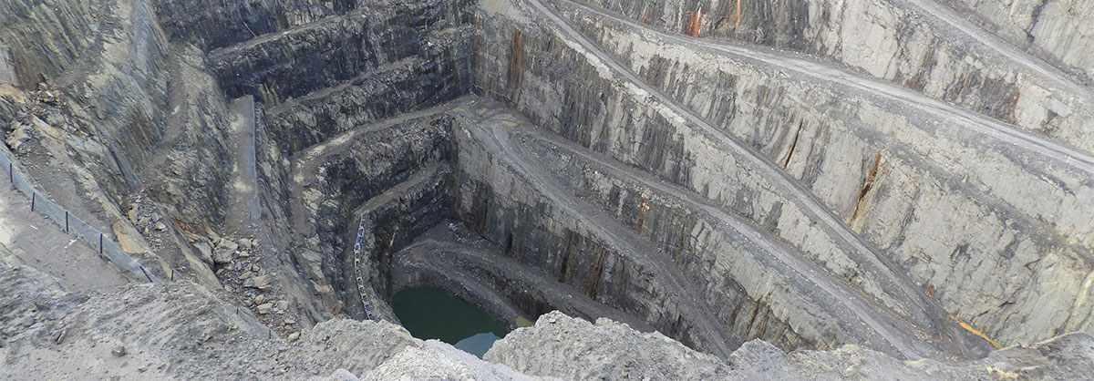
Maptek mine measurement systems are providing invaluable insight into the structural safety of a mine and guiding planning around repurposing the site.
Maptek Sentry combines laser scan data with dedicated software to track and analyse surface movement over time. Hillgrove Resources has been integral in the development of Sentry, trialling it since 2013 at the Kanmantoo Copper Mine in the Adelaide Hills of South Australia.
The technology was integral in facilitating an aggressive steep walled mining approach to maximise ore recovery.
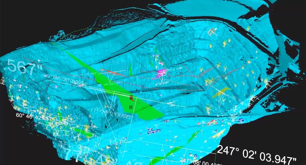
The 3D spatial data collected through Sentry stability monitoring and regular 3D laser scanning has been used to generate a full digital terrain model of the site.
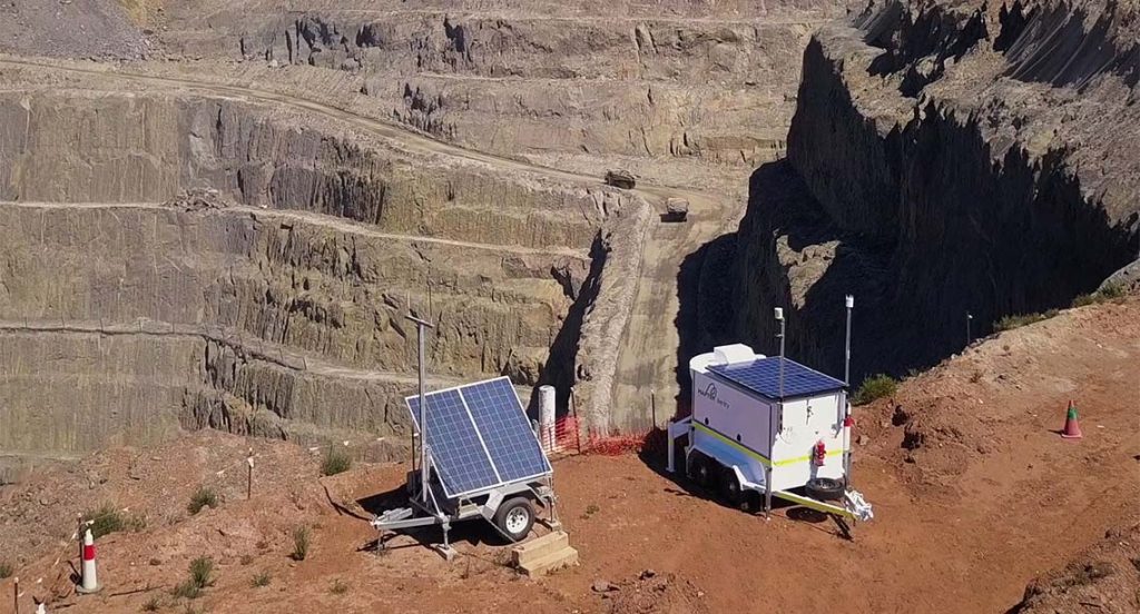
Sentry is designed to allow sites to monitor and react to certain risks in open pit and underground mining operations, including slope failure, tailings or infrastructure displacement and rockfalls.
Alarms can be set to alert operations when movement reaches specified thresholds, facilitating decisions about whether it is safe for mining to continue or if an exclusion zone is required.
In addition to the live field data being crucial to operational safety, huge value lies in the ability to back-analyse the 3D spatial data collected by Sentry to refine a monitoring program.
More than monitoring
At Kanmantoo the Sentry data was shared with the survey team so there was no need for them to go into the field to capture survey data of the areas already covered. This constant stream of survey data from multiple locations around the main pit was analysed in Maptek PointStudio alongside the survey team’s regular scans.
The Sentry data informs where the survey team needs to scan at a higher resolution or from different angles. Each Sentry scan can be used in PointStudio for any of the software’s deliverables such as geological mapping and analysis of geotechnical structures.
Hillgrove Resources’ former Geotechnician, Justine Chambers, who now works for Maptek, says the geotechnical mapping data was pulled into stereonets and run through PointStudio kinematic analysis.
‘That shows all potential failure mechanisms and where they can occur,’ Chambers says.
‘There’s so much you can do with the data, and it all started from Sentry monitoring of walls with hi-res scans.’
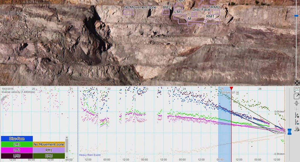
‘Every month we looked at how much walls may have moved, and any hotspots that we needed to be aware of or keep people away from, and set up alarms and monitor more closely.’
‘The great advantage of the Sentry software and PointStudio is that we were able to pick up rockfalls down to only 30-50cm in size.’
‘This approach has allowed us to tie historical scans from multiple positions into a single long-term monitoring project and to look at mine-life dilation.’
In addition this dilation has been directly related to remotely mapped surface structures that have controlled the dilation.
Sharing knowledge
The structural mapping data is being used in the design of a potential underground stoping operation beneath the current pit, which may be undertaken by Hillgrove Resources.
The Maptek mine measurement data informed various feasibility studies by independent consultant Mining One about the change of use to an underground operation.
For instance, Mining One has carried out 3D stress analyses for the open pit and now the underground work. The remote structural mapping was used to build the FLAC (Fast Lagrangian Analysis of Continua) model by incorporating the major structures and joint sets.
The open pit 3D stress analysis was then calibrated using the long-term dilation data from the Sentry monitoring. Various stoping options are now being analysed in the underground model to select the best configuration to ensure stable conditions.
The data may also be used to assess the development and operation of a pumped hydroelectric energy scheme (PHES) facility using the open cut mine’s Giant Pit as the lower pond.
The existing slope monitoring data may be transferred to the new owner to continue with long term slope monitoring of the pit walls which will form the lower pond.
The Maptek data of the pit would improve the lower pond detail and assist in design of the underground facilities. The existing wall monitoring data can also be used in setting up the long-term slope monitoring program.
Maptek Mine Measurement Product Manager James Howarth says the benefit of the digital model is sharing the collective knowledge of experienced Hillgrove employees.
‘Different site uses or mining methods require different sets of expertise,’ Howarth says.
‘This structural information would provide a baseline to create safety plans for working in the pit and developing drives. The key win would be that we’re informing people about the geology and structures so they can develop their tunnels and caverns safely.
Continual learning
Reflecting on the years of collaboration between Maptek and Hillgrove Resources, Howarth says the Kanmantoo open pit completion scans are the ‘icing on the cake’.
‘The final digital terrain model will be useful for Maptek, Hillgrove and any new owners to continue investigations into structural mapping and analysis of long-term pit dilation,’ he says.
The history of survey and monitoring at Kanmantoo and analysis of data collected also provides Maptek with key findings that can be applied to ongoing development of software and hardware systems.
Thanks to
Hillgrove Resources
- Mine history can be recovered and communicated through visual display in easily interpreted 3D software for community and mine company use.
- Back-analysis of 3D spatial data can inform the ongoing development of stability monitoring and safety programs.
- Structural mapping and mine-life dilation become key assets when faced with a change in mining technique or corporate ownership.